USA - Florida, Miami to Virginia, Chesapeake Bay

SV Meshugga
Nicholas & Deidre Mace
Fri 10 Jul 2020 18:16
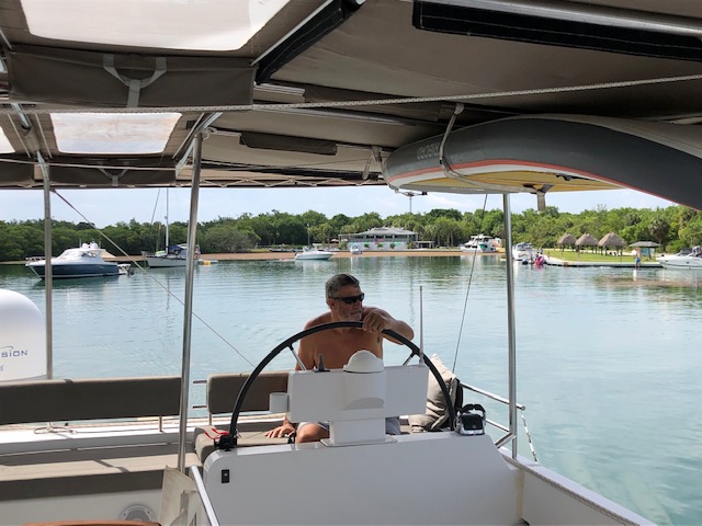
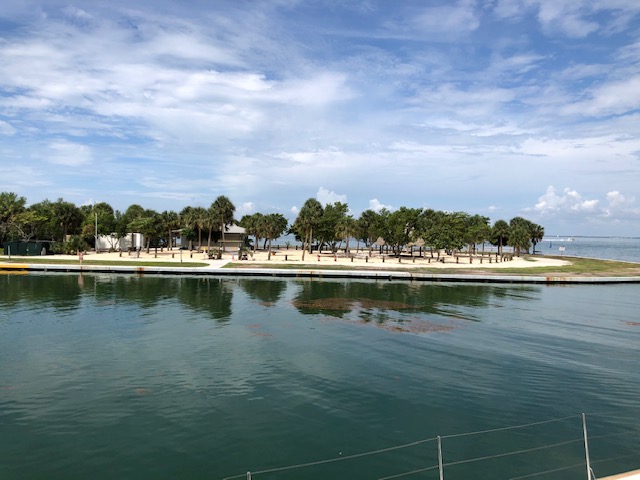
Leaving Bill Baggs State Park, Key Biscayne on Sunday 5 July at 11am with no wind.
The Park is closed to visitors, except boats.
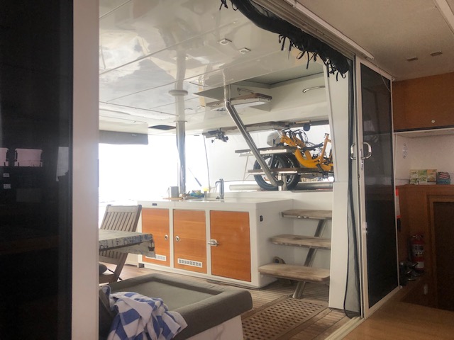
The Hobie has a temporary storage arrangement above our Davits. We’ll see en-route how this works.
Our trip started off with light winds, as predicted, sailing with full main and genoa. Our Boat speed was a miserable 2.5 knots thankfully aided by the 4 knots of Gulf Stream Current, our SOG (Speed Over Ground) 6-7knots. By Monday midday the southerly wind started filling in and our boat speed increased and we upped our SOG to 8 knots.
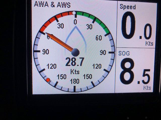
Tuesday the southerly increased and we quickly slotted into our standard 10 knots with 2 knots of current giving us a nice 12 knots SOG, although afternoons brought squalls with winds peaking well over the 25 knots apparent wind norm, making us reef the main.
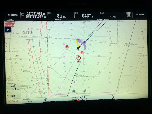
Purple Radar indicating the Squalls in front of Meshugga
Squalls up ahead
28 Knots, slapping in a couple of reefs
Wednesday put pressure on us, 150miles off the coast sailing across the Bight up to Cape Hatteras, with the Tropical Depression from the Gulf having moved across the Florida Panhandle, and moving north along the coast. The skies are completely overcast and it has been raining constantly Tuesday night and still today. The temperature has fallen from 35deg C to 25 deg C, and for the first time in months I am wearing a T-shirt. We need to beat the system in getting to Hatteras, as the winds close inshore at Hatteras could be northerly which would be awful for us, wind against waves, and the wind would be strong.This makes us sailing and trimming getting the most boat speed, and ensuring we stay in the Gulf Stream even with it as low as 1.5kts, every little bit is helping our SOG. Additionally our Weather GRIB file is from Sunday morning, and as our TrackPhone is not yet connected to our new WiFi system we are not able to download new GRIBs, so touch wood, and watching the Barometer for a constant fast drop will will indicate whether the Tropical Depression has increased and moving into the Atlantic Ocean close to us.
Whilst I write, we are a few hours south of Hatteras, averaging 10 knots SOG, and the wind has already gone more east. Nicholas has been trimming sails every 15 mins all day.
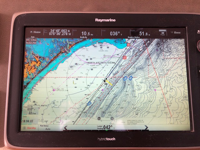
The Chartplotter shows:- (Explanation especially written for Genevieve, my mom)
Top Line;
Our GPS position
Our SOG is 10.5 knots
Our Course Over Ground (COG) is 36deg
The Depth of the water is 51.6 meters
Our RADAR is On
The Picture;
The BLACK boat in the Center is Meshugga
The YELLOW line the direction of the wind onto Meshugga
The BLUE icons are ships we can see on AIS.
The RED squares are Waypoints we have inserted, the closest to Meshugga is a NOAA buoy in the water which we don’t want to hit :-), and the second our Waypoint at Cape Hatteras
On the Bottom LHS and below;
Our Waypoint to Cape Hatteras is 22 miles away at direction 33 deg True
The time is 18h56
Our AutoPilot Status is AUTO
Meshugga’s Auto Pilot is heading is 42deg True, even though we are making 36deg True COG
After Hatteras the coast falls away to the west, so if and when the wind then goes NE and then N from the Tropical Depression we can still sail okay, though the sea state might be yuck. After Hatteras we have 120 miles to sail to the entrance of Chesapeake Bay.
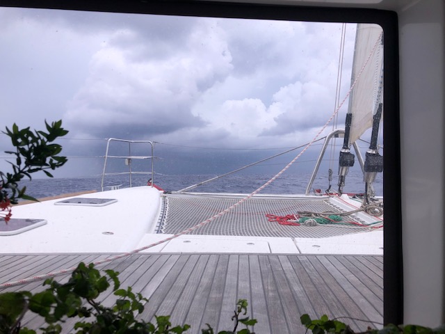
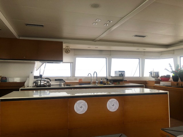
Some photos around the boat whilst underway
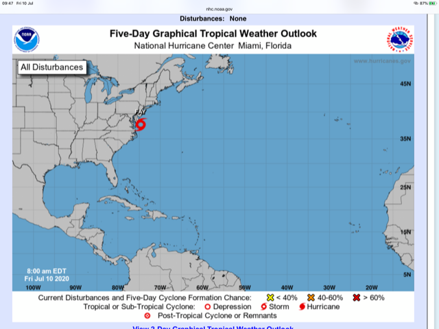
Nicholas spent every hour trimming sails to outrun the potential adverse winds from what is now Tropical Storm Faye, and we did so successfully, and we sailed into Chesapeake Bay with darkening skies.
Thursday July 9, 2pm
Our anchor is down in the Hamptons, Chesapeake and although tired, Meshugga is prepped for potential big winds and rain from TS Faye tonight.
About 900 miles in 4 days is tiring sailing......
Thank you Nicholas......
Friday
TS Fay is located just offshore from Chesapeake Bay, slightly to the north of us. We are in a well sheltered Cove and only have light winds, however north of us in the main body of Chesapeake Bay the wind is blowing a hoolie from the north.
We went into Hampton today to sightsee and look for a local Cruising Guide. We found many stores closed, but the bookshop we went to was open and staff wearing Masks, even though they did not have our requirements. Back at the dinghy at the Public Dinghy Dock, next to Hampton Marina, they kindly gave us their last book, the store copy of Waterway Guide, 2018 as they were awaiting new 2020 stock. Generous kind Southerners!
We’ll start heading north tomorrow in Chesapeake Bay, over a few days, to the Annapolis area to find a suitable spot to see out the Hurricane Period.
Take Care and Stay Safe
WEAR A MASK !!!!!!
Deidre Mace
SV Meshugga
E: Deidre {CHANGE TO AT} Mace {DOT} co {DOT} za
C: +1 754 213 7663
⛵️⛵️⛵️⛵️⛵️⛵️⛵️⛵️
Sent from my iPad
