The Dangerous Archipelago

VulcanSpirit
Richard & Alison Brunstrom
Sat 16 Jun 2012 17:08
|
We're in the Tuomotos, known to mariners until
recently, and with good cause, as the Dangerous Archipelago. The Tuomotos
are one of five archipelagos in French Polynesia and comprise dozens of huge
coral atolls strung out over thousands of square kilometres of ocean. But unlike
Tahiti to the west and the Marquesas to the east these are very low-lying. The
atolls are generally oval, and oriented NW-SE. The northern and eastern sides
are slightly higher and reach the dizzying height of a metre or two above sea
level. This allows coconut palms to grow to a height that enables them to be
seen from about 8-10km away. But the southern and western sides are lower - just
awash, with a few low islets. This combination makes the whole shebang very
dangerous indeed, especially if approaching from the southwest. Here is the
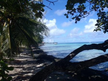
external reef on the east on a calm evening - you definitely do not
want to run a boat onto this! Not even a steel one, never mind fibreglass. The
southern side is like this but without the palm trees as a give-away - i.e
much worse!
 The distances between atolls are such that any
passage requires night navigation (there are almost no navigation lights) and
before the advent only a few years ago of GPS this must have been nerve-wracking
to foolhardy. In addition, entry to the safe lagoons must be gained through a
'pass' - a relatively narrow (sometimes extremely so) gap in the reef through
which water enters and exits the lagoon. These are shallow and have fierce and
sometimes unpredictable currents running at up to 8 knots which is at the
absolute limit of our speed under engine. One aims to arrive at a pass shortly
before slack water, wait until the breakers in the pass subside at slack, then
enter. Some are safely navigable on the inflow, others are not. Unfortunately
slack water varies enormously. There are various tide tables available which
unhappily do not agree with each other, but the main problem is the weather - a
strong easterly wind for instance will drive water over the reef into the
Fakarava lagoon in such quantities that it may flow out through the only
pass (in the NW) for several days without stopping, while strong wind over tide
conditions can make entry and exit unsafe even at slack water. Entry may then be
impossible - while remaining outside is in itself dangerous. Or the pass may
face into the prevailing wind - even worse. And weather prediction here is
unreliable - even more so than the BBC. This archipelago is definitely not for
the fainthearted. Even radar and depth sounders are of limited use - depths are
extreme (3000m!!) until very very close to the shore, and the reefs do not show
on radar. Even with GPS and a modern chart-plotter we approach these things with
extreme caution; without these aids we'd give these beautiful islands a very
wide berth indeed.
But at present the weather is benign, and inside
the lagoon the atoll beautiful:
 Above is the lagoon beach, 300m across the island
from the previous photo. The water really is this colour.
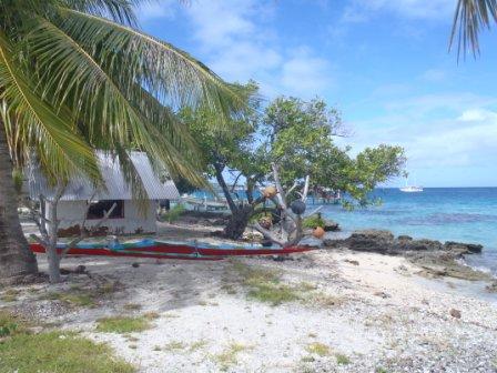
 The sport here is outrigger canoe racing which
seems to be taken seriously with inter-island rivalry across Polynesia. Canoes
are now made of fibreglass, as you can see above.
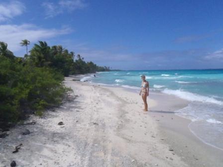
 And here is Alison in her preferred environment -
an empty coral sand tropical beach littered with cowries. Note that the wind
even here in the lagoon is blowing strongly and the water is quite rough. The
pass is just behind me, and entry on this day would have been exciting.
Definitely big standing waves, and blue water on deck.
|