Sint Eustatius ""17:28.8N 62:59.4W"

VulcanSpirit
Richard & Alison Brunstrom
Fri 4 Mar 2011 22:51
|
Here we are in Sint Eustatius, or Statia. The
island has been Dutch continuously since 1816 but as usual in these parts
changed hands between the Spanish, English, French and Dutch 22 times in the 200
years following its discovery by Columbus (who claimed it for Spain without even
bothering to land). The island is famous, I discover, as the very first place in
the world to recognise the United States, in November 1776 - only four
months after the Declaration of Independence. An armed American ship the 'Andrew
Doria' fired a 13 gun salute on entering harbour (the island was supplying
arms to the rebels) and the Dutch Governor at the time, possibly by mistake,
caused a standard 11 gun response to be fired from the Dutch fort, thus giving
international recognition to the rebels.
The island has recently voted for closer
integration with the Netherlands (along with Saba and Bonaire); the first
visible result of this seems to be the introduction of Customs for the
first time (ever!) on 1 January this year. It's nearly as bad as
Portugal.
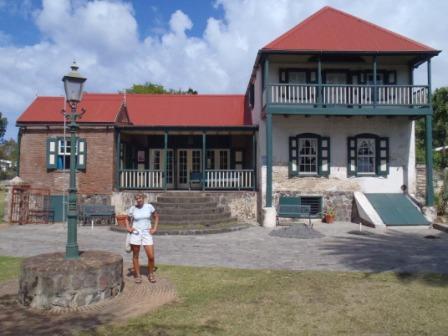
The first photo shows Alison at the
(excellent) museum, originally a Plantation House and then briefly Admiral
Rodney's HQ following his capture of the island in 1783 (his successor promptly
lost it to a French invasion in November of that year, resulting in his court
martial).
The island was extremely prosperous in the
seventeenth century as a free port (no customs duties at all), then faded badly
in the nineteenth. The population peaked at 20000 and is now 3400 - English
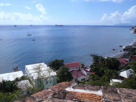
speaking for some reason that i don't understand. As the second photo shows it
is enjoying a renaissance of sorts as a transfer point for oil tankers from
around the world due to its safe deep and large anchorage and large oil storage
facility. to the right of the photo Saba (pronounced Sayba) is
visible.
Tomorrow we're off up the small dormant volcano on
a rarity in the Caribbean - waymarked self-guided
trails.
|

