Fw: St Kitts and Nevis N17:17.18 W62:43.73

Tioram 4
Tina & Tony
Sat 10 Apr 2010 14:52
|
St Kitts and Nevis--- 30th March to 4th
April.
We lifted anchor at 8.30am in St Barts after a
rolly night and headed for Nevis. The wind and sea state in the naturally
protected Gustavia changed as we headed out to sea. The wind unkindly went south
east although we still managed to sail and made the decision to go to
St Kitts instead-- the more northerly of the two islands, getting a
better wind angle.
The sea state was rough and 22 knots wind speed
and the boat handled it great. Surprisingly it was a good sail and
psychologically motivating to be able to see the next island 30 to 40 miles
away. The J class, 'Ranger' to our
starboard/right side handled the wind and gusts with full sail and we watched as
she quickly gained speed and headed off to St Eustatia north of St
Kitts.
We managed to sail until we rounded the north of the
island in the channel between St Kitts and St Eustatia (Statia). The two islands
provided a mirror image of one another with grand high volcanic peaks sweeping
gracefully into the Caribbean sea.
It always still amazes me how wonderful it is to arrive
from the sea and to see the land and vegetation of a lush green island turn from
black and white to colour. St Kitts ticked all the boxes, beautiful volcanic
green slopes. We sailed along the leeward side of the island where there are
surprisingly little opportunities to anchor as the coast and seabed drops away
steeply.
We called the marina which was full and made our way to
White bay where we found shelter from the strong winds but no holding with the
anchor. We tried about 5 times on a rocky bottom and for the first time we were
beaten. With little anchoring opportunities and the light fading we tried the
following Ballast bay. We guess named for the rocks it provided as ballast for
ships of old. Eventually between 2 other boats and a reef we managed to find a
good holding. The wind calmed and we were rewarded with a great solid nights
sleep.
.
We decided to visit Basseterre for a couple of nights
and go into the marina. Walking into town was very refreshing. We had
enjoyed the French Caribbean islands with their style and beautiful people but
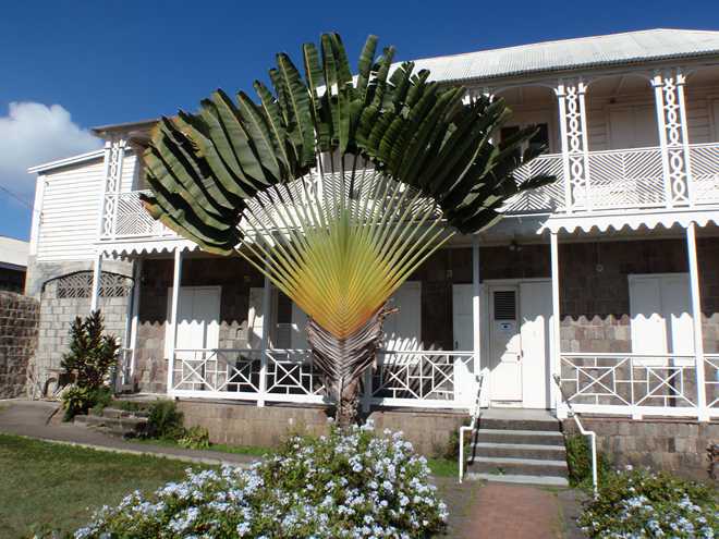
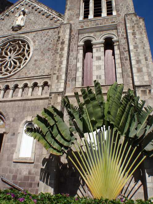
St Kitts was simple and culturally Caribbean----lovely. The names of local boats
in the marina said it all-----Live de life, Isey Lime. Limeing ofcourse is
about chilling, resting, have a good time or just being lazy. The history of the
word 'lime' originated from ships of old whose crews were given Limes to prevent
scurvy. The sailors lounged around , drinking on land and were known as
limeys--------
The main road island and focal point of Basseterre is
'Piccadily' and it is a great place to sit and people watch. The cars and taxis
sport fab names like, Is de bank money---Tap Shatta---Too old to die young----De
Axe----Ruff Neck----Up 2 de time----World of calamity----Love one
another---One day at a time---Tek Dat----See de pink deh !!!!
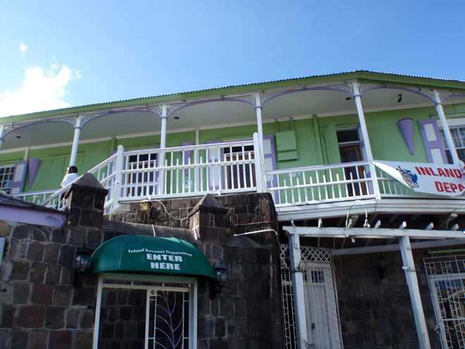
We did the obligatory customs/immigration and giggled our
way through the forms and banter with the local officials---one who was
incredulous when we showed him on a world map where we had sailed from, Hamble
Uk to St Kitts. Our last port of call on our form showed St Barts--- he thought
we had just chartered from there-----just a few thousand miles
short.!
We left St Kitts for Nevis and Pinneys beach. The Chris
Doyle guide books have been excellent in all respects and his description of a
lovely long, sheltered, palm tree covered beach--- and 'Sunshines' beach
bar with Killer bee cocktails grabbed our interest. Sadly it is the one time we
were let down badly. Sadly after the guide had already gone out on sale Nevis
faced a hurricane with the winds tearing the heads off all the palms on the
beach. The beach bars and Four seasons hotel were hit---mainly by the sea
pushing into the resort. Eighteen months later, the 5 star luxury Four
Seasons Resort is still boarded up and 80ish buoys along the beach sit
empty.
We didn't trust the buoys so we anchored for the day and
went swimming in calm water. We circled the boat a few times until I
looked to the side and saw 2 largish fish swimming closely towards us. The first
one was the ugliest thing I have seen with a large head, speckled and so close I
could have touched it. I quickly dived behind Tony pulling the poor guy in front
of me, sucking air and water again!! I was almost too afraid to dip my head
under water, so I looked over Tony's shoulder to see the fish on the top of the
water close to Tony's face and he had to strongly push it away with his hands.
By this time I was totally freaked, shouting, 'Where is it, where is it?'
My walk on water theory was totally and utterly
tested------ and finally I have to admit that it's really not possible. My Mark
Spitz front crawl to the transum ladder of the boat was of gold medal speed and
as yet I haven't been back in the water. I'm waiting for a shallow beach with
tiny Captain Nemo friendly fish----one's that might gum you to death but no
teeth !!
Tony is not sure what the fish was, certainly not a
Barracuda and a bit like a Dorado----very ugly. It was only about 2 ft long but
a big head, Tony reckons it was just friendly and wanted to see into his
goggles????????
The evening and night continued badly with a very
rolly sea, Tony sleeping on deck on anchor watch and myself trying all manner of
star shaped positions to stabilise myself in bed.
The next day we anchored in a big
unprotected northerly swell outside Charlestown the capital of Nevis. It is
a small place but with Caribbean charm.
We anchored for the night in Cockleshell bay ,St Kitts
near The Narrows and had a wonderful calm nights sleep.
The Narrows are as called 'Narrow' between St Kitts and
Nevis with many shoals/ shallow areas some of which can't be guaranteed on
the Imray charts and many soundings based on old lead line readings. So you can
imagine historically a difficult place to navigate.
St Barts has been a free port since 1784 and therefore
many ships of old bought cargo from the island to sell on others. The main
problem was to avoid the St Kitts and Nevis customs men as they passed
the island who would confiscate the cargo. To avoid being caught many ships
would brave The Narrows at night.
At 8am on 4th April we lifted anchor bound for
Antigua and my thoughts turned to the many skilled 'pirates' who braved the
shallows, reef and rocks at night. Tony's paper chart bearings and the wonderful
GPS chart plotter took us effortlessly through to safe, deep water.
Our sail to Antigua was one of our best. We passed Redonda
island and Montserrat. The volcano erupted in 1995, blowing away the top of
Mount Soufriere and destroyed the capital, Plymouth. It still ominously billows
away and has both a land based and 2 mile sea exclusion zone.
We sailed with a glorious North Easterly 8 to 12 knot wind
with cruising shute skipping along and arrived in Jolly Harbour, Antigua. The
area is a natural harbour with a purpose built marina. We checked in with a
different Antiguan custom/immigration at Jolly. The formal proceedings had us
longing for English Harbour and Mrs. Doubtfire. We stayed for 2 nights, checked
out the excellent supermarket for our return Atlantic trip provisioning and used
the opportunity in the marina to scrub the boat.
On 6th April we slipped our lines, sailed around the
coast to Falmouth Harbour where we are now. It is great to be back but
it sadly brings our island hopping to an end. We plan to see the island
during the next month and finally sail from Antigua for the Azores early
May.
The weather is a little unsetlled at the moment and strong
winds, but when it settles we want to visit Green Island and Non Such
bay-----you have to visit somewhere with such a great name don't you think
???
Love to all
Tina and Tony x x
|


