Statia
|
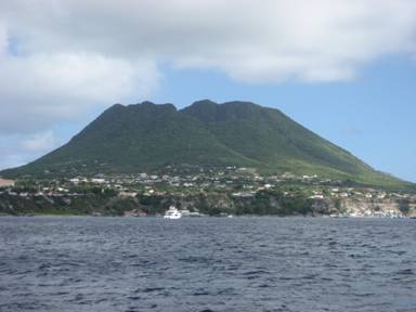
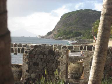
We left Saba mid morning on Tuesday January 29th, again expecting a fast sail 18 miles to the next island of St Eustatius (known always as Statia). This time the wind turned south of east which would have meant tacking down, so we did the lazy thing and motored all the way. We arrived in the sleepy bay of Oranjestad and picked up a marine park buoy here too. As we looked around the quiet spot with its sprinkle of waterside restaurants, hotels and dive shops and modest black sand beach, it was very hard to imagine the scene some 250 years ago. The port here was then one of, if not the, busiest in the world and as many as 300 ships would be anchored in the bay waiting to offload anything and everything into the free port. It was a haven for trade in the midst of the many warfaring nations and also renowned as the first place anywhere to recognise the independence of the United States in the middle of their war with Britain (much to GB’s fury at the time!) The only evidence from that period now are the ruins that line the shore and extend under the water, as the land reclaimed for all the commercial activity has since been claimed back by the sea. There are ruined warehouses along the path to town and one or two have been beautifully restored. A steep cobbled path called “The Old Slave Road” takes you up to the town above with its neat little Dutch style painted and shuttered houses with cool verandas, the restored fort on the cliff edge and the evocative ruin of the Dutch Reform Church. Statia is thought by vulcanologists to have the most perfect shaped cone, and (R) the beach and ruins:
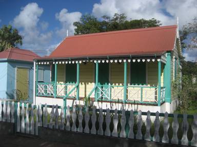
We spent one very peaceful night on the buoy on Statia and were very pleased that we had stopped at both these fascinating little islands on our route. After a refreshing swim we left around midday and headed off into a brisk wind with reefs in both our sails. Typical Statian buildings:
|