Confused Seas and Lots of Gray - Pelican Bay, Great Sandy Strait, Queensland, Australia
Harmonie
Don and Anne Myers
Mon 26 Apr 2010 20:16
|
25:48.820S 153:02.523E
On April 19th, we left Mooloolaba bright and early
- well really gray and early because the clouds were still with us - and sailed
64 miles north to Fraser Island and the Great Sandy Strait. Sixty-four
miles in eight hours. It was a fast sail. A good thing too because
it was none too comfortable. This, from someone who took two sea-sickness
pills starting the night before. With only a reefed headsail and mizzen
out, we sped along at eight knots in confused seas. The term "confused
seas" is used by weather forecasters as a euphemism for sloppy, rough waves that
bat a boat around and cause the crew to feel sick - but only the weaker half of
the crew. Over the course of eight hours, I took three naps and Don looked
after the boat. Looking back at our log, I can always tell when it was a
rough sail because Don's handwriting fills the page (usually we take turns
filling in the logbook every hour with boring stuff like course, position, speed
through the water, speed over the ground, wind conditions, etc.). When
it's rough, sea-sick people have no desire to go below deck to fill in
logbooks. If they do, it's usually the thing that puts them right over the
edge, or right over the rail, as the case may be. If it were the end of a
sailing season, 25 knots of wind and a bucking boat in confused seas with a ten
foot swell wouldn't faze either one of us, but on sail #2 of the season, it
was a bit uncomfortable and reasonably exhausting. But again, its the destination that justifies the journey, and
usually the destination is so incredibly lovely, that it doesn't feel deserved
unless some pain was inflicted along the way. It can't be good all the
time or else we would all die of a lethal mix of boredom brought on by constant
euphoria - or at least that's what we tell ourselves when experiencing a
less than pleasant sail.
Part of the problem with our sail that day was
that there was a constant feeling of impending doom hanging over our
heads. Impending doom because to get into the sheltered waters of the
Great Sandy Strait, which lies between big Fraser Island and the mainland,
one must sail over the Wide Bay Bar. Wide Bay Bar is a vast sand bank
famous for violent and dangerous seas, especially when
the outgoing tide runs against strong southeasterly winds in its
shallow waters. We were sailing in strong southeasterly winds, and
our arrival time at the entrance to the Wide Bay Bar coincided with the outgoing
tide. This was not a surprise. We knew when we left Mooloolaba that
it was possible we would arrive at the Wide Bay Bar and not be able to enter due
to the wind/current situation. If that happened, we knew we
could turn around and sail back to Double Island Point, about a
ten-mile backtrack, and anchor in its sometimes untenable, slightly unsheltered
bay - not an attractive option at the end of a long sailing day.
When we were in Mooloolaba, we stopped by
the Coast Guard tower and received information about the best way to
approach and navigate through Wide Bay Bar. Just meeting with the Coast
Guard was an experience. The Australian Coast Guard is composed of
volunteers. These volunteers are usually older folks with a keen interest
in sailing and boating in general, as you would expect. What we didn't
expect was the overwhelming desire these folks have to help people like us and
their willingness to spend a good bit of time doing it. The two men we met
in the Mooloolaba tower looked like they were character actors taken straight
out of a folksy sea story movie set in New England (minus the
Australian accents, of course). They offered to track us during our
Mooloolaba to Fraser Island trip, and we took them up on it. When we left
Mooloolaba, we radioed the Coast Guard station to let them know we were on
our way. Then, when we passed Double Island Point, we radioed the Tin Can
Bay Coast Guard to let them know we were approaching Wide Bay Bar and to
ask them about conditions there. All of this went very smoothly and we
felt like we were being tracked by air traffic controllers, each Coast
Guard station handing us off to the next. What didn't go smoothly was
the response we got from the Coast Guard about the condition of Wide Bay
Bar. "Oh, a couple of boats went up and had a look at the bar today, then
turned around and headed back into the bay. They said it
looked rough." Oh, excellent, the bar looks rough and even
a fishing trawler wouldn't cross it. Faced with visions of an extremely
uncomfortable rolling anchorage at Double Island Point, we decided to go for the
bar anyway. "How bad can it be?" we asked each other as we donned our life
jackets and tidied up the cockpit of our rocking boat, getting ready for any
eventuality. We informed the Coast Guard that we were going to go for the
bar, and then we went for it. As we approached, we could see the
heavy seas breaking on the sand banks ahead of us, and we could also see what
looked like a wind surfer bobbing and hobby-horsing its way through the
bar. After a closer look, we realized it wasn't a wind surfer at all, it
was a good-sized sailboat heading out over the bar toward
us. The sailboat was tossed about so much by the incoming waves
that it really looked like a tiny wind surfer out there. It wasn't much
longer before the sailboat emerged from the worst of it and passed us as we
headed in. They came close enough for us to see the man
waving heartily to us from the wheel and a woman sitting calmly in the
cockpit. Well. If they could exit the bar motoring against
a 25 knot wind and into 10 foot seas and still wave heartily at a passing boat,
we figured we could easily continue on and ride those 10 foot waves
into and through the bar. Which we did. It wasn't that
bad. It's possible that it was the easiest part of our day. We
couldn't see the approach light, but we did have the waypoints the Coast Guard
gave us loaded into our GPS, so using those, we surfed down the waves
against the outgoing current, with breakers on either side of us as we
transited what's called the 'mad mile". No problem.
We then spent two rainy, cloudy days and
nights anchored in Pelican Bay, which is a wide, shallow, sheltered, featureless
bay at the foot of the Great Sandy Strait and just around the corner from Wide
Bay Bar. We spent the two days recovering from the rough sail
(wimps!), tidying up the boat and various other boat-related jobs. After
that we started up the 40-mile long expanse of sand banks and shallow channels
that make up the Great Sandy Strait. More on our Strait transit in a day
or two.
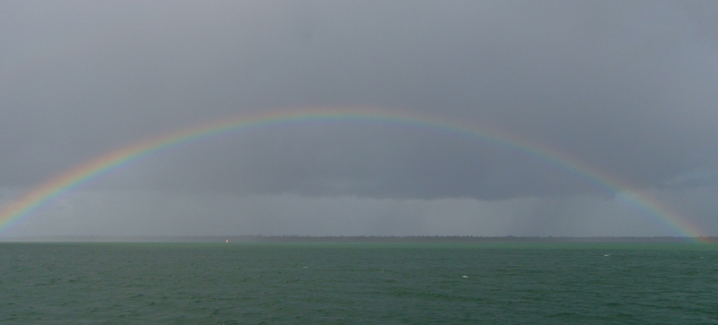
Picture 1 - Our boat-bound stay in Pelican Bay was
decidedly gray, except for the rare bit of color.
Anne
|