Kitava
Lochmarin
Wed 31 Aug 2016 04:05
08:37.557S 151:18.428E 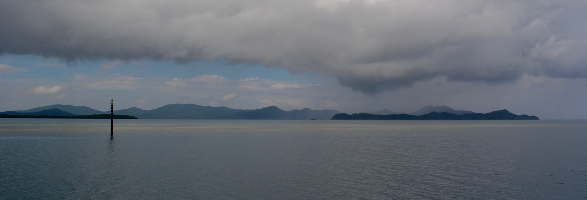 Leaving Woodlark Island, looking South.  The start of night watch en route to Kitava, the Marshall Bennett Islands, also makateas, coming into sight. For us, part of the magical lure of Papua New Guinea was the Trobriand Islands, where Malinowski wrote his famous studies. We wanted to see the islands for ourselves so decided to divert to Kitava, the Easternmost Trobriand, before heading up to Kokopo and Rabaul. Again, we didn’t have much to guide us except a passing reference in a South East Asia Cruising Guide, which gave us a very approximate position and said “Deep, good shelter. NW side friendly”. As we got closer we started asking ourselves why it was we’d decided to come there. We’d not been able to get close up satellite images, Google didn’t seem to think it worth photoing and Bing hadn’t bothered going to much detail. Our new cockpit plotter showed one small area surveyed and our older main chart plotter showed no surveyed coast line at all. Still, we were there now so we decided to give it a try. I’m so glad we did. Kitava is an uplifted atoll, a makatea, like Niue. It has a fringing coral shelf, which is wooded and planted with coconuts, then a cliff rises some 500 feet, the original coral ring of the atoll, and in the centre there is a plateau, the original atoll’s lagoon, dipping down to some 100 feet below the coral wall that surrounds it. We sailed around the North of the Island and passed down the North West side (friendly, so the book said) just after day break. We could make out a few huts made of palm just above the beach, there were a couple of wooden canoes over the reef and one, two, no three wood fires sent up their smoke. The same scene would have greeted the arriving sailors some 200 years ago. As we rounded the NW tip Uratu Islet came into view, quite the prettiest little island in the Pacific I think, set in the perfectly clear blue water we’d found around Niue. 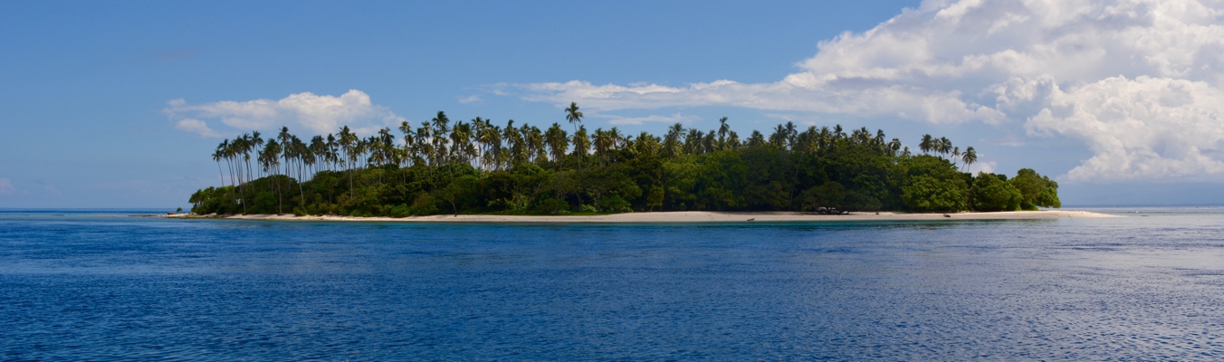 Uratu Islet, the reef on the left hand side stretches over to Kitava. It was so clear that even at 25 meters depth I could easily see the sandy bottom and the coral heads as we gingerly nudged our way into the shelter between Kitava and Uratu, dropping the anchor in 11m of crystal blue water. We were over the side in no time, where we discovered that we’d been lucky and anchored at slack tide. In the time it took to pack away the sails and get changed it was now running at maybe 5 knots and so we hooked our legs over the ladder and let the cool clear water sweep over us instead of trying to swim. Gorgeous. No crocodiles here. 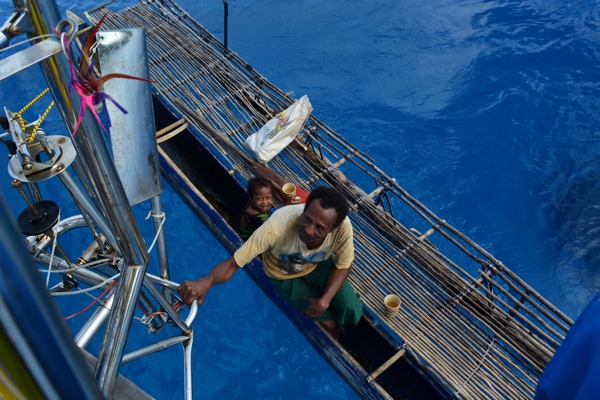 I liked the ‘table’ on Joe’s outrigger canoe. Joe and his daughter Eunice paddled over to greet us and to invite us to visit the village with him. It was strange seeing the jagged limestone of the original atoll poking its way through the greenery when we were used to seeing it as bommies in a lagoon, with fish darting in and out of the crevices. There are plenty of people living on Kitava and they are now supplementing their living by Australian cruise ships bringing tourists to buy handicrafts and picnic on Uratu a couple of times a month (hence the newly surveyed bit on the chart). Joe bypassed the empty stalls and laid out gardens on the coral shelf and led us up the slope to the central plateau where the villages are.  One of the houses at the top of the coral ring. They were beautifully kept with flower- lined garden walls built from the coral cleared for the gardens. 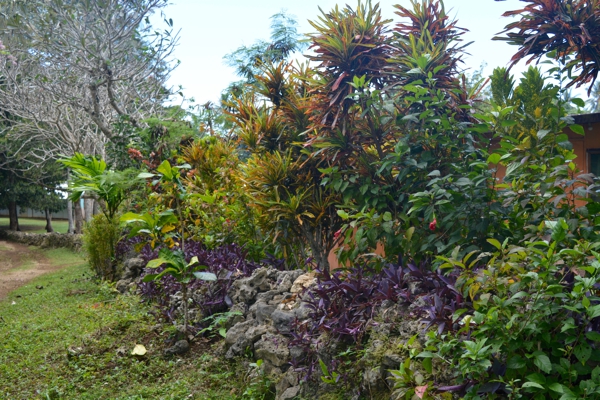 We came to the main primary school of the island and had a chance to see the students and meet a couple of the teachers. One, Ben, the headteacher, was excited to hear I’d taught maths and science and asked if I could help him. The PNG government gave a list of outcomes the students needed to attain but he was having difficulties working out how to achieve them - what progression the students needed to follow to get there. We invited him over to the boat for tea after class and I sat with him and talked through the whole idea of teaching for understanding, basing progression in maths on a concrete grasp of the concepts involved, and in science on the principles of scientific experiment, rather than the rote learning that he’d been the product of and which was the norm in PNG. Ben was immediately sold on the ideas and left full of enthusiasm and armed with plans for lessons and some teacher’s assessment books that Carolyn in New Zealand had passed on to us from her school. Compared to most of the schools we’d seen Ben’s seemed well equipped: some sets of text books and lots of reading books. We’d not felt the need to leave books to help here but instead I think we were able to give some inspiration and leave a seed for change. 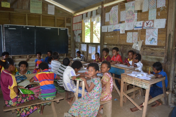 |