Moving South

Ile Jeudi
Bob and Lin Griffiths
Fri 29 May 2015 22:42
|
17:09.23N 52:37.89W
Tuesday 5 to Thursday 14 May 2015
Sorry there has been a bit of a delay updating the blog.
For 9 days nothing much happened as we waited for favourable winds in Marigot
Bay and subsequently we have been at sea.
During our wait in St Martin we visited Dave and Taryna on
‘Heymede’ who are also waiting to travel south and we discussed the timing of
the likely weather window and they are keen to ‘buddy boat’ as far as
Guadeloupe. This is the hardest part of the trip being south easterly and
thereafter we start to turn more to the south. We also called on Brian and
Coralie on ‘Inga’. Lin met Coralie at a ladies lunch here in St Martin
some weeks ago. Brian and Coralie have been waiting 5 weeks so far for a
new engine to turn up from Miami. They are both very frustrated not just
by the lack of progress but the lack of information about what is going on and
we really felt for them. We enjoyed a couple of trips ashore with them and
they were relieved just to get off the boat.
Thursday 14 May was looking good for departure so the day
before both we and Heymede motored around to the south coast of St Martin to
Philipsburg. This also put us as far east as possible to spring off for
the 60 or so miles to St Kitts. We set off at first light, about an hour
after Heymede in a perfect easterly wind of about 15 to 17 knots from the
east. After a couple of hours we had to dodge some fishing pots which were
laid in over 55 metres of water. We usually reckon we are safe from pots
at this depth and we were glad we hadn’t been sailing at night as we wouldn’t
have expected or seen them.
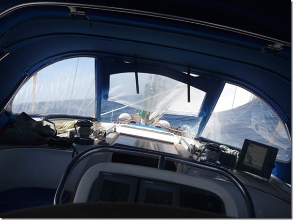
Romping along on a fine reach with a little bit of
heel:-
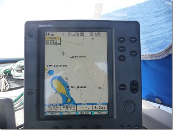
 The next photograph is the chart plotter showing our position
represented by a boat icon near the top left of the screen. The 48nm at
the top left means that the distance from the top to the bottom of the screen is
48 nautical miles. We are passing St Eustatia (‘Statia’) some miles away
to our right. St Christopher (St Kitts) is coming up and we are making
progress to the east of our track and waypoint off the north east of St Kitts
(the square box with a cross in it). We were taking the opportunity to get
a little to the east so that if the wind changes direction adversely later we
will still be able to sail due south again and not have to tack. We aimed
to sail around the bottom of St Kitts and up the west coast a little to an
anchorage near the narrowest part of the island. As it turned out we made
such good progress we continued a few miles farther south to the island of Nevis
which is just out of the picture a few miles below St Kitts:-
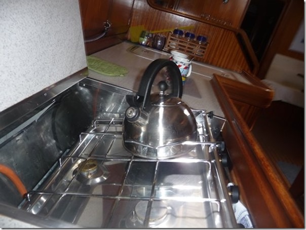
 The effect of the heeling on life down below. The cooker
is swinging on gimbles to stay horizontal and the coffee cups behind the kettle
show the angle of heel. Grab handles around the boat enable you to walk at
an angle:-
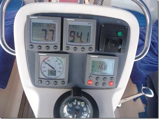
 Instrument time. I know a couple of ‘techies’ read this
so see picture below. Top left is the boat speed in knots. 7.7 knots
is just under 9 mph which isn’t bad for an overloaded cruising boat in this
wind.
Middle top is the depth sounder. This stops reading when
depths exceed around 80 to 100 metres and the word ‘LAST’ pops up to show the
last successful reading. Either the echo sounder is too weak to reach the
seabed and back or we have moved on before it does so. I don’t know which
but as long as we have sufficient depth (we need 2 metres) it doesn’t
matter!
The thing at top right looking like a game boy is the lever to
control the bow thruster, a propeller driven by an electric motor to control the
bow during very low speed positioning in harbours etc. Not used when
sailing.
 Bottom left is the wind indicator. The readout shows 16
knots of wind speed and the arrow indicates where the wind feels like it is
coming from, about 50 degrees off the port bow. The wind is actually
coming from near the beam , at about 85 degrees but the speed of the boat
combined with the true wind direction makes the ‘apparent wind’ direction feel
like it is coming from more in front. The true wind speed is only about 12
knots but again boat speed makes it feel stronger. The distinction between
true and apparent wind (both direction and speed) is an important one and
sailboats sail to the apparent wind which changes as boat speed changes.
We can sail as close as about 30 degrees to the apparent wind but this is only
about 45 degrees to the true wind. Any closer than 30 degrees and the
sails would just flap like flags do.
The bottom right instrument is the autopilot control. We
have set this to show the course over the ground which is 168 degrees.
This is the direction the boat is travelling but the direction the boat is
pointing in is shown by the compass and is about 164 degrees. The 4 degree
difference is caused by the boat making leeway to the right. The keel goes
down to 2 metres below the water line and, apart from it’s 4 ton weight keeping
the boat upright, it limits drifting. If it were, say, 5 metres deep, we
probably wouldn’t drift at all but the extra drag and weight would mean we
wouldn’t have any speed. Yachts are designed with a compromise between
limiting drift and enabling boat speed.
We picked up a mooring buoy off the west coast of Nevis before
4 pm. Heymede is a different type of yacht and could not make such good
progress to the east unfortunately so stuck to Plan A and anchored off St
Kitts.
|