Bush Stream
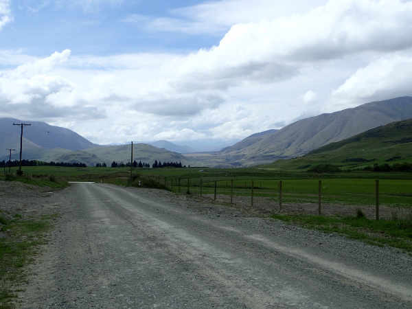
The West Coast had been beautiful, Mt Cook and its glaciers spectacular but where was the wilderness we had imagined we would find in New Zealand? With Christmas over, the urban exodus from the east coast towns had started. Kiwis of all walks of life had packed their vehicles and were heading west. As we drove towards the plain, we passed a steady stream of shiny ‘utes’ towing the latest jet boat model, old camper vans piled high with kayaks, bikes, barbecues and the dog’s kennel, and everything in between. Our search for wilder places started on the map. Two Thumb Range, running parallel to the Southern Alps caught my eye, not just the name but because it looked wild and not as high (meaning fewer glaciers for which we weren’t equipped) as the Mt Cook area. The southern end turned out to be a military shooting range, out of bounds to the public but an internet search revealed an article in ‘Wilderness Mag’ about a tramp further north. A couple of sturdy lads set off one evening and hiked up Bush Stream to Crooked Spur Hut then carried on over the mountain. There were no details but at least we knew it was possible. The full trek across the mountain wasn’t an option for us as we needed to get back to where we would start from. From the map, I was confident we could work out a 4 day circular hike, the only problem was that the tracks didn’t quite join up*. Franco vetoed my proposal, blazing a path with our bare hands through thick undergrowth on a compass bearing using a 1:100,000 map was not his idea of fun. I reluctantly accepted his wisdom. We turned off the main road at Arundel and shortly after Peel Forest Village, the tarmac road turned into gravel. We still had 40km to go to Mesopotamia Station and the start of our route. The vast glacial Rangitata Valley we were driving up was beautiful and had once belonged to a single estate, the vast Peel Station which was later subdivided. Although farmed, the landscape was rugged and wild, more like the New Zealand we had envisaged.
The road turned into gravel
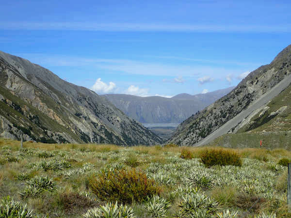
Rangitata Valley We camped in the DOC (Department of Conservation) carpark at the start of the hike.
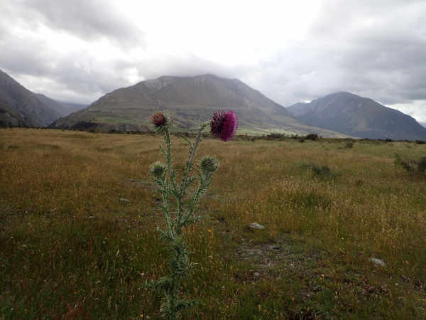
Scotland? Who was the idiot that introduced thistles? When white men came to New Zealand seeking adventure or a better life, they bought 99 year leases for tracts of land from the newly formed New Zealand Government. Ninety-nine years, longer than most lifetimes, seemed like an eternity and the new farmers installed themselves, as if for ever. Leases were handed down the generations or sold on and a century passed. The government hadn’t forgotten the land it had leased and instigated a ‘tenure revue’ process. The farmers are unhappy but in our eyes, they are doing rather well, they give back some of the land (usually the less productive) and in exchange are given the freehold on the remainder. The returned land has often been handed over to DOC to be managed as open access land for all New Zealanders and visitors to enjoy. Mesopotamia Station handed back the mountain which became part of Te Kahui Kaupeka Conservation Park.
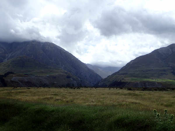
The Bush Stream Valley While cooking tea, we discussed our route. It was along a river valley and the line on the map showed it crossing the river repeatedly. Neither the article in Wilderness Mag nor the DOC information panel** mentioned river crossings so we assumed there would be bridges, probably the kind of small suspension bridges we’d seen all over the west coast.
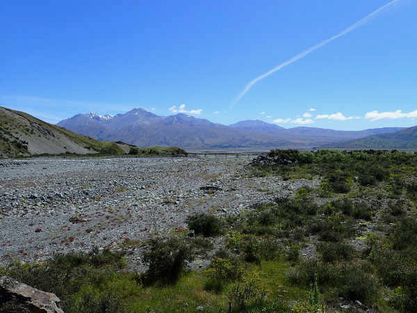
Looking further up the Rangitata Valley from the DOC carpark We awoke to another glorious day and set off. A helicopter was taking off from Mesopotamia Station and we waved at a teenage JCB operator who was skilfully improving a drainage ditch.
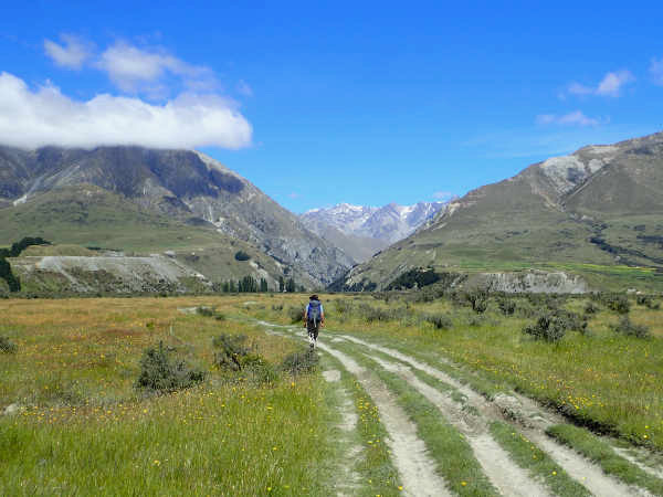
Franco setting off
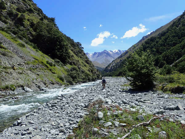
Bush Stream
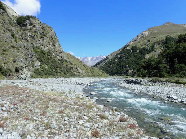
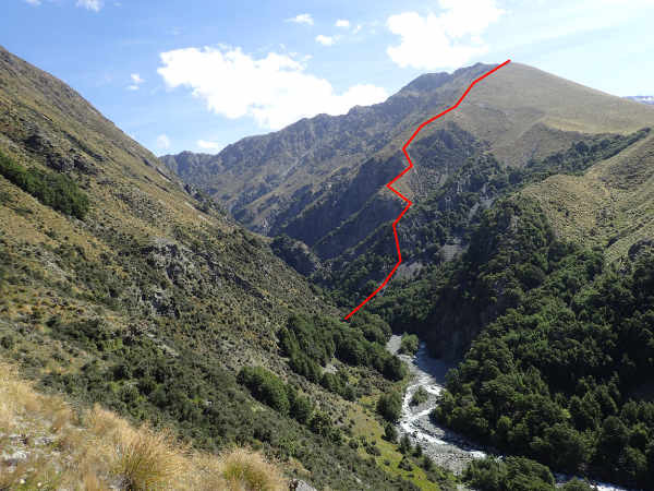
Looking back towards the Rangitata Valley with the Mesopotamia Station Bridge After an hour tramping up the pretty valley, we were surprised to find our track blocked by the river and not a steel post (marking the route) nor a bridge in sight. Bush Stream was fast flowing and it was hard to gauge how deep it was. Franco tried climbing up the bank but it only led to narrow shelves in the rock-face. We were reluctant to give up so early, so in the end Franco attempted a crossing. The water level came up to his thighs, high enough that you wouldn’t want to lose your balance and take a swim. He returned with a long stick and we used it for support as we crossed over, one in front of the other, holding onto each other, (“just like the Ona native people of Tierra del Fuego” I thought) apparently a method taught in mountain leadership courses in the UK. River crossings are inherently dangerous and had the water level been higher or the current faster we would have had to turn back.
The red dot is where we decided we had to cross the Stream Less than a kilometre later, our route was obstructed once again by a stretch of white water. This time, a path lead up the steep cliff. Up and up we climbed, but sooner or later we needed to head back to the valley floor. We slithered down a steep scree slope, only to find we had to cross the river anyway.
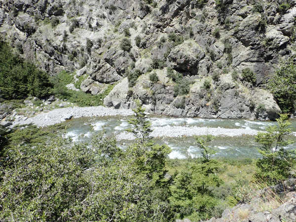
Looking down on Bush Stream
Wet boots again The detours were proving harder than the crossings so we decided to stick to the river bed. Soon we lost count of how many times we’d forded Bush Stream, emptying the gravel from our boots every now and then.
Franco walking up the river bed with our pole
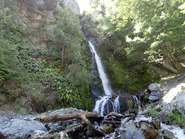
A side stream waterfall
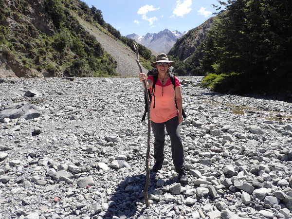
Kath Ahead the gorge narrowed, here the water would be deeper, luckily the map showed the path heading up over a shoulder. In places the narrow track had been dug up by wild pigs, another white man import. Crooked Spur lay ahead but it looked like we had another river crossing before our final ascent. We hadn’t seen a soul all day but high up we could make out a small group of walkers.
Franco on the shoulder detour
The route up Crooked Spur As we approached Crooked Spur Hut we heard laughter and much to our surprise found a full house and the ‘garden’ packed with tents. As we were erecting our tent, Rasmus, a Danish hunter offered us thar (a Himalayan goat brought to New Zealand in the late 1800s for ‘sport’) he’d shot that afternoon. The meat was tasty but tough as old boots as it hadn’t been hung and the communal mastication brought us together. The other hut occupants were Murray and his extended family. Half the gang had helicoptered in (the one we saw that morning) with the gear and a good supply of beer and spirits. Murray, the eldest at 70 had walked. He explained that he’d worked at Mesopotamia Station when he was a young man in the 70s before going off to (the NZ part of) Antarctica. His claim to fame is that he was instrumental in getting the husky dogs shipped back rather than shot when the decision was taken to make the continent dog free. He reminisced about his farming days and we soon got onto the subject of keas. Murray told us that the farm hands used to attract them with little rolls of aluminium, then ‘bop them on the head’. His wife was seething about keas, certain that they kill sheep. Murray was less adamant, though he had seen evidence of the birds pecking the fat off the backs of the livestock. He regretted the creation of the conservation park, fearing that the land would become covered in impenetrable scrub, no good for farming nor tramping. Sharing the ‘garden’ with us were three trampers who’d come from across the mountain. They asked us, genuinely concerned, about the water level in Bush Stream. Apparently the water levels were unseasonably high. Rasmus had missed the path over the shoulder and continued up the river through the gorge, where he’d slipped and taken a bad swim, not an experience he wanted to repeat. It was a jolly evening and we were sorry to part company the next morning as we left to retrace our steps. This time we got it right and only crossed Bush Stream six times.
Looking towards Rangitata Valley from Crooked Spur Hut
* A round trip is possible, it passes through land owned by Mesopotamia Station and uses two private huts. It rejoins Rangitata Gorge Road down Forest Creek. Seek permission from the station. ** The DOC notice board does mention the hazard of rivers. We were so convinced there would be bridges that we somehow missed the river warning section! |