Rivers, Anchors, Superyachts and History
|
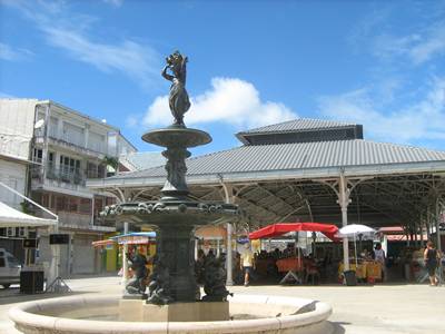
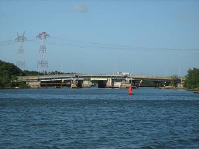
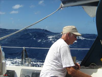
Our position is 17:00.25N 61:45.60W 9 February 2011 On Saturday we left Bourg des Saintes to sail to Guadeloupe. The wind was only 15-18 knots but unhelpfully was coming from North of East so initially we were motor sailing. However as we got closer to the South East coast of Basse Terre the sea got flatter and the wind came round so we were able to sail close hauled. This was made more exciting by having to dodge many fishing pots and as we approached the entrance by having to dodge big ships that appeared not to be following the buoyed channel. But we arrived unscathed in the Fort de Bas marina at Point a Pitre and, upon receiving no reply to our radio calls (it was lunchtime), took advice from the man on the fuel pontoon and motored into the Blue Lagoon – a sort of marina extension – where we were met by someone who looked official and helped us tie up. It wasn’t the most convenient spot as the dinghy was needed to access the Capitainerie and the facilities, so after a quick lunch we duly inflated the rubber boat and were on the verge of going to check in when another yacht arrived and said we were in his space. Some confusion reigned as he seemed unclear as to the number of his space and the warps on the pontoon looked a bit short for his size, but he went off to another space and we, after going back inside for the things we had forgotten, made another attempt to leave when the official person from earlier came dashing up and told us to wait as there was “un probleme”. His English wasn’t the greatest and neither is my French so he then said we were to radio the office and talk to Carl to get it sorted out. On first contact Carl didn’t seem to know anything about the problem and asked if we were unhappy with the space, but when that was sorted out we were told to come round to the visitors’ pontoon in the main part of the marina, where we duly tied up bow to a pontoon and stern to a buoy right next door to the Capitainerie. Unfortunately the dinghy got trapped on the adjoining boat’s stern line and was a complete pain all the time we were there, as we had no use for it once moved, and the messing about had gone on so long that any shops that were open on a Saturday afternoon had closed, but otherwise everything was fine. The next day being Sunday we walked into the town as no busses seemed to be running and there was very little evidence of taxis. When we got to Point a Pitre we found all the taxis servicing a cruise ship, tied up in town. The ship seemed to have its own market, inside the harbour gates selling the usual sort of tourist merchandise, but apart from that everything was closed. The walk seemed to take us through the red light district as there was one street where many women in short skirts were sat outside small wooden houses on chairs and when it came on to rain they just put umbrellas up. We were sheltering under the overhanging balconies but when cars started pulling up it seemed time to move on. We had contemplated walking to Pont de la Gabarre to look at the anchorage by the bridge and assessing the quality of the buoyage beyond but it was too far and too hot so we decided to return to the boat instead. In the evening we went round to the Polygon Basin (another part of the marina) where there are many restaurants and boats can tie up right next to them. Some people on a big catamaran were entertaining dinner guests on their aft deck in full view of all the restaurant diners – I felt like asking if they had any spare tables – but we opted for one recommended in the pilot book. The next morning I made use of an internet cafe to do some work (until the connection went down). There was supposed to be wifi in the marina but that also wasn’t working, and then we went to the chandlery to buy a chart of the bay at the top end of the Riviere Salee, followed by some food shopping before preparing for leaving the marina berth and moving to the anchorage by the bridge. The plan was to reduce the distance and improve the angle of sailing to Antigua by leaving Guadeloupe through the Riviere Salee, which separates the two halves of Guadeloupe (Basse Terre – the high bit – and Terre Haut – the low bit!) There are three opening bridges across the river but they only open once a day – the first at 5am and the next one at 5.30am so the journey through the river is undertaken entirely in darkness. Because of this we went up as far as the first bridge on Monday afternoon and anchored there very peacefully in company with 2 others who arrived later. The river and its approaches can be shallow and the advice is that the maximum draught that should attempt the trip is 1.8m. Such charted information that we had indicated the depth as 1.5m but in fact there was very little information as both the chart and the chart plotter gave no indication of anything in the river although we knew from Chris Doyle’s pilot book that there are lit buoys in the river. He also said there were waiting buoys north of the second bridge for use by those coming south (their first opening is at 4.30am) and that those going north should use them to wait for daylight, but when we got there they didn’t appear to be there any longer. In the end there were 5 of us going North as 2 more arrived in the morning, but the passage in the dark proved much easier than had been feared – the most dangerous moment came while we were all milling about waiting at the second bridge and a Frenchman started reversing into us – and we all arrived in Grand Cul de Sac de Marin unscathed. At that point we all anchored and had breakfast before attempting to follow the buoys across the shallow bay to the Passe a Colas. The sail to Antigua was a good beam reach but the seas were big and confused so there was quite a lot of water breaking into the cockpit. We were grateful to arrive at English Harbour at around 14.30 but we then spent some time trying to decide where to anchor. Eventually we chose a spot in Freeman Bay, where the wind swirls round and everyone can end up pointed in different directions. First time down it dragged and upon recovery brought up a old coil of cable, but the second seemed to be OK so we felt confident enough to go ashore to reconnoitre Nelson’s Dockyard. The next day we walked round to Falmouth Harbour and were overwhelmed by the super yachts, which were far bigger and shinier than anything we’d seen to date. The paid crews were cleaning with toothbrushes and tooth picks to make sure no speck of dirt escaped and no millimetre of boat unpolished. We then dinghyed round the harbour investigating alternative anchorages, without coming to any firm conclusions and instead of moving the boat went and had lunch on the Antigua slipway side of the harbour, away from the millions of cruise ship passengers arriving by the busload for a tour of Nelson’s Dockyard. This indulgence seemed to call for some exercise to balance out the excess so we walked to Fort Berkeley and then over the ridge to Pigeon Beach in Falmouth Harbour. I felt quite virtuous about the exertion until we were passed by runners – obviously paid super yacht crew keeping in trim for all the winch grinding. Going on deck for a look round before going to bed revealed that the anchor had been dragging in the vicious squalls that had been coming through (It appeared that the GPS display had not been responding properly to the movement) and we were about to nestle alongside another boat. Eventually, after a couple of attempts we re-anchored but it is still slightly unclear how well it is holding so a long night of anchor watches stretches ahead.
Market Square at Point a Pitre Pont de la Gabarre in daylight
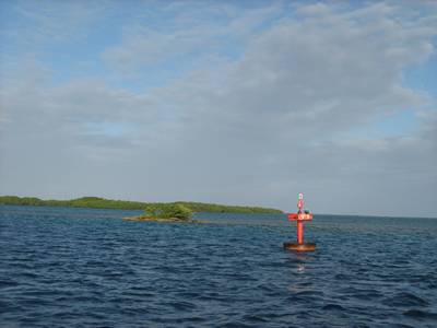
Negotiating the Passe a Colas Big waves on the way to Antigua
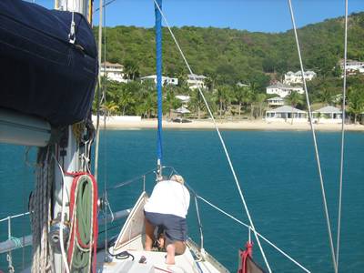
Anchoring in Freeman Bay - is this the final effort? Super yachts in Falmouth Harbour
Old sail loft pillars in Nelson's Dockyard, English Harbour |