The Last 20Nm
Moorglade's Voyage
Ted Wilson
Thu 20 Sep 2012 04:46
|
Our Position is 41:57.414N
70:39.580W
When we motored out of Scituate Harbour, a few
minutes after ten, into an Easterly swell, I don't think either of us thought
much about this being the last sail of 2012, and probably Kay's last sail this
side of the Atlantic aboard Moorglade. The swell made the ride uncomfortable in
the shallow water close to shore, so we chose a track a bit further out to
sea, where the waves were less steep. By 11:15 we were under full sail, the
engine off and drinking coffee. at least we sailed the last 20Nm.
Plymouth Harbour shares an inlet with
Duxbury Bay and Kingston Bay. Gurnet Point and Browns Bank form an
entrance about 3 cables wide behind which is a very large area of shallow water,
banks and islands. We made our way up the 5 Nm of winding, well marked and
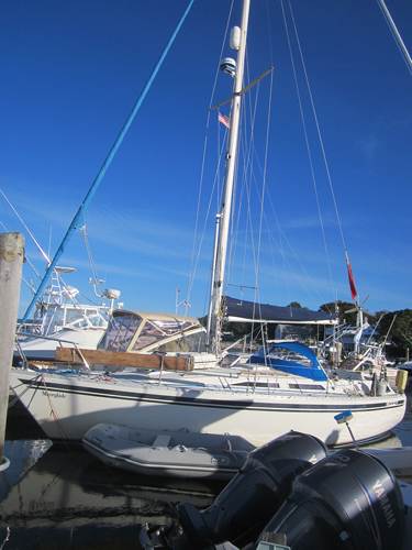
dredged channel to Plymouth Marina. We tied up at the slip allocated to us but
Kay pointed out that, we were on a falling spring tide which was
going to go down a foot more than we had water under our keel at the dock. After
a bit of shuffling motor boats, a deeper birth was arranged and we relocated
and settled in by 14:40.
Over a cup of tea we reflected on our Cruise. We
had done the last 20 miles of a cruise of more than 3,500 miles. (the log was
broken for a while until new parts arrived and stuck with weed a few
times) We had visited 15 different countries the last one being the USA
where we sailed in 17 states. (if Minnesota and Wisconsin are
included)
Tea over, it was time for Kay to start sorting out
her possessions and try to work out how to get them all back to the UK. After a
lot of weighing of bags and rearranging of heavy items and a good deal of
cursing, Kay had her luggage just on the limit, a bulging laptop bag and a
fleece, coat and waterproof to wear at the luggage drop. It is a good job we
have a bag weigher on board. We had established the timetable for the direct bus
to Logan Airport for the following day and the marina had offered to drive Kay
the few miles to the bus stop, so tomorrow was now free to have a look
round Plymouth.
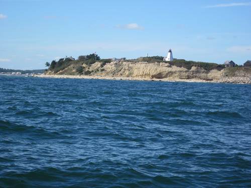
 Gurnet
Point
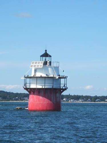
Duxbury pier light, turn left here for Plymouth
 The channel to Plymouth runs close behind a narrow
spit of sand
dunes
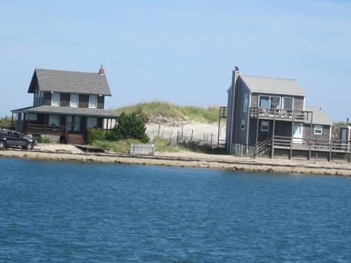
finally settled in a slip with adequate depth
which surprisingly has a few homes built on
the harbour facing shore
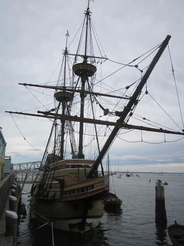
Plymouth is all about the Mayflower and the
Pilgrims This is a replica built in Brixham Devon in 1955-7 with its
shallop
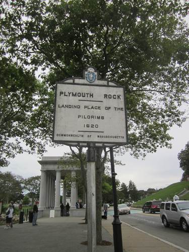
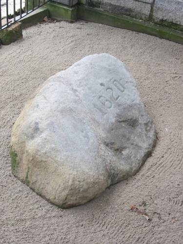 Much is made of the Plymouth Rock onto which the
Pilgrims are said to have stepped ashore, However there was no mention of a rock
in contemporary writing.
It was first mentioned in 1741 and not engraved
with 1620 until the 20th century.
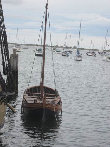
An advance party arrived in Plymouth in a
small shallop. Actually they intended to go to Virginia but ended up at the
wrong side of Cape Cod, so anchored the Mayflower where Provincetown is now and
went looking for a place to settle.
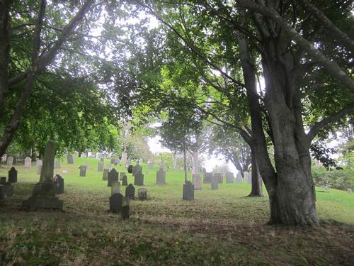
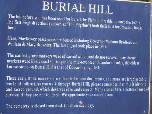 Half of the party died in the first year and are
buried here
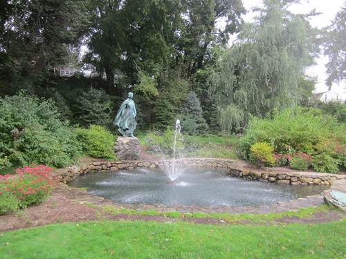
 This pleasant little park is a recent addition. The
statue recognises the
role
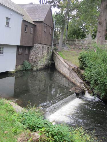
This river was a primary reason for selecting Plymouth as a place to
settle
women played in the founding of a
nation. Erected by the
National Society The
earliest houses were along its banks not down by the sea.
of New England
Women
|