Martinique
Mystic of Holyhead (successor to Lynn Rival)
Rachel and Paul Chandler
Fri 3 May 2019 01:16
|
14:44.43N 061:10.62W The winds were light during our last few days in Roseau and we left before breakfast expecting a slow 36-mile passage to Martinique. But once we got to Scott's Head, the conspicuous headland at the bottom of Dominica's leeward coast, the winds became strong so we made good time, beating the whole way with full main and 2 reefs in the genoa. By early afternoon we were anchored north of the jetty in Saint Pierre but soon had to move as one of our neighbours was concerned that we were too close. The area for anchoring is very limited - the bottom is steep-to and shifting winds and currents make it difficult to find a suitable spot amongst already anchored boats. After one night we moved to a spot south of the jetty and closer to the town centre. Last time we visited Saint Pierre the weather hadn't been good for exploring so now with the promise of relatively fine weather we hired a car. The northern part of Martinique is very picturesque and much of the area is a National Park, including Mount Pelee - the volcano that destroyed Saint Pierre in 1902. We planned to take the least difficult walk up Mount Pelee and when we got to the trailhead, which is on the west side, we were promised a 2 hour "moderate" hike to the caldera. 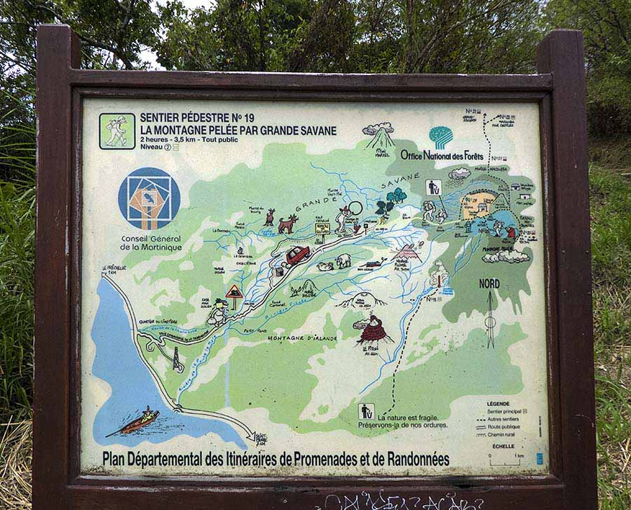 Most of this signboard refers to the road to the trailhead! Luckily we had printed a good trail map from www.alltrails.com 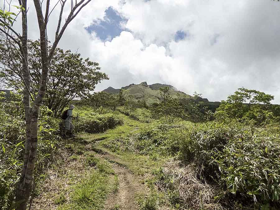 Looks straightforward from here 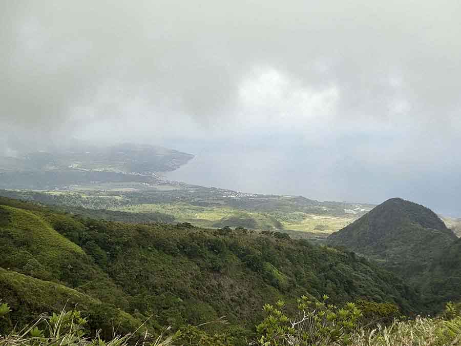 Half way up, looking back down to St Pierre. Can't make out Mystic at anchor With plenty of stops to catch our breath we got there within the alotted time. The trouble was that we were not at the top and so we followed the path upwards, which got steeper and more precarious as we went on. After another hour and much clambering over rocks we got to one of the peaks but couldn't see a thing because of low cloud and rain. Our descent was a bit tricky at first but then quite a bit faster so we eventually got to the bottom after about 5 hours in all. 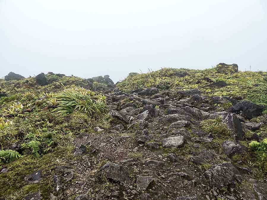 Within the caldera the terrain changed - this is the easy bit! 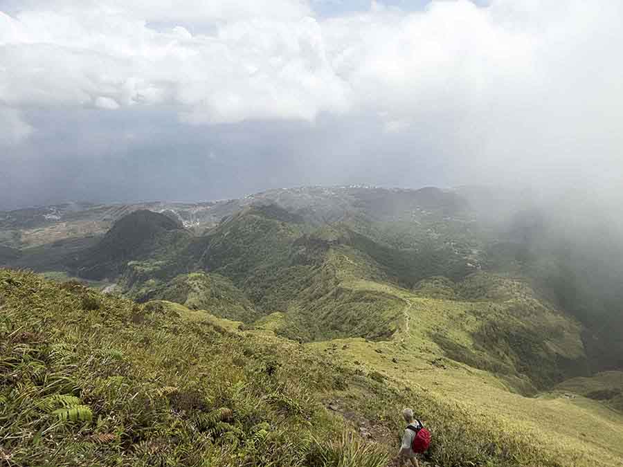 What goes up must come down. Knees, do your duty! Feeling exhausted but satisfied with our achievement we drove back to Saint Pierre only to find our dinghy stuck under the jetty. We had tried to use the anchor to keep the dinghy in place but it doesn't work in sand. It's often a problem that town jetties are designed for large boats and not dinghies. The alternative is to use the beach but being steep-to makes landing and setting off a difficult and wet experience. Once unstuck we were soon back at Mystic only to find our neighbour gesticulating to us. Apparently we had "collided" with them during the day, despite not having any problems in the previous 24 hours. Our anchor was still in the same place but in light winds and shifting currents funny things can happen, different boats don't always move the same way. As soon as we could we moved our anchor just a few metres away and had no subsequent problems. The following day we gave our feet a rest and drove to the trailhead on the east side of Mount Pelee. An information board there told us that the hike we'd done at the top was classified as "difficult - for adventurous hikers"! Now we know. With that boost to our egos we drove back to the main road and onward to the east coast of Martinique. We then headed south along side roads bordering the National Park, passing through many scenic villages and also intensively cultivated areas. At a little village called Josephine - perhaps the Empress's birthplace? - we turned back west winding through the mountainous region of the Pitons du Carbet with gorgeous scenery, much like passing through an overgrown botanical garden. 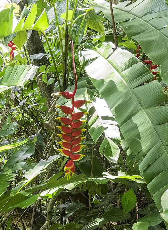 Heliconia, grows here like weeds  Less common - porcelain rose After our day of rest we put on our hiking boots to walk the Canal de Beauregard, which was built by slaves in 1650. For some time this has been a popular hiking trail but it's now officially closed. But not physically closed, so when we got to the trailhead at the lower end and saw another car parked, we set off along the canal side. The scenery is spectacular with the canal clinging to the edge of the cliff in places. Photography doesn't do it justice. We met just a few other hikers and the only sounds are of running water and birds tweeting. Nearer the source the route is lined with flowering plants - heliconia, red ginger, porcelain rose and bird of paradise. Being only gently sloping the walking is quite easy but you do need a good head for heights in places. It rained as we got close to the source which made the going more slippery but certainly no more hazardous than the top of Mount Pelee. 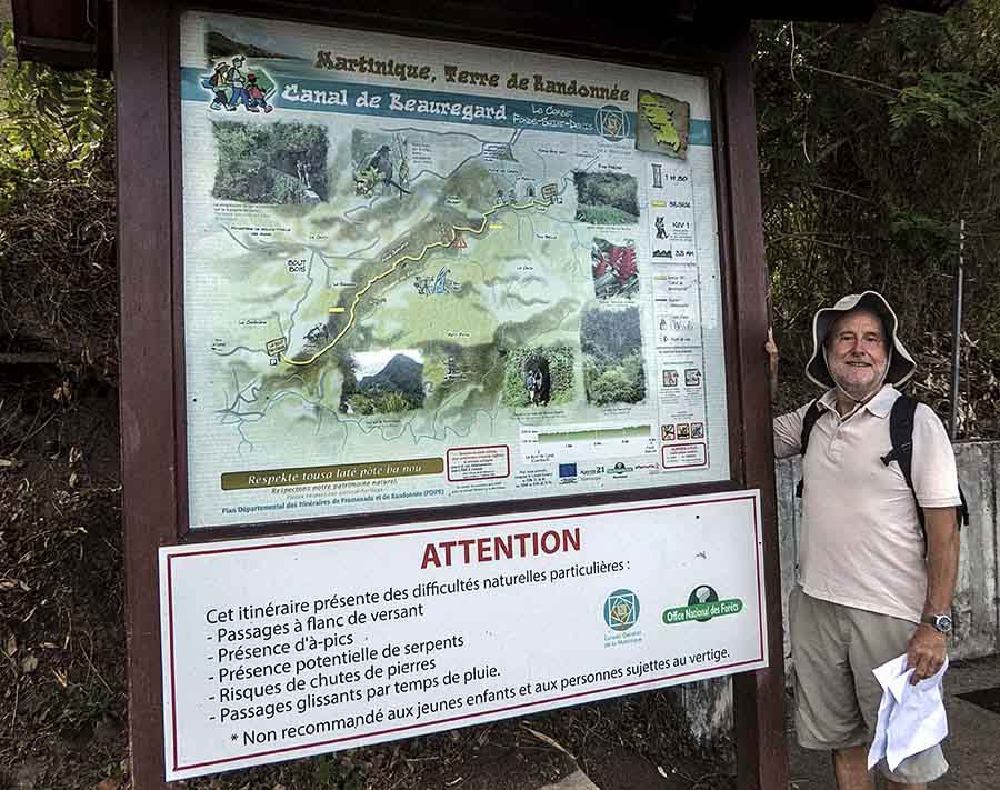 With all those hazards you'd think the trail would be closed. Actually it is, but we won't let such a minor detail stop us. 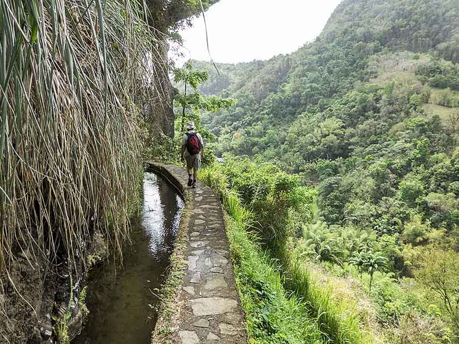 Challenging terrain for canal builders. The Canal de Beauregard is still in use after over 350 years 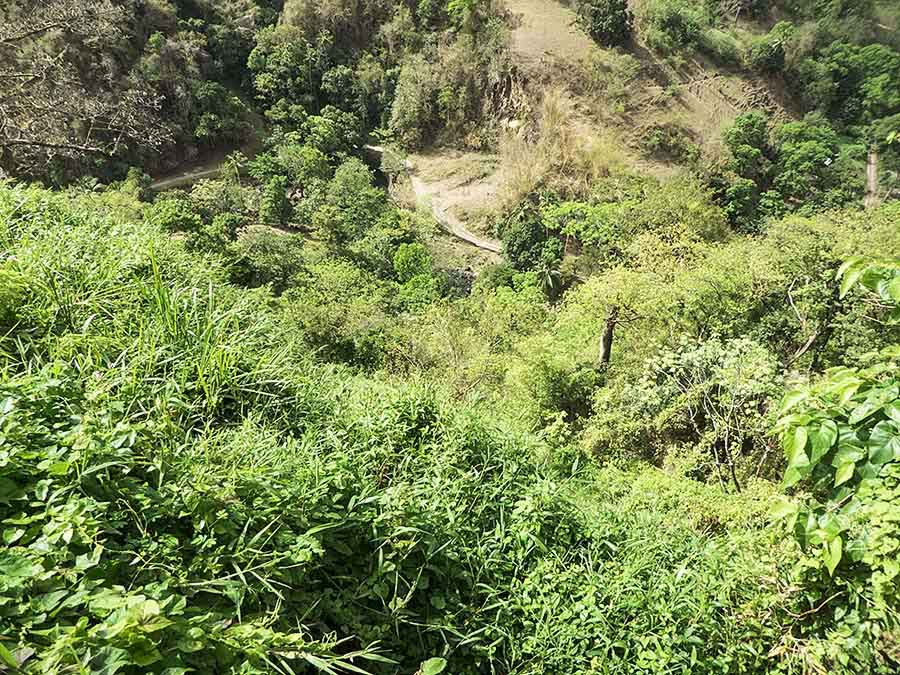 Looking down . . . 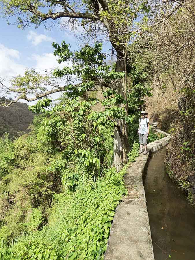 . . . but not while walking! 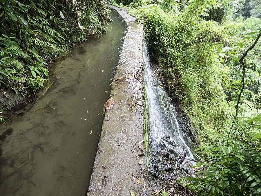 A slippery bit 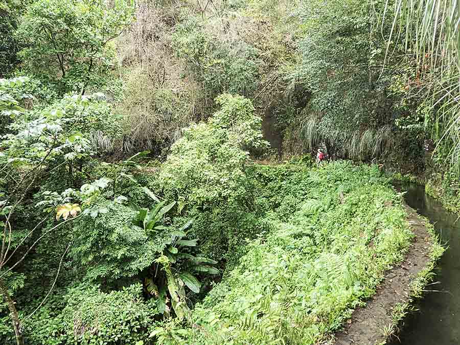 Triumphantly we reached the source; then we enjoyed the whole (4km) trip from the opposite perspective We stayed a few more days in Saint Pierre. The winds were light so we dispensed with the outboard and rowed ashore to the beach for our daily trip to the bakery. On May 1st everywhere was closed and there were ominous signs of musical entertainment being prepared for in the main square. Sure enough it got going in the early evening but fortunately it finished before 11pm. |