Brasil's hidden gems
Mystic of Holyhead (successor to Lynn Rival)
Rachel and Paul Chandler
Thu 6 Aug 2015 18:57
A week went by at Pier Salvador, catching up with
the usual chores, fixing a few things and getting a new (starting)
battery. Most evenings we strolled around the seafront to renew
our acquaintance with the local pizzarias and ice cream parlours.
Having done the sights in 2013 we were happy to avoid downtown but
needed to visit to the Captain of
Ports. In Salvador they insist on a visit first to the
immigration office - a long walk to the other end of the port -
even though our visas are up to date. The process of getting
entry and exit stamps to register a cruising yacht's presence
takes a whole morning - involving 2 separate visits to each
office: first to enter, then to exit.  Typical street art in Ribeira, Salvador It's been a while since we ventured inland ... and we were keen to see more of this part of Brazil (the state of Bahia). A few people had mentioned the Chapada Diamantina National Park, 400kms inland, as a nice place to visit so we arranged a hire car and packed our bags. Sandoval was horrified and suggested we took the bus - because it's a long journey and the roads (he said) are bad. Heading inland the immediate hinterland is called the Reconcavo - a fertile area where in colonial times African slaves laboured on sugar cane and tobacco plantations. Out of sprawling Salvador and off the main road, we drove through the lush countryside seeing few signs of the once intensive cultivation. We visited the quiet towns of Cachoeira and Sao Felix on the Paraguacu river - once important ports and centres for slave trading. Now they are local hubs in an area that - apart from the tropical vegetation - reminded us of rural Uruguay (the populated bits), particularly because there are many old (1950s or 60s) cars and trucks about. We even saw a gaucho, though not many horses. 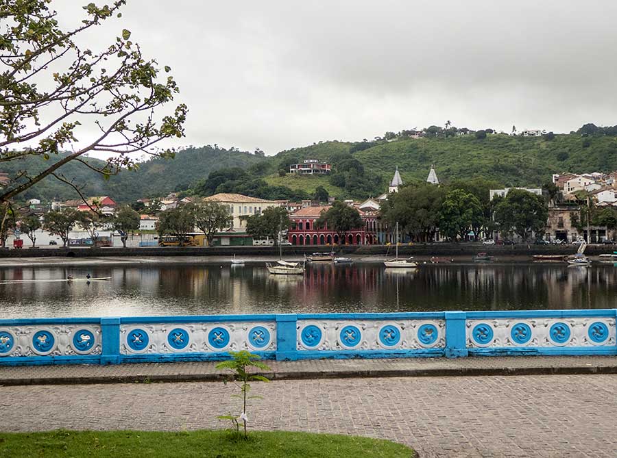 Looking across the river to Cachoeira 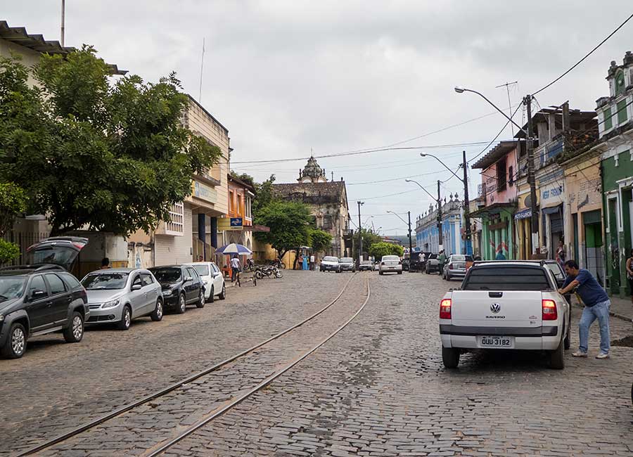 Sao Felix - and yes, the rail tracks are used We were fascinated to cross the river between Cachoeira and Sao Felix on a railway bridge (British built) that has been boarded out for shared - road vehicles when there are no trains - use. We thought the railway must be out of use but in the evening we heard a train and sure enough a very, very long freight train slowly wove it's way through the town, over the bridge and onward. Presumably the locals know the times and plan accordingly as there is no other crossing nearby. 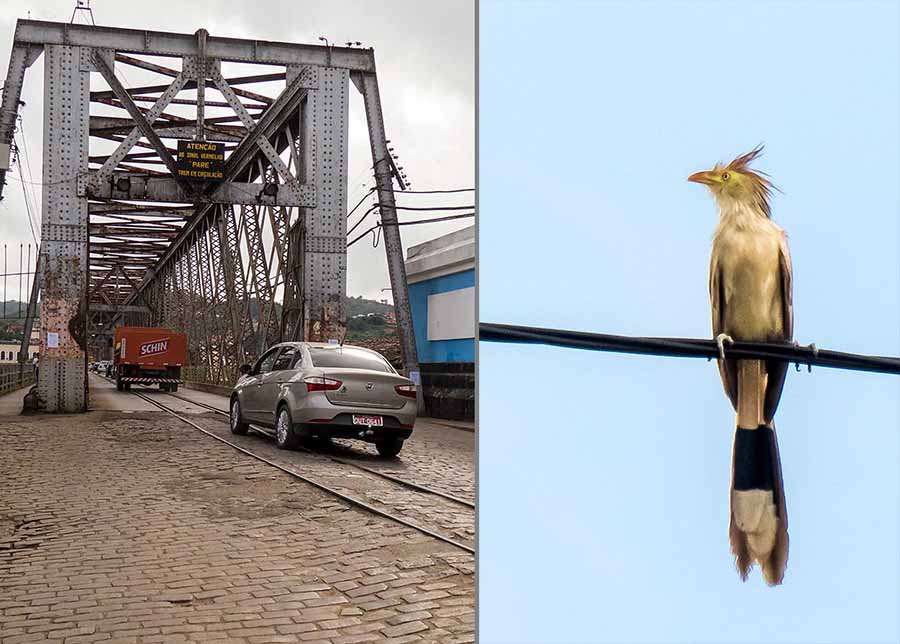 The bridge in vehicular use . . . . . . What make am I? (inhabitant of the Reconcavo) After a night in Sao Felix we continued west. Our route took us on a ferry across part of the river Paraguacu that has been dammed to form a reservoir. Up to now the roads had been ok but after a stretch on the BR 101 (which runs north-south along the coast) we were on the road west towards the heart of Brazil (Brasilia, about 1,400 kms away). It's a fairly busy road with lots of lorries and potholes. Here the countryside is often quite sparse, in places little grows on the rocky ground except hardy shrubs and cactus.  Waiting for the ferry The driving was hard work - although it was easy enough to overtake the lorries, dodging the potholes at the same time is challenging. At lunchtime we were ready for a break. No problem: in Brazil it's easy to find roadside restaurants serving delicious food that would put most UK service stations to shame. And by mid-afternoon we turned off the main highway to arrive in Lencois, a small town on the east side of the Chapada Diamantina.  A Lencois street - reminds us of Greece in the 1980s The "Diamond Highlands" is a beautiful area with a long and complicated history. After a preliminary gold rush diamonds were discovered here in the 18th century (well before the finds in South Afica) so the area was settled and exploited. The diamonds eventually ran out and it went into decline until the 1980s when a National Park was established. It's a hiker's paradise and - thankfully for us - there's an excellent guide written by Roy Funch, an American who helped establish the National Park.  Clambering down the Lencois river bed  Rock pools - wonderful colours but not much sign of life  Rachel in the spotlight, in one of the 'thirty sand colours' caves  Avian visitors at breakfast on our hotel terrace We spent four nights in the Chapada and only managed to explore a small fraction of the many valleys, rivers, waterfalls and caves. We visited some of the main sights including some on the Lencois river close to the town. The trails are not signposted and local guides tried to "pick us up" but the paths to the nearby sights are well worn and we prefer to go at our own pace. We were glad of the car to get to further away sights like the Pai Ignacio mountain and the Lapa Doce cave as otherwise we would have had to use a tour bus. In the Lapa Doce cave a guide is mandatory so we tagged along with another couple. The guide spoke good English so translated what we didn't understand of his Portuguese explanation. 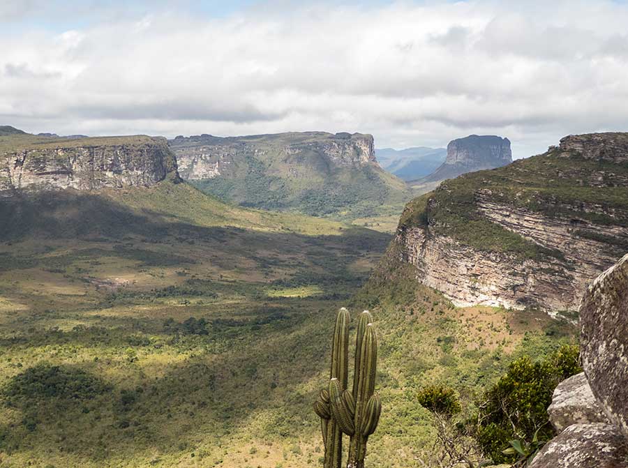 The view from Pai Inacio, southwards along part of the mountain range forming the Chapada Diamantina  Looking the other way - all the flat tops are at an altitude of about 1300m - and it's very windy on top!  In the more sheltered areas the hilltops bloom 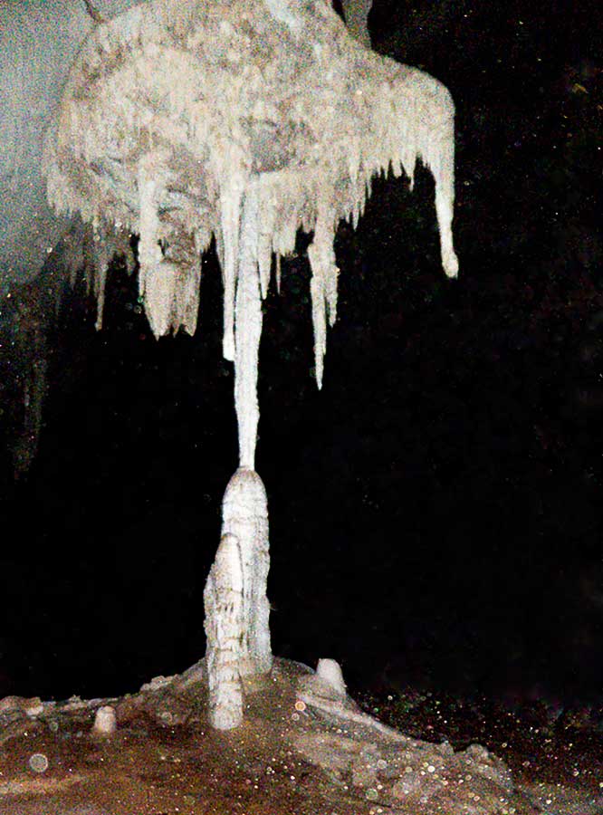 While down below, inside Lapa Doce, it's dark - we went in only 1km, of the total explored length of 26km Lencois is a very pretty town - the prettiest colonial town we've visited in Brazil. The narrow cobbled streets, brightly painted houses and the tumbling river, combined with plentiful bars and restaurants make it an ideal place to stay. However we wanted to visit the Cachoeira Fumaca (smoky waterfall), which meant an 80km drive from Lencois to Vale de Capao. From the trailhead it's a steep climb for an hour and then another hour's more gentle hike. It's a popular trail so we met lots of others, mostly younger but not necessarily fitter, on the way. The waterfall, the second highest single drop in Brazil, is best viewed by crawling onto a ledge that sticks out above it - definitely not for vertigo sufferers!  That's 340m vertical drop - and there's a volunteer guide to hold onto one's heels!  No safety net here We stayed the night in the village of Capao, which is a fast-growing village, popular with new agers. We felt a bit out of place having forgotten to bring our hippy gear and dreadlocks. After such a wonderful time we were not looking forward to the drive back to Salvador. The lorry drivers, mostly with their long 9 axle combis, are generally considerate, if unpredictable when weaving around the potholes. Some of the (relatively few) car drivers are a bit mad. At one point we drove around a bend to be confronted by a car on our side of the road, overtaking a lorry. The car swerved onto our hard shoulder, leaving room for us to pass between it and the lorry. Luckily Rachel - at the wheel - didn't panic! Another amusement was the enterprising locals who dodge the traffic to fill in the potholes with gravel. As you slow down they hold out their hands in the hope of donations. They have shovels, barrows and some even wore hard hats. If only a small proportion of truckers give them something it may be a good earner, but not much fun in the rainy weather we were having by then and we felt rather sorry for them as their work soon got washed away.  Well, if the government won't fill the potholes we know a man who will! |