Pretty Puerto Rico
Mystic of Holyhead (successor to Lynn Rival)
Rachel and Paul Chandler
Sat 25 Feb 2017 16:41
17:57.15N 066:17.52W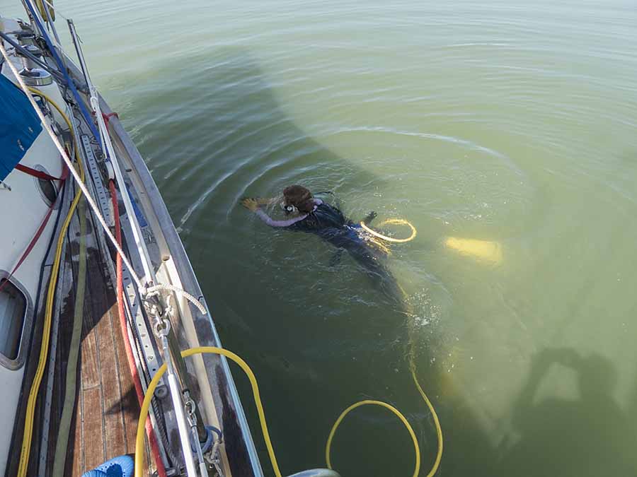 First things first! A propeller inspection, using our 'hookah', was necessary 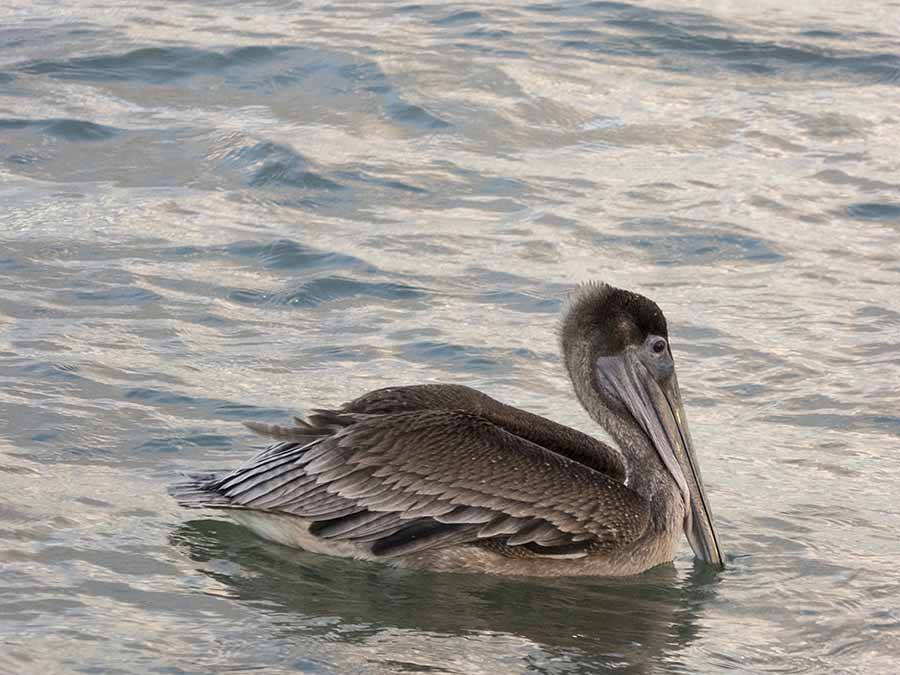 At dusk the brown pelicans came out to catch supper (each wolfing down a bucketful of small fish) After another few days enjoying a mostly quiet (apart from the weekend jetski club) life aboard in Puerto Real bay we hired a car and went exploring. Puerto Rico is bigger than the islands we've been visiting of late but the main roads are a lot better. Even so a trip to the capital, San Juan, is 2.5 hours so we were content to explore only the western half of the island. We drove down to the south coast and east as far as Ponce, taking a look at some of the places we might visit with Lynn Rival. The countryside of the coastal plain is green and fertile, with extensive dairy farming and horticulture. Every village has a tsunami warning sign; of course hurricanes are a risk. It's hard to imagine what havoc they must play on the well-ordered scenery and laid back pace of life. 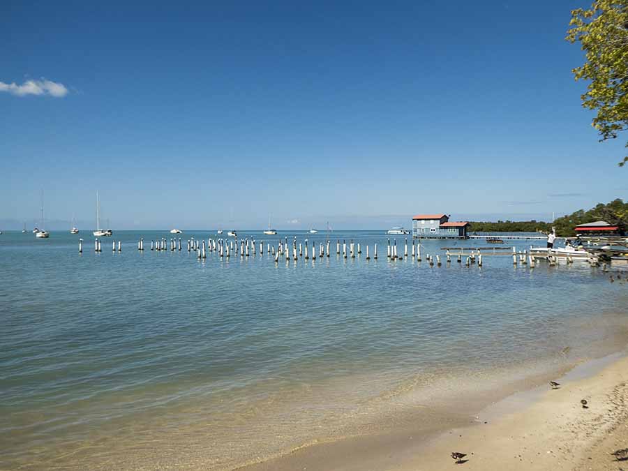 The anchorages at Boqueron, just south of Puerto Real . . .  . . . and La Parguera, just around the south west corner of Puerto Rico Ponce is not a very old town but has a pleasant centre.  Colonial architecture in Ponce  Valentines Day cometh! After a walk around the main square and marketplace we drove north into the rainforest covered mountains and picked up the "Panoramic Route" which winds it's way from the east to west across the island. It doesn't just follow one road so the navigator has to keep alert. The scenery is dramatic as the route winds its way up mountains and along ridges where sometimes houses are perched on stilts, then down into valleys filled with cloud. The dense green of the rainforest is often broken by flowering shrubs and trees, including the pretty white and mauve Brunfelsia - which we last saw in abundance in southern Brazil. The roads are not busy so they are pleasant to drive along - until it rains and visibility becomes a problem. 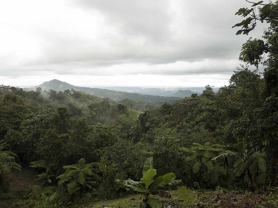 In the mountains of central Puerto Rico On our second day exploring by car we drove north to visit the Arecibo Observatory, which is the world's largest single dish radiotelescope (1000ft wide). The setting is extraordinary, seemingly in the middle of nowhere, surrounded by rainforest covered haystack hills. No wonder it is a popular film location, including for Goldeneye. The area is also famous for it's vast underground river cave system. 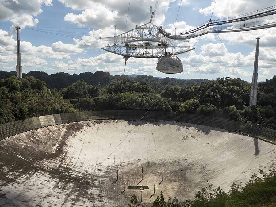 Arecibo Observatory - now used for radar observations as well as traditional radio Before leaving Puerto Real we had another day out to do shopping and also visit San German, founded in 1506 and for some time the island's second city but now a quiet place with many beautiful buildings to admire. Wherever we've been we have found Puerto Ricans incredibly friendly and cheerful, including here where we were greeted by locals passing us on the street. Most speak some English but, if they don't, they are very welcoming and always keen to help. The only exception to that rule seems to be in mobile phone shops. We had to try three different outlets before we found someone who would help us get sorted with a local data SIM (the others only being interested in selling us an expensive phone and plan). 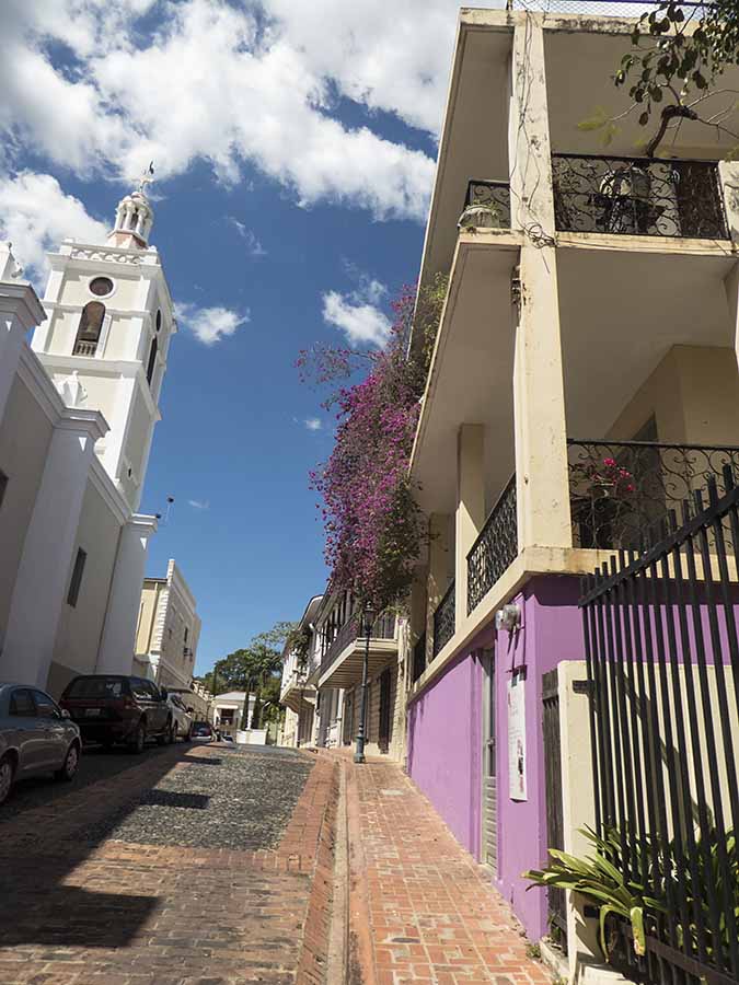 The old (for the USA!) centre of San German On Sunday evening we went ashore to say goodbye to Jose (the Marina owner) and while sitting at the bar we were approached by a local woman we hadn't met before. She asked if we were the people who had been kidnapped and appeared on a programme she'd seen 2 months before on Netflix. We were amazed that she'd recognised us, after that long. Monday was a public holiday and we left at first light to head south, then east around the southwest corner of the island. We had headwinds, mostly light, so we motored 23 miles to the resort of La Parguera. We arrived in the early afternoon so the light was good for seeing the offshore reefs that litter this coast. By then the area was busy with tripper boats but we managed to find a nice spot to anchor in good shelter from the northwesterly winds we were anticipating. 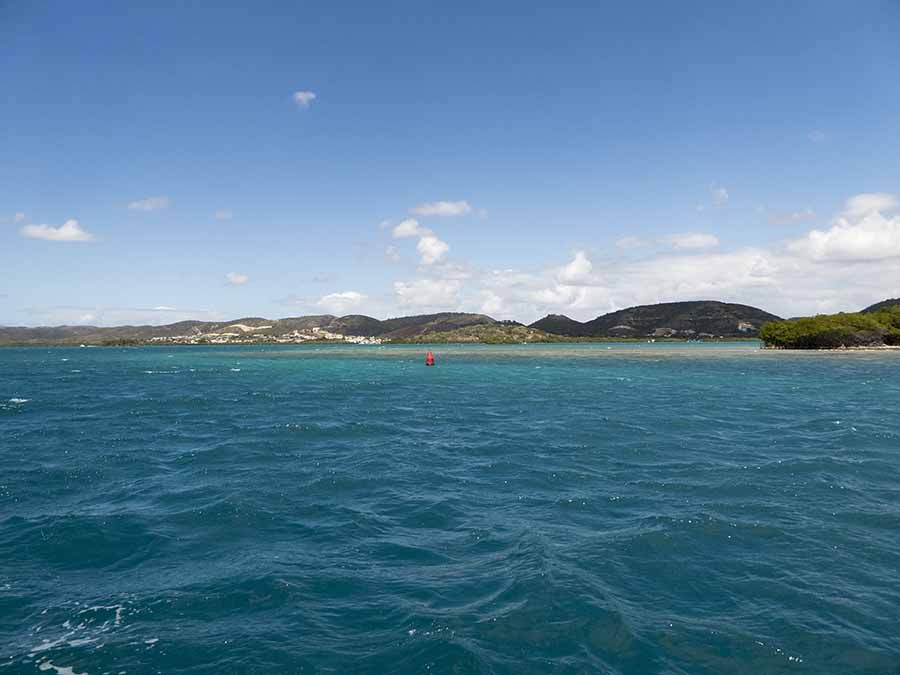 La Parguera entrance - red buoys on starboard hand in these parts, not port hand as in Europe Starting later the next day, we planned to take advantage of the infrequent northerly wind to have a leisurely sail for another 25 miles or so, arriving at a reef anchorage near Guanica. However, once we got going the wind was so good - northerly F4-5 - that we continued on towards Coffin Island, southeast of Ponce, arriving just before sunset. Unfortunately what we thought might be an anchorage on the south east side, had a rocky bottom, so we continued on to Las Salinas. Arriving somewhere new after dark is not something we normally do but we crept in, managing to identify the yachts at anchor or on moorings and finding a suitable spot for ourselves. 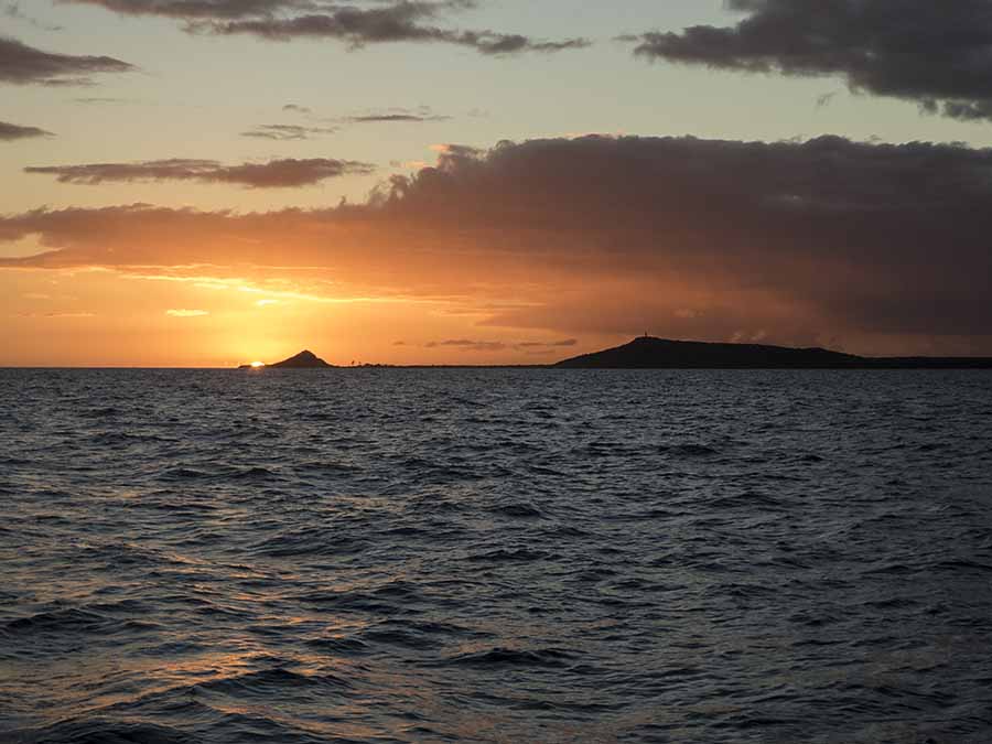 No anchorage suitable in these winds, but worth a photo! Sunset at Isla Caja de Muertos (Coffin Island) The next morning we were approached by our nearest neighbours, Bill and Chris, who told us that in easterlies their catamaran would lie in the position we were in. We didn't think this would be a problem because we were a long way away and would shift with the wind accordingly. The next day we stayed aboard - fixing holes in the dinghy again. The winds were southerly and the catamaran came closer - obviously it was on a long rode - but not too close for comfort. Our neighbours came again and told us that they had 90 metres of rode out - in a depth of 4 metres! (We can only assume they had let it out for the hurricane season and couldn't be bothered to reel it in.) Their tone suggested they found us an intrusion: visitors to that part of the anchorage are not welcome! We took the hint and the following morning we moved to a spot much closer to the village of Punta Salinas. |