Day 2 - Smooth crossing of Gulf Stream 35:41.2N 73:21.57W
Blue Note
Marco M.
Mon 13 Nov 2017 17:44
|
Date: Monday 13/11/17 - Time: 12:00 EDT Position 35:41.2N 73:21.57W COG 115T SOG 5.6kt, Wind 189T 11.0 kt, Temperatures: Air 22 C, Sea 30.6 C Barometer: 1014 hPa Sailed distance since departure: 306 NM Last 24h Sailed Distance: 156 NM Last 24h Decrease Distance on rhumb line: 100 NM Time since departure: 2d 4h 45m Average Speed since departure: 5.80 kt Average VMG since departure: 4.26 kt Average VMG speed last 24h: 4.15 kt Intention: sail to Antigua Distance to End on rhumb line: 1274 NM ETA : Friday Nov 24, 2017 @ 07:00 Detailed Track: https://share.garmin.com/svBlueNote A cold front right on top of the Gulf stream allowed us to make the cross last night with a South-East wind on starboard tack making it a smooth crossing and gaining at the same time East Longitude (at the expense of some lost of Latitude). The wind now is expected to shift to the west and it will allows us to take advantage of the North to South current of a big Eddy. During the night we also experienced the first (and hopefully last) breakage on Blue Note, The steel cable of the outhaul of the clew of main sail broke and we had to rig a temporary fix with a Dyneema line. 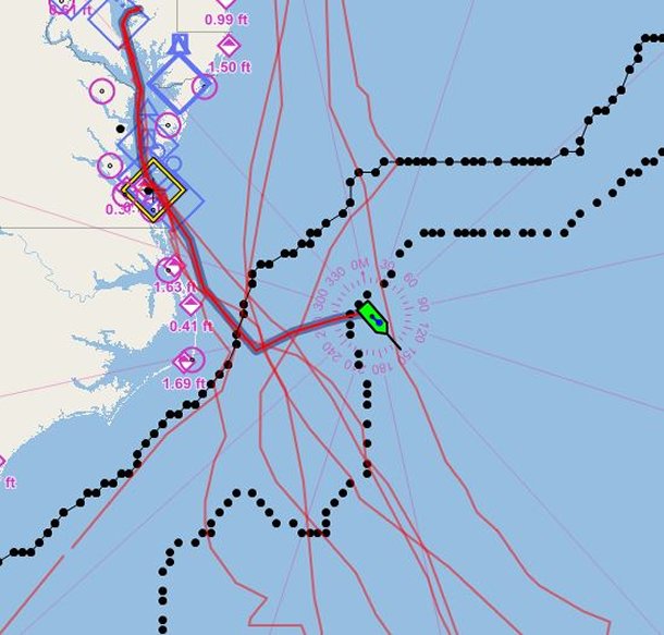 Blue Note just exited the Gulf Stream South boundary. (North and South Gulf boundary as from: http://ecowatch.ncddc.noaa.gov/JAG/Navy/data/satellite_analysis/gsnw.mrf) Note the many track of the several passage of Blue Note to and back from the Caribbean. 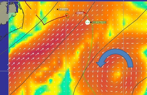 The cold front should pass over and shift the wind to the West, allowing us also to use North-to-South current of a big Eddy. 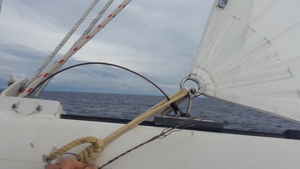 Broken steel cable of the outhaul and temporary fix with some Dyneema line |