Depart Kos for Simi but instead Tilos
|
36:27.66N 27:19.77E We were going to leave on Monday but moved it back till
Tuesday to better get access to grocery stores and enjoy the nice weather we
were having. So we provisioned in town and at the marina store. Bought
some Greek cooking gas and we were ready. Winds were from the stern on
leaving the side to berthing so it was a piece of cake departure. The
marina staff is always ready to assist and they stood by with the dingy in
case. Nice to have the help if needed. Of course our direction was directly into the head winds and
building seas. Winds were about 15 knots but nearby Turkey at this
location provided some reduction in fetch so the waves were not too bad.
As we went we were “escorted” by a Greek Coast Guard Cutter.
They seem to patrol the border quite frequently. We made sure we stayed
in Greek waters and not stray into Turkey without approval. Rounding the
point of one of the Turkish peninsulas we were now exposed to a greater fetch
and the seas built accordingly. Looking at the charts and seeing that
Simi was about a 15 mile slam into the rougher seas we diverted to Nisos Tilos,
much closer and it also should provide protection from the waves on the way
in. As expected it did reduce the wave height. The Pilot guide give
good information about coves and harbors that are useful during the normal
summer winds. These winds are always from the north. Now we had a
strong wind from the south for the next few days and the pilot guide only shows
the northern most anchorage with no information. But it looked good from
the charts and views on Google Earth. It turned out to be a good
choice. At the very northern end of the island in a u-shaped cove it
provide great protection from the waves. The bottom is sand with some
weed, meaning good holding for the anchor. The winds were strong in here
however. As it goes with the islands they do not provide great protection
from the winds, in fact they store up a mass of air behind them and release it
in strong gusts. The gust normally die down at night which they
did. So we anchored in 9 meters of water and let out eventually 60 meters
chain to be nice a secure for the night. This cove is a very quiet place with only a very small
fishing harbor and a few houses. High up on one of the hills was an old
ruin of a fort. One other sailboat was anchored here for the night and
that was it. Two fishing boats went by, no traffic, no waves and okay
some winds but much better than battling waves. Good night sleep.
Also now it is too cold to enjoy a swim so summer has ended. Tilos is not on the normal tourist route. There is a
ferry to the island in the main town along with some tavernas. Again an
island occupied by different dynasties. The Knight did build a few
fortifications in medieval times.
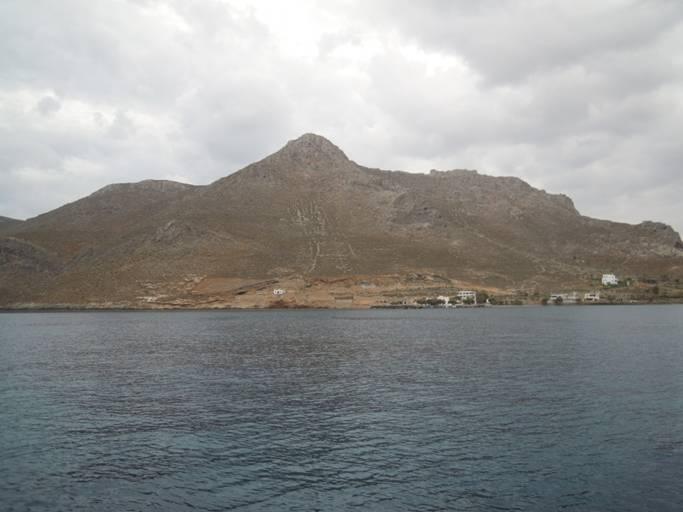
View east from where we are anchored. On the top right
of the picture is an old fortification that they light up at night.
Strange to see since the few houses are not occupied and there are almost no
lights except for this landmark. It was cloudy most of the time and the
permanent cloud over the island added to the dreary look.
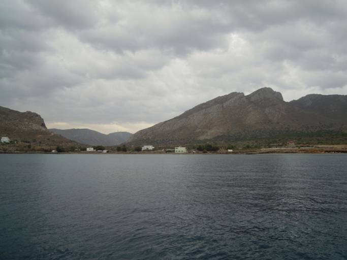
Second view to the south. That is the town with one
taverna. Looks like a few summer houses built here, one from an old stone
windmill common on the islands. But in the summer with the winds coming
straight into the bay from the north I am not sure this is a place to
enjoy. We are so far off from the shore because the bottom comes up quickly
closer in and we wanted to be away from shore in case the waves entered during
the night. By the way water clarity is great. 9 meters (30 feet)
and the bottom is easily seen. A few fish though was all we saw.
Also the winds funnel right through the gap in the middle, no protection. |