Brindisi Italy to Corfu Greece
|
39:38.87N 19:50.99E Just as the local restaurants were closing and the last
patrons left for home or their hotel we departed. It was 02:00 in the
morning with a light wind but not too hot or humid. Leaving a large commercial
port at night is easy and hard. Plenty of lights to let you know where
you are but these lights also hide the small fishing boats that usually only
have a small single white light. Once out of the harbor we turned toward Korfu and set a
waypoint just northeast of the island a mere 100 miles away. Seas were
calm and the light wind remained so. Nearly a full moon with only the
brightest stars able to shine through, Constellation Orion was on the rise (bad
sign since Orion is a winter constellation indicating summer is coming to an
end). With the motor running at 2,000 rpm we were making roughly
8.5 knots per hour. Further along waiting for the sun to make its
appearance there were a few low level clouds. That progressed into a fog
banks that blotted out the moon and stars. The fog grew thicker as the
sun started to rise. Soon we were only able to see several hundred meters
by 05:00. For the next couple hours there was some hope that the sun
would quickly dissapate the fog. No chance. As the morning began
the sun was of no help and the fog was so thick that all the boat was soaked in
the water collecting on the mast, boom, deck, bimini, etc. The collected
water falling from the mast onto the dodger (the canvas and glass windshield) it
sounded like it was raining. This is when the radar and AIS (automated Identification
system) came into full use. We changed course twice to avoid a cargo and
passenger ship seen on the AIS. We also made about 4-5 course changes to
avoid either fishing boats or sailboats that appeared on the radar as tiny
blips. None of these vessels we ever saw in the fog. We did hear
the passenger ship’s horn wailing when I think she just avoided a
sailboat that obviously did not have AIS or radar or did not know how to use
them correctly. It just stayed on a course set for collision. All
of this was observed as blips on the radar so I added in my assumptions. Finally at 11:00 we broke out of the fog and in the distance
Albania coastline could be seen. Time for a nap and hand the helm over to
Pat since I had been steering for the last 9 hours and needed and break. We rounded the north coast of the island Korfu (Kerkira in
Greek) and made our way to the marina north of the town of Korfu.
Arriving at 16:30 (Central Europe time, local time is one hour ahead).
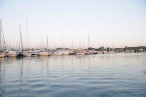
Gouvia Marina is a large facility with just about everything needed for a boat.
West side berths. There are about 10 times this amount
seen in the entire marina. Good protection, electricity, free non-potable
water and a charge for potable water. |