Fort Lauderdale Florida
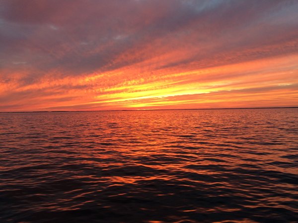
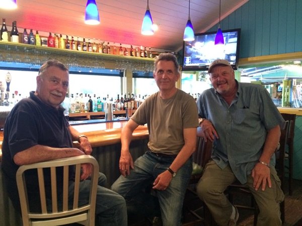
Date: Tuesday 18th November 2014 Position: 26:07.757N 80:07.269W Although it was all arranged at short notice, I managed to find a couple of good sailors to accompany me on the trip down to Fort Lauderdale. Tony and Ferruccio flew in to Norfolk on Saturday 8th and we managed to leave Norfolk early on Sunday 9th November. However it hadn’t been until Saturday that it had become clear which route we would take. There were two options, either the seaward route around Cape Hatteras, or the inland route through the awful Intra Coastal Waterway (ICW) with its shallow channels and multiple low bridges. The seaward route would need a good weather window whereas the ICW was less weather dependent, but would require us to spend several days motoring and hand steering all of the way. I had experienced the ICW on my way north a few months earlier and I really did not want to travel its waters again. The recent weather forecasts had been so changeable and uncertain that it was not at all clear until close to our departure date if the weather would be suitable for sailing around Cape Hatteras. Fortunately as the departure date got closer the forecasts gained more confidence that the seaward route would be possible. Cape Hatteras has a notorious reputation amongst US east coast sailors. A glance at a chart will show a headland protruding a long way eastwards. The entire east coast is shallow but around Hatteras the waters are not only shallow but constantly changing as strong currents move sands around. In fact my charts show no depth contours near to the cape (just blank paper), as the cartographers have given up trying to keep up to date with changes to the seabed. (Either that or US litigation enthusiasm has scared them away from any potential liability for sailors who come to grief whilst using their charts). To add to this the Gulf Stream passes just a few miles offshore of the cape and a northerly colder current cuts inshore. The two contrary bodies of water meet head on at Cape Hatteras. This all produces some very local weather patterns that can change very quickly and can be quite violent. The presence of several hundred wrecks that have accumulated over the years sort of indicates a locality that is not kindly to shipping. Having said all of the above I can’t see that Cape Hatteras is in itself more difficult than many of the notorious capes on the European side of The Atlantic. I’m thinking of Land’s End, Ushant, Raz de Sein, Finisterre, Cape St Vincent etc. The thing that sets it apart is the distance that has to be run to clear it. Between Norfolk VA and Beaufort NC is a distance more than 200 miles with absolutely no port of refuge between them. Travelling that distance in a small boat takes around a day and a half and in that time predicted weather can change significantly. Just behind the narrow strip of land that forms the coast around Cape Hatteras lies a small island called Roanoke, which was the site of the first British colony in the Americas. It was not successful, and eventually new colonies were established to the north and south where the coastline was far more hospitable. When you look at the area from the perspective of a small boat sailor then it would be hard to select a location that was more difficult and dangerous to get to from seaward. The history books cite other reasons for the decline of the colony but I wonder if its singularly unfortunate location was a factor that has not been sufficiently explored. Our trip around Hatteras was uneventful. The weather was benign and we motored most of the way from Norfolk. At sunset we had one of the most magnificent displays as the sun slipped over the horizon formed by the low lying land to the west of us. As we approached the Cape we had to detour several miles to seaward to avoid the shallow (and uncharted) water that stretched out from the cost. This took us out into the Gulf Stream where we encountered a contrary current of over 3 knots which slowed our progress for several hours. From Hatteras the next headland to be rounded was Frying Pan Shoal off Cape Fear (fantastic names eh?), some 150 miles distant. By now the wind was starting to build from the NE, the sky was overcast, it was cold and rainy. By the early hours of Tuesday morning the wind strength had crept up to around 30 knots and the seas were starting to get quite high. One of the crew was starting to feel uncomfortable and asked if we could perhaps make landfall and take a rest. About 40 miles away was an inlet to the ICW called Masonborough, near to Wrightsville Beach. Fortunately I had stopped there on my way north several months before and so I had knowledge of the approach. I decided to make a detour and by 7:30am on Tuesday morning we were anchored in sheltered waters. We had a good sleep followed by a fry up breakfast. To resume our previous route would require a long detour to seaward to get far enough offshore to round Frying Pan Shoal before continuing in a SW direction. But now that we were in Wrightsville Beach there was another option: to travel through the ICW for a relatively short distance and then get back offshore around Southport. This would be a shorter distance and avoid the shoals altogether; but would the ICW be too shallow for our 6’ 7” draft? I telephoned Boat US, an organisation to which I belong and who have intimate knowledge of the ICW waters. They assured me that we should be able to get through, so soon after midday we lifted the anchor and headed off down the ICW. Late afternoon we had reached Southport and there was no wind. Rather than head out to sea motoring I decided that we would stay a night in a marina. Southport marina was very comfortable and we had a good fish supper in a local restaurant with some excellent local beers. Purely by chance it turned out that a local weather guru was giving a presentation that evening and we managed to get to see it. The graphical display showed the entire continental US being invaded by a giant wave of icy weather slowly advancing from the north. Clearly getting ourselves south was becoming urgent. We left early Wednesday morning with winds of less than 8 knots, and things stayed that way all day. There were a few hours of sailing but we continued to motor for most of the time until we got to St Augustine, Florida around 8:30am on Friday morning. The reasons for calling in there were twofold. Tony was running out of time as work commitment meant that he had to return home. Also Ferruccio lives in St Augustine. Ferruccio’s wife, Jean, met us at the marina and after breakfast ashore in a local café they took us back to their house just outside the city. There we were able to take a long and luxurious shower whilst our laundry was miraculously washed for us. Then followed lunch in the local golf club and in the evening an enjoyable meal in a nearby restaurant. All told it was a splendid day. Tony left the boat early on Saturday 15th and shortly afterwards Ferruccio and I departed the marina heading southwards along the coast of Florida. We were able to sail most of the day but by late evening the wind had dropped and we were back to motoring. We carried on that way through the night. The weather forecasts were promising southerly winds on Monday so Sunday evening we pulled in to West Palm Beach and anchored near the ICW. We were now only a day away from Fort Lauderdale, but with southerly winds promised we thought that we’d continue along the ICW. I checked again with Boat US and they gave me the all clear. I also contacted Pam Wall the Fort Lauderdale Port Officer for the OCC who kindly arranged a private dock for me to use once we had arrived there. The trip through the ICW was to say the least tortuous. There were just so many bridges that made us wait before they would open to allow us to pass. At a couple of them, because of engineering works, we had to wait nearly an hour. As a result we failed to get to our destination before nightfall and had to pull over into a small anchorage called Lettuce Lake beside the waterway at Pompano Beach. Tuesday morning we were underway and reached our destination by 10:00am. Pam had arranged for us to dock on a canal at Hendrick’s Isle just off the ICW. It was owned (and rented to us) by a man called Bruno. He was able to accommodate about 6 other boats, and he’d named his operation ‘Bruno’s Zoo’. The journey southwards down the US east coast had been completed and we had managed to stay just ahead of the really cold weather following us all of the way. |