Going Dutch; Gallows Bay, St Eustatius (Statia)
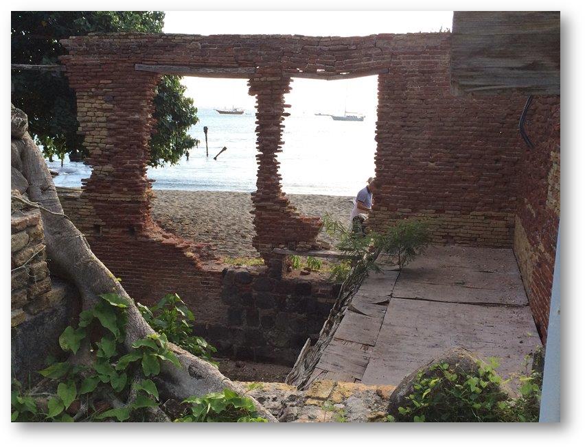
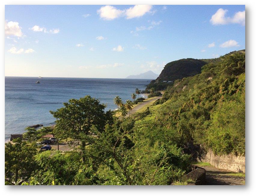
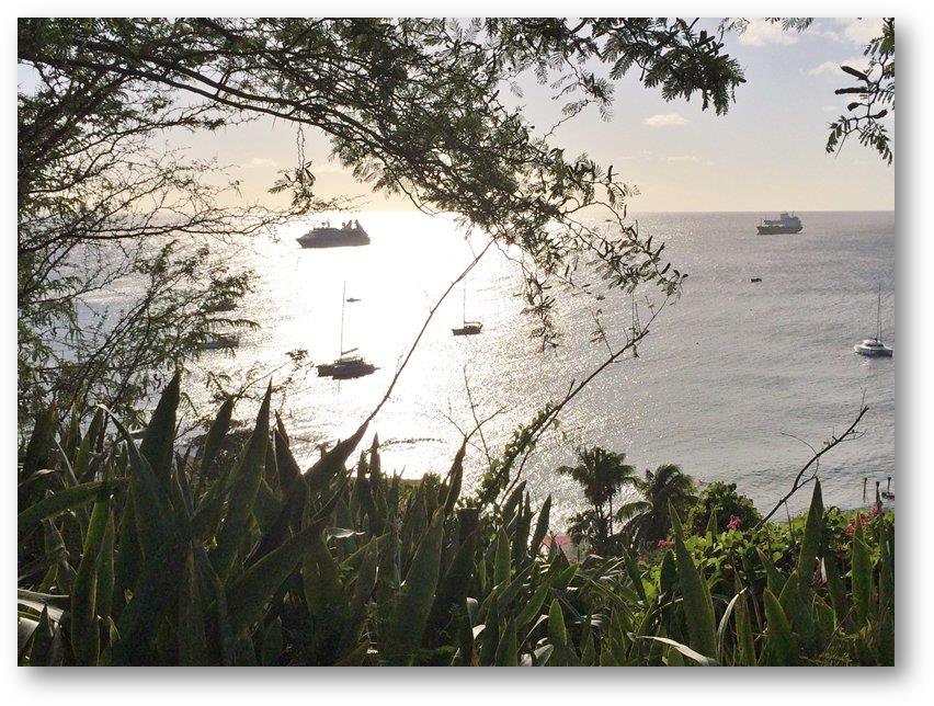
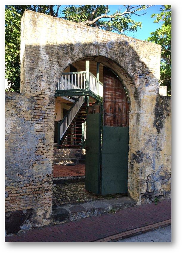
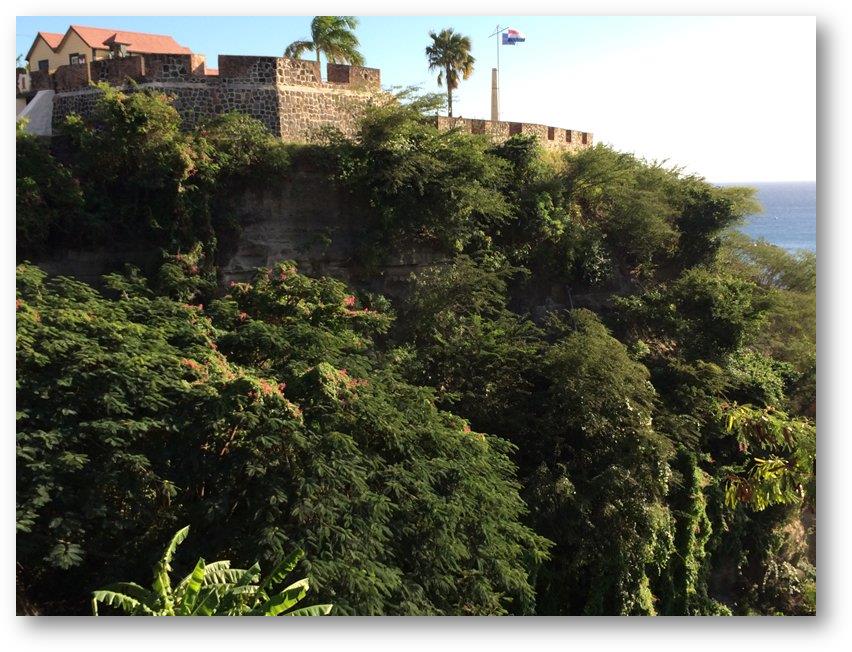
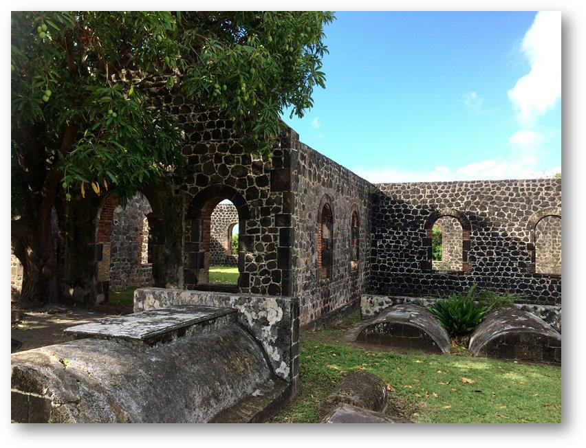
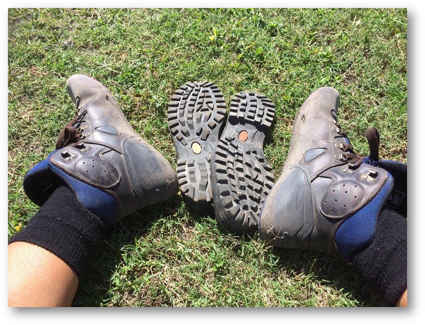
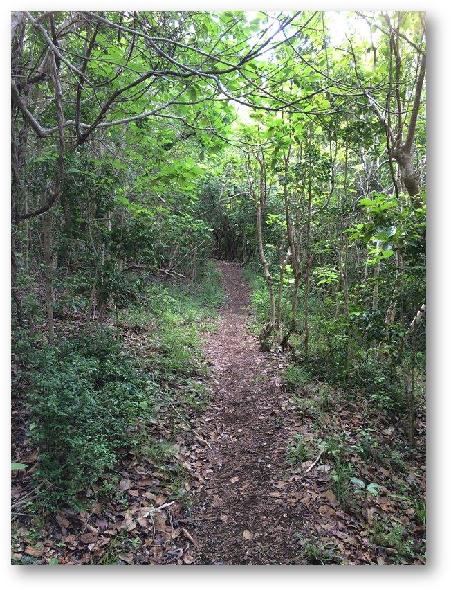
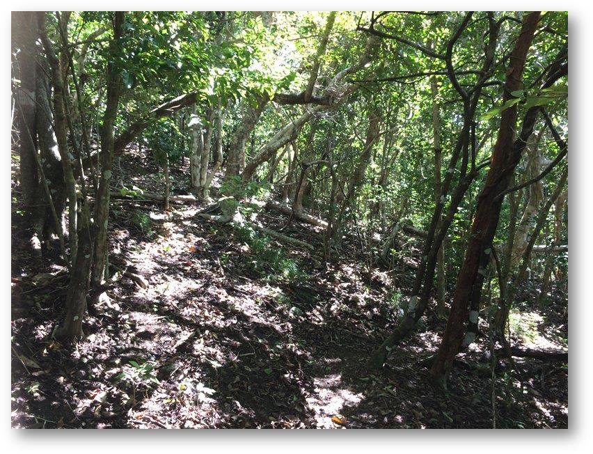
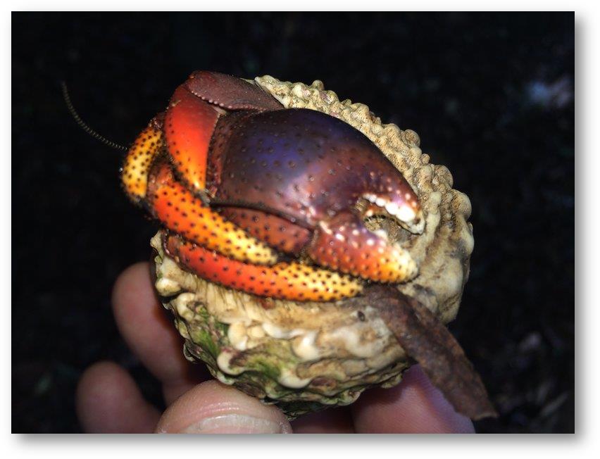
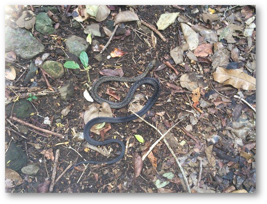
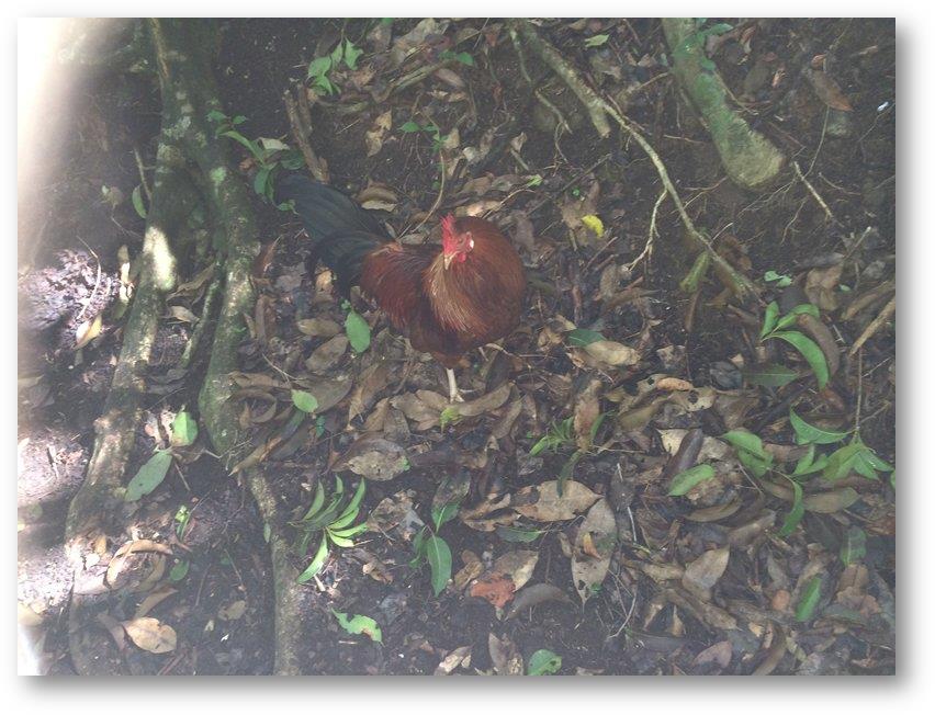
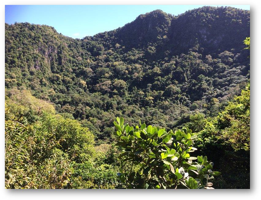
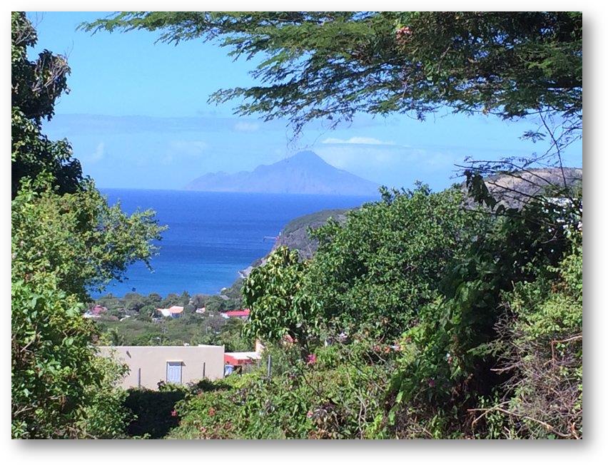
Date: Wednesday January 15th 2014 Position: 17:28.855N 062:59.339W On Tuesday morning the weather forecasts promised several days of more settled weather, so we decided to move on to the St Eustatius, usually called Statia. This is a small island, about 5 miles long, and it is the first island we have been to so far that is Dutch. To be precise it is a special municipality of the Netherlands. As such it has a distinctly different quality to the other islands we have been to in The Caribbean. We anchored outside the main town, Orangestad, in a partially protected bay called rather unpromisingly Gallows Bay. Looking shoreward you can see a narrow strip of land at sea level with steep cliffs about 80 feet high behind. The slopes are covered in vegetation and nestling on top of the cliffs sits the town with the ruins of an old fort peeping cautiously over the edge. It is quite picturesque. We took the dinghy ashore and our first impressions of the town were confirmed, it’s a splendid little place. Of course being a new country, the first thing we had to do was to complete the customs and immigration formalities. But this time things were very different from the previous islands we have been to. The customs officer told us not to bother filling in any forms, but to come back before we were due to leave and just do the exit paperwork. How refreshingly laid back. The shore side is actually much narrower than it was until fairly recently. About 100 years ago there was quite an extensive town situated there behind a large sea wall, but subsequent storms destroyed the wall and reclaimed the land. We were told that there were extensive ruins under the sand around where we were anchored. Some of the ruins are still visible on the shore side. We took a walk up the cliffs to the town above. The character of the town was a real change from the islands we had seen so far. Everything was on a small scale and very tidy. Several of the houses were built from a small orange/yellow brick that we hadn’t seen anywhere else yet. There was a very laid back, but organised feeling around. Everybody we met was friendly and helpful but at the same time everything was in its place, clean, tidy and uncluttered. The fort was being used by the tourist board and other local authority activities. We also stumbled across the ruins of the old Dutch Reformed Church. The next day I thought that I’d test my legs by walking to the top of the small volcano in the centre of the island. It’s called ‘Quill’ for some obscure reason involving the English corruption of a Dutch word. It’s about 2000 feet high and the National Park office told me that there was a well-marked trail, so on Wednesday morning I set off, bright and early, well not too late. Since we had been in Italy many years before I’d been carrying a pair of walking boots on the boat that hadn’t had a lot of use. I was determined to use them so I made sure that I was wearing them for my trek. I climbed to the top of the shore side cliffs in just a few minutes but no sooner had I reached the town above when I was aware of something strange around my feet. Looking down I could see that the soles of both boots had simply fallen off. A pair of lost soles….. So I was now wearing boots that were substantially protective around my ankles, but under the soles of my feet was a layer with the consistency of a pair of carpet slippers, not much thicker than the socks I was wearing. After cursing, and then laughing I thought that I’d carry on for just a few more minutes, but if the soles continued to disintegrate then I’d hobble back to the boat. The first part of the walk was a gentle uphill slope for about a mile along a road surfaced with concrete. This was managed without any further problems. Then the path changed to turf and entered the forested slopes up to the summit. The track was an almost perfect texture being soft and not too stony, so I carried on. It was a most enjoyable morning. I saw no other person all of the way up and back down again, but I did come across quite a lot of wildlife. The most comical were the land ‘hermit’ crabs. There were hundreds of these along the way. As I approached they would sense my proximity and immediately retract into their shells. This would cause them to lose their grip on whatever they had been holding on to so that gravity would have its effect and their round shells would roll downhill, usually right across the pathway. There were also a couple of snakes sleeping on the path. They were red bellied racer snakes, not venomous (I am assured), and not particularly vigorous movers either at that time of the morning. In fact the first one I encountered was nearly a meter long and stretched right across the path. Never having met one of this species before I wasn’t keen to just step over it so poked it with a long stick. It didn’t react, so I thought maybe it was dead. A second prod produced a small reaction, so I just stepped over it and continued. Whilst I took a small rest a feral rooster crept up on me and stuck it’s head around my feet. It was probably as aghast at the state of my footwear as I was startled to see it there. I reached the top after about an hour’s walking, and there was a magnificent crater, overgrown with all kinds of vegetation. There was a path down to the bottom of the crater but the first part at least was very steep and rocky, in fact it was a bit of a scramble. I decided against gambling on my boots holding together for much longer so reluctantly decide to return the way I had come. On the way down there was a break in the trees that showed me Saba, the next island we hoped to visit. What a beautiful island! It was well worth the visit and I’d recommend it to anyone who has the chance to go there. |