Rudder Cay, Exumas, Bahamas
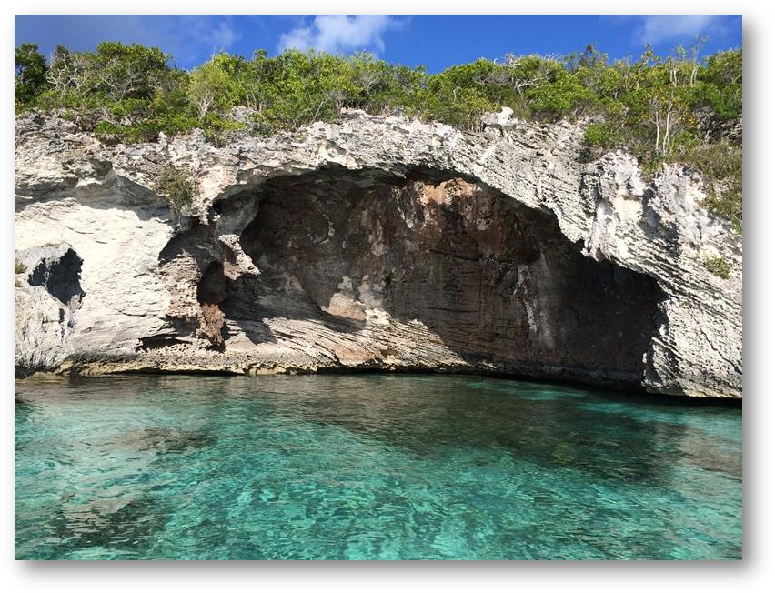
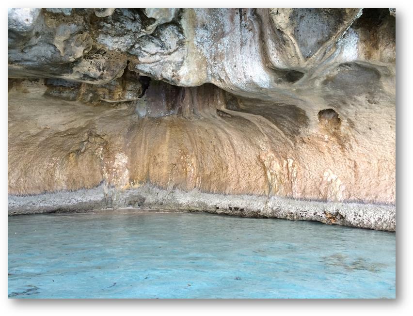
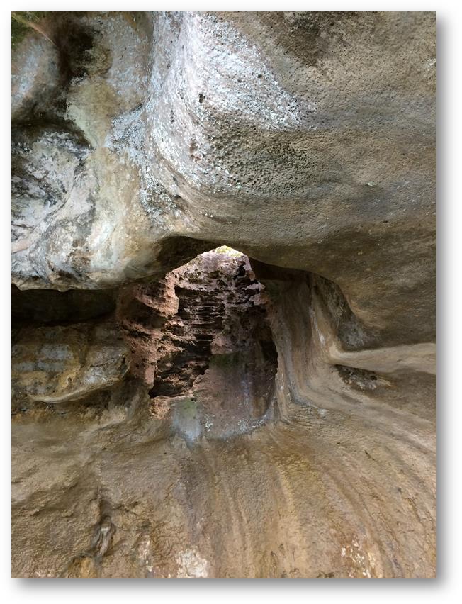
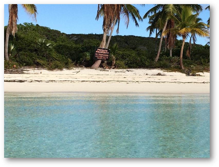
Date: Tuesday 6th May 2014 Position: 23:52.286N 76:14.404W On Tuesday 6th we left the area of Georgetown to move a short distance northwards along the Exuma Cays. Leaving Georgetown required quite careful pilotage as the channel was very shallow (at times with just a couple of inches under the keel), there were lots of rocks to work our way around, there were several sharp turns to follow (missing one of them would have had unpleasant consequences) and in places there was a strong side current running. However we made it without mishap and enjoyed the short sail up to the cut that would give access to the area behind Rudder Cay. The Exumas are a long chain of low lying islands running for about 150 miles from the south east through to the north west. On their eastern side lies the Atlantic Ocean which is, of course, deep, tidal and can have large waves and swell. With very few exceptions there are no anchorages or harbours on the Atlantic side of the Exumas. To their western side lies hundreds of square miles of very shallow, turquoise water lying over white sand. This shallow side tends not to have large waves or swell, so if you can find an area with sufficient depths to accommodate your boat then this is where you choose to stop. However between each of the islands there is usually a narrow channel, called a cut. The currents through these cuts can be very strong (at times they run faster than a sailboat can travel), and more importantly if the current is running in the opposite direction to the wind they can kick up large steep waves that can make life very uncomfortable for anyone trying to negotiate them. So when planning a journey from one island to another it is important to know beforehand what the wind, tides and currents are expected to be doing, and also of course the depths that are to be expected on the sheltered side of the Cays. These constraints can often work against each other. Sometimes you have to wait for high tide to have sufficient depths to leave and/or enter an anchorage, but this inevitably means that the currents in the cuts will be fierce. On this occasion, more by luck than judgement, we got things more or less right and entered the cut with the tide still running in the same direction as the wind. We rounded the lee side of Rudder Cay to find a quite beautiful anchorage. The water was clear, the island was green and had no observable buildings on it, there were only a couple of other boats nearby and there were some caves we could see ashore that were crying out to be explored. To further enhance the exquisite ambience there were lots of songbirds filling the afternoon air with their mellifluous trilling. In the morning we took the dinghy ashore to look at the caves: However not everything was idyllic. The island was private and the owners clearly did not welcome anyone sharing their little piece of paradise. Every beach was fouled by these hostile signs. In the Bahamas the beach below the high water mark cannot be privately owned, and in theory anyone can walk upon it. However the owners had decided to expropriate even this basic right by stationing roaming German Shepherd dogs to deter anyone from trying to land. Whoever they are, may a pox from Hades invade their gonads. |