16 Sept - Isles of Maine Part 5 - island living and fog heading to Pompey!

|
43:04.4N 070:42.7W All good things must come to an end and whilst we could have loitered at Mount Desert to explore more of the Acadia National Park, we’d seen about enough fir trees, granite boulders and distant glimpses of the islands to last a while. There’s something about living on a boat too; I think it’s probably to do with the continuous motion, that after a while you get restless in a place and need to move on. Into the bargain, we have had a weather eye on Hurricane Florence and our rather long journey south from here to the British Virgin Islands for Christmas. So on Wednesday we pushed down to Southwest Harbor where we conducted one of those ‘pitstops’ beloved of Navy and cruise ships down the years: in under a hour, we took on fuel, filled the water tanks, ditched the rubbish and picked up some mail and stores and swapped cruising dits with an adjacent yacht… and then headed south towards Long Island, Maine.
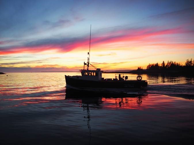
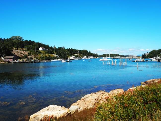
Entering harbour at sunset, Long Island,Maine Perversely, Long Island is round. There’s a promising looking bay to anchor in on the east side and the fishing harbour of Frenchboro on the west. Despite a total lack of wind, there was a long, low swell from the southeast (probably the effect of Florence) which made the eastern anchorage look rather uncomfortable and after a short recce we went around the top of the island and picked up a visitors buoy in Lunt Harbor, off the fishing village of Frenchboro. In the morning, we went ashore for a look. The harbour is very pretty and almost completely given over to lobster fishing – not much tourism here and not many holiday homes here either as far as we could see. However, the place was effectively closed for business – the one shop (which runs the visitors moorings) appeared to be shut for the duration and we hardly saw anyone. We did enjoy a glorious walk though, through the woods and across the island to the rocky southern shore where there are a couple of impressive shingle beaches amongst the granite. There’s plenty of evidence of the lobster industry washed up on the beaches here, but it’s been cleared into piles by someone trying to keep the walking trails open. We didn’t see a soul, but watched some seals fishing and tracked the fog banks rolling in as they alternated with vivid blue skies and a gentle southwesterly breeze.
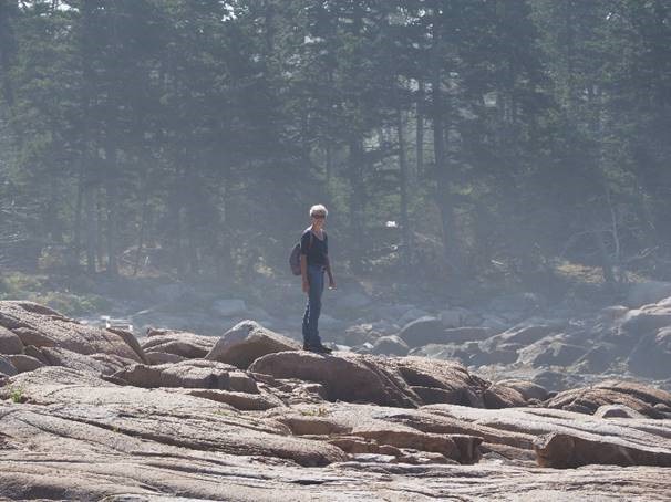
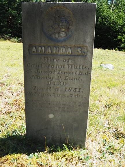
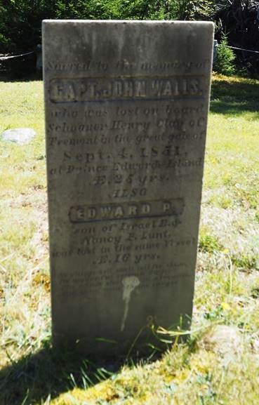
My mermaid scrambling on the rocks – that’s sea spray in the background! Our route back took us through the village and its outlying homesteads. We found the Lunt family graveyard and I was fascinated by a couple of the tombstones: Amanda Lunt married a seaman called John Walls but died at the age of just seventeen in April 1851. In September of the same year, John Walls was drowned off Prince Edward Island, Canada when his mackerel schooner, the ‘Henry Clay’ was overwhelmed in ‘the Great Gale’. Tragically, Amanda’s younger brother Edward was also onboard and lost… at least, that’s what the inscriptions relate.
What an awful year for that family. Did she die in childbirth, from malnutrition or some disease? Did he go off to sea bereft with grief and longing to join her in the Afterlife? Or was this all in the normal course for the tough, independent folk who chose to live in these remote islands? These tragic clues spurred me to do some research into the loss of the vessel. Elsewhere we have learnt that the fishing communities of New England suffered the most horrendous losses in the second half of the nineteenth century: these were the days before reliable engines, before liferafts (they came post-Titanic) or radio communications or any scientific approach to weather forecasting, before there was an international standard for the loading of ships (the Plimsoll Line finally came in worldwide in 1930); but the huge population growth in cities during the Industrial revolution underlined the value of fish as a foodstuff and a commodity to be traded at any price. It would hardly count as rigorous academic study, but I spent a couple of hours digging around in the corners of the Google world trying to link some interesting threads together. It turns out that the gale in question did not rise until 3 October. There were around a hundred New England schooners at sea in that area off Canada chasing mackerel and many were driven ashore or lost, with an appalling loss of life in what came to be known as the ‘Yankee Gale’. Some reports suggest that the storm wasn’t particularly destructive ashore, but that many of the vessels were unseaworthy and some were poorly handled. The New York Times of 17 October reported that the ‘Henry Clay of Tremont’ (a fishing port on Mount Desert Island) was one of a number of vessels that survived with ‘all hands safe’. Yet elsewhere, I found records that a man from Swan’s Island called Joshua Trask was also lost aboard the Henry Clay on 3 October in Chaleur Bay, whilst under the command of John Walls. Chaleur Bay lies northwest of Prince Edward Island in New Brunswick and the vessel apparently went down with all hands. The men’s headstone on Long Island is a memorial, not a grave – clearly implying that they occupy a watery resting place elsewhere. What to make of these various anomalies? Without talking to the current generation of Lunts (who seem to own much of the island and probably know the history) or looking for records in Tremont where the vessel was based, I can’t be sure… but my theory is that the date on the gravestone – 4 September 1851 - might be the date the men left Maine (and were last seen by their surviving family) or it could just be a simple mistake by the stonemason which went un-corrected. They almost certainly perished on the 3rd or 4th October in the Yankee Gale, but the vessel may well have been driven west onto the New Brunswick shores by the storm. Perhaps the other crewmen survived? I doubt it. Or perhaps the New York Times was inaccurate, even then? Until the Halifax Explosion, this incident was the largest maritime disaster in North America…
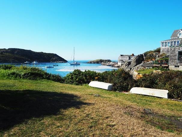
Lunt Harbor, Long Island, Maine Nowhere in Frenchboro was open to enquire further and we decided to push on to Monhegan Island early the following morning, so I doubt that my curiosity will be any further satisfied. We motored in glassy, flat calm seas the fifty or so miles south west to Monhegan, where we arrived early afternoon in a really lovely little fishing harbour. A bearded gentleman was rowing out to his lobster boat with a lady in the stern, so we stopped alongside them and asked if he knew whether any of the mooring buoys were available for visitors. He pointed us towards a vacant buoy down the harbour and directed us to the Harbourmaster’s office to pay.
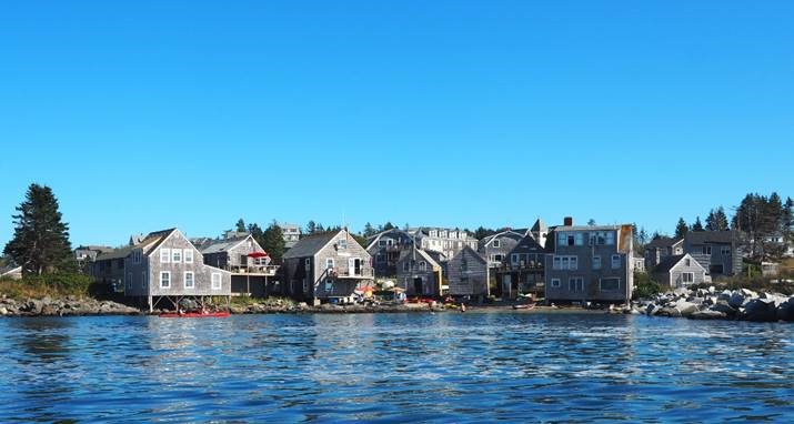
Escapade at Monhegan Island, Maine A short time later, I rowed ashore and went looking for the harbourmaster in his magnificent ‘den’ above a nice little fish shop. They pointed to the chap in his boat and told me that he was the harbourmaster. Suppressing my mild frustration, I rowed back out from the glass-strewn beach to where our hero was fiddling with his engine. ‘Hello, I gather you may be the harbourmaster as well as the owner of this boat?’ ‘Yup’. ‘Well, I own that yacht and we just asked you about a mooring. Many thanks for that – but when I went ashore to pay for it as you directed, I was sent back out here to see you. What would you like me to do now?’ ‘Pay in the fish shop. It’s $25 a night’. Humourless fellow… Probably not been off the island much? We had a lovely time though, walking round the harbour, watching a series of ferries bringing walkers, birdwatchers and arty types to the pier just fifty feet from the yacht and enjoying a fine cup of coffee at the only obvious establishment of that type in striking distance. There are plenty of B&B places and a surprisingly large hotel (which looks a little out of place). There are a rash of artists’ galleries and even out of season there were a few bohemian souls propping their easels up on the granite boulders trying to capture the light and the motion of the sea on the rocks in oil or whatever they have to hand. Monhegan has, for about a century, been an interesting collection of lobster fishermen (who fish for mackerel out of season) and artists. You might assume that the two communities might not mix, but we spoke to a young woman who was painting some lobster pot buoys (standard emulsion) to ask if she was preparing for an exhibition or getting ready to set some new traps. ‘My mother’s an artist and my dad’s a fisherman’. That’s that, then: the community has mixed!
Fishing Beach, Monhegan Island, Maine We were taken with the place and decided to stay a second night. Sadly, Saturday brought thick fog so the camera stayed stowed. We made our way up to the lighthouse and the associated museum, where we found that our rather dry harbour master is a major figure of island life. Some of the art was very good (fortunately none of it was for sale) and the place gave a really good idea of island life over the last 100 years or so. We ate lobster rolls at the fish shop owned by the harbour master. They were tasteless (probably ‘previously frozen’ and definitely overcooked) and overpriced. On Sunday morning, we slipped out of the harbour in 50 yards visibility. Close to the entrance we saw a mackerel boat at work; they waved and disappeared into the gloom. For the next hour we saw very little, but eventually the fog lifted, the sun came out and we relaxed a bit. Unfortunately the wind did not pick up though and we motored most of the seventy-odd miles to Portsmouth. Where? That’ll be Portsmouth in New Hampshire, then. There’s a Gosport nearby in the Isles of Shoals, just offshore, and we picked up a mooring buoy off the Coastguard Station at New Castle, just inside the harbour entrance on the New Hampshire side of the river. It’s a fort with a long history but the current structure is about the same vintage as the Palmerston Follies in the Solent and there the similarities with Pompey begin… |
