North Carolina to Virginia
Catacaos
Graham Shaw
Tue 14 Jul 2009 02:47
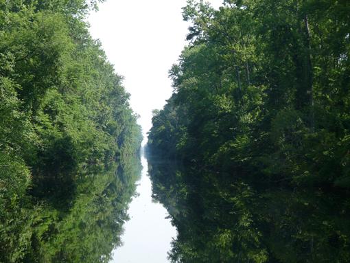
And just like that, the Intra-Coastal Waterway was all over. On Sunday we sailed past mile zero at Norfolk, Virginia without even noticing it. The mile marker numbering system for the ICW starts at the northern end (mile 0 at Norfolk), and works its way to mile 1095 at Miami. We had joined it back in May at West Palm Beach, which is at Mile 1018. So there we are, just over a thousand miles of varying scenery - latterly a ditch cut through a swamp - and pop out at Norfolk, into the biggest port we've ever been to. Several miles of container cranes, coal docks, ro-ro berths, and every type of naval vessel you could imagine - the aircraft carriers (like everything else in this country) are enormous. I've heard it said that the Nimitz class carriers could fit six British (HMS Ark Royal-size) aircraft carriers on the deck. Seeing them, I can well believe it.
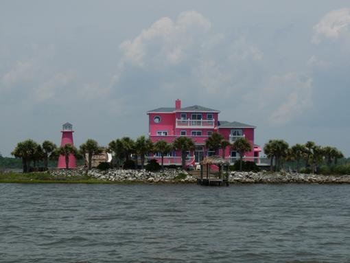
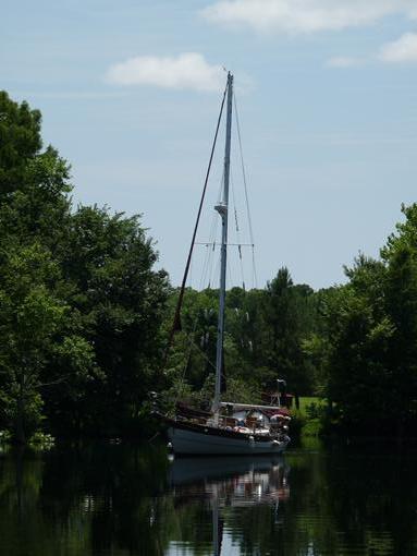
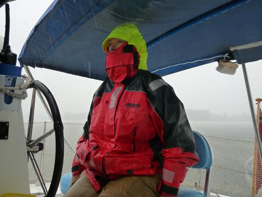
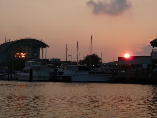
The last few days of the ICW saw a variety of weather, as can be seen from the attached photos, and a variety of locations. For the first time in quite a while we were alongside a quay for a couple of nights. The town of Elizabeth City has free (yes, free) public docking, even with somebody to take your lines! The Harbourmaster (semi-retired due to his age) drove me to a garage to get our spare propane tank filled for the cooker. After filling it the garage man says, "You've only had point something of a gallon...I can't charge you for that!" and off we went. Free moorings and free propane. Can't be bad! The semi-retired-due-to-his-age Harbourmaster was actually a lot older than he looked: A navy man, he had been at Pearl Harbor. Do the math, as they say round here! A very interesting chap with many a story to tell.
That 1018 miles of the ICW we covered is in fact 1018 statute miles (I don't know why!), which makes it nowhere
near 1018 nautical (proper) miles. We have had the log set in mph rather than knots, and recording statute miles rather than nautical miles. This has made planning much easier, for distances to cover each day, as the Pilot books give details of anchorages or ports in terms of their "Mile Marker". As it would be almost impossible to measure any distances by hand on the ICW charts, we have had to use the statute mile as our unit of distance. Now we are out of the ICW I was quite glad to change everything back to nautical miles. Our log reading has gone from 25728 sm down to 22357 nm. Very bizarre! And probably very dull, for the non-maritime technically minded reader!
We are now anchored at a place called Hampton, a historic town just opposite Norfolk, at the southern end of the Chesapeake Bay. Anchored just near us is a French boat, a German boat, and a little further down, another Jersey boat. It is nice to talk to some real people again, as opposed to ones who say things like "I just lurve y'alls accent - say sumthin else!", and then crack up laughing when you do. I don't think many of the folk round here encounter foreigners very often, and most of them don't seem to have ever been anywhere, so I guess it's understandable. A common question is whether we are British or Australian, which seems odd to me. Today we were talking to a genuine Aussie, and the American with him said that on hearing our two accents together, he could now appreciate that there is a difference!
Anyway, not quite sure where we go from here. North, up the Chesapeake for now, and see where we get to. We would like to carry on to New York, maybe even up as far as Maine. We'll have to see....watch this space!
Graham.