Finally the Cesapeake
|
37:15.3858N 076:28.6002W Thursday August 12, 2010 9:30PM So we are finally in the Chesapeake. Where we stopped in Portsmouth
VA was about a half mile before mile marker zero of the intercoastal waterway
so I didn’t consider us officially in the Chesapeake. Today we motored by
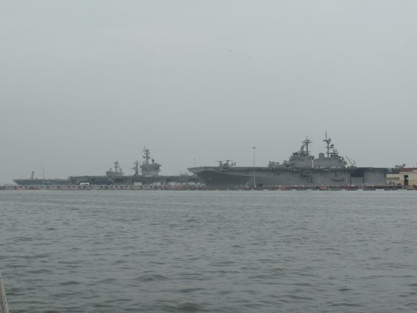
the Norfolk Naval Base. We missed seeing the carrier CVN 74 - Harry Truman
leave it’s berth, but we did see CVN 69 – Dwight D Eisenhower and
CVN 77 – George Bush . In this picture the Ike is in the middle, the Bush
is in the background and in the front is a helicopter carrier. Technically it’s
LHA1 – Tarawa.
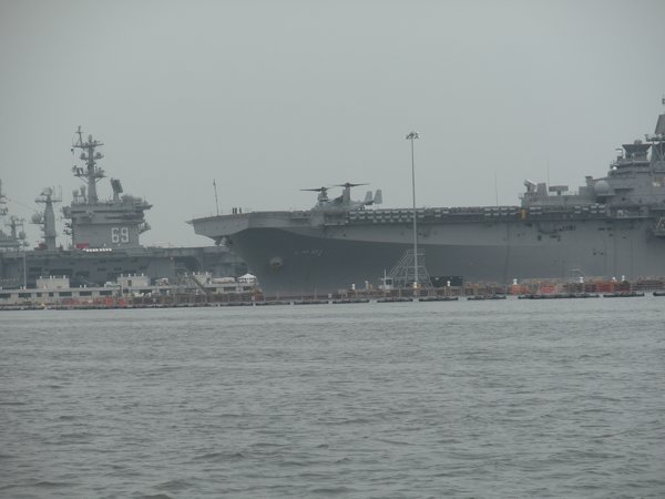
It you’re wondering what is on the bow of the Tarawa
here is a close up
It’s a V-22 Osprey. Vertical takeoff, 225 knots cruise
speed, in flight refueling, a helicopter pilot’s dream– I was born
too soon. I did spend several weeks on CVN-69. So after leaving Norfolk we continued north to the York
river. We are now across the river from Yorktown VA. Our plan as of Thursday
night is to do some boat repair stuff, walk through Yorktown, perhaps catch a
bus to the Yorktown battlefield and then move on. If we follow today’s
plan we’ll be leaving Sunday for Deltaville. All plans are subject to
change. We have finally run into a bit of rain. This is not our
first encounter but it’s been a while. One thing I’ve discovered,
nothing takes a person from a deep sleep to wide awake faster than sleeping
under an open hatch when it starts to rain. This is not a situation that can be
fixed by rolling over and pulling the sheet over your head. Since the hatch
over the bunk is open, chances are several other large water gathers are also
open. The fire drill that follows, as two people, wearing what people do when
sleeping in hot weather, bounce off each other as they close all the boat’s
openings, is not a pretty sight. (No pictures available.) We have been using a wireless card to connect to the internet.
I’m glad I have it. Most places we’ve stayed have had WiFi, but the
connections have been iffy at best. Today as we headed up the Chesapeake the
card proved its worth. There were several storms in the Bay and with the wireless
card we were able to stay connected to the internet and watch the storms
progress via the local weather radar, something our radar alone couldn’t
do. I could see the storm’s track and intensity and adjust our track to
miss the worst of it. I’m gonna miss that when we go south. |