Namibia!
Where in the World are Margie & Peter? Namibia!!!
Peter and I have spent the past month here in Namibia and, while I’m sad to say we didn’t find any diamonds out there in the desert like the early German settlers did, we did find this country to be one of the most delightful stops along our way around the world. I’ll give you just a quick run-down about the time we’ve spent here and some of the highlights. But first, let’s have some geography and history! We have to admit, we couldn’t have found Namibia on a map before we arrived here. Could you???

Namibia’s western border is the Atlantic Ocean. It shares land borders with Angola and Zambia to the north, Botswana to the east and South Africa to the south and east. The dry lands of Namibia have been inhabited since the 14th century AD by the San, Damara, Namaqua, Herrero, Ovambo and Bantu tribes, among others.
The population is just over 2 million with 88% black, 6% white and 6% of mixed race. Its capital and largest city is Windhoek. At roughly 825,000 square kilometers, it’s twice the size of Germany, bigger England and France together, larger than Texas and over half the size of Alaska! Given the presence of the vast Namib Desert, it is one of the least densely populated countries in the world yet is has one of the highest per capita income levels and literacy rates in Africa.
Today, Namibia enjoys good political, economic and social stability. Agriculture, tourism and the mining industry – including mining for gem diamonds, uranium, gold, silver, and base metals – form the basis of Namibia's economy.
Short history…In the last decades of the 19th Century, the British, Portuguese, French, Dutch and Belguim all embarked on the famous “Scramble for Africa” seeking safe harbors along their route to the Far East. As time went by, the colonizers moved further inland grabbing land from the native tribesmen and ultimately staking claims on mining rights. Germany was late joining this party but in 1884, it claimed the land around Luderitz as a German Imperial protectorate – naming it South West Africa. Land was progressively bought up as German settlers arrived in droves. The German colony thrived until the end of World War I when England urged South Africa to push north and wrestle South West Africa from the Germans.
So, at that point, South African took over South West Africa as a “trust territory” and over the course of the next 30 years, new colonists (mostly Boers from South Africa) joined the existing German settlers in exploiting the native population that they were supposed to be protecting!
After WWII, South Africa unilaterally “annexed” South West Africa. The natives rebelled and uprisings and demands by African leaders led the UN to assume direct responsibility over the territory. It recognized the South West Africa People's Organization (SWAPO) as the official representative of the Namibian people in 1973. Namibia, however, remained under South African administration during this time and was still known as South West Africa. Following serious internal violence, South Africa installed an interim administration in Namibia in 1985 and Namibia, finally, obtained independence from South Africa in 1990! That makes Namibia one of the youngest countries in Africa and its constitution has been hailed as one of the worlds’ most democratic.
OK, so now you’ve got your background info. Let me tell you a little about our time here!
First of all, it’s a lovely sail from Cape Town to Namibia. We stayed within 10 miles of shore and still averaged almost 7knots with the Benguela Current helping us along the way. Winds were 15-25 knots from the S/SW and we sailed wing and wing almost all the way to Luderitz, which was first sighted by Bartholomeu Diaz, the Portuguese explorer, in 1487.
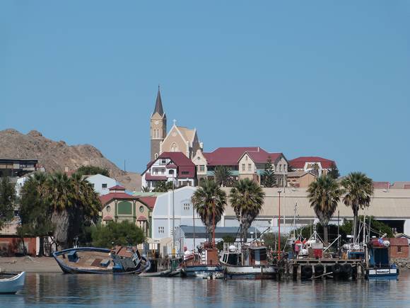
The town is small and
just about everything to see is within a six block square. The charming German architecture makes a
walking tour of the city a pleasure.
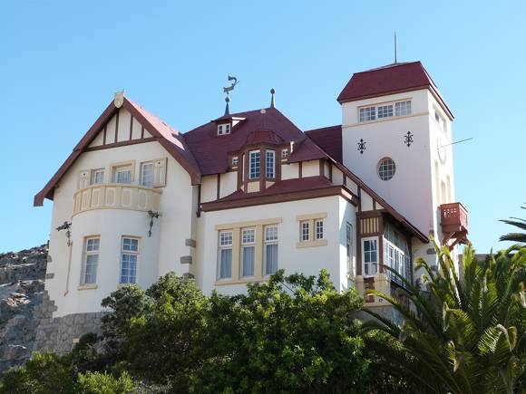
The most picturesque area of town is Diamantberg, the
highest elevation in town and where all the “Diamond Barons” built the most
gracious homes. The most famous of all
is Goerke Haus which overlooks the town and is the most well-preserved. Hans Goerke made a fortune in the diamond
rush and when he returned to Germany, he sold the house to De Beers’
Consolidated Diamond Mines which maintains the house as a museum and VIP
accommodations for its’ employees.
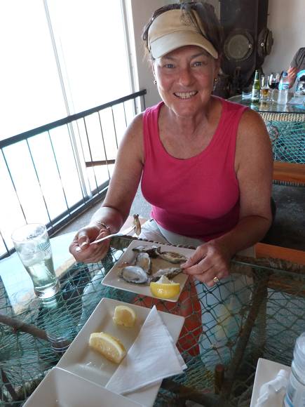
If you like oysters, this is the town to indulge in them. The Shearwater Oyster Bar is over at the Luderitz Boatyard is right in the processing plant so you can’t get much fresher than that!
Road Trip!!!
We had the BEST road trip heading off into the desert and down to the Fish River Canyon! Here’s Peter relaxing on our Ford Ranger – a favorite choice among Namibian pick-up trucks, or “Bakkies” as they call them here.
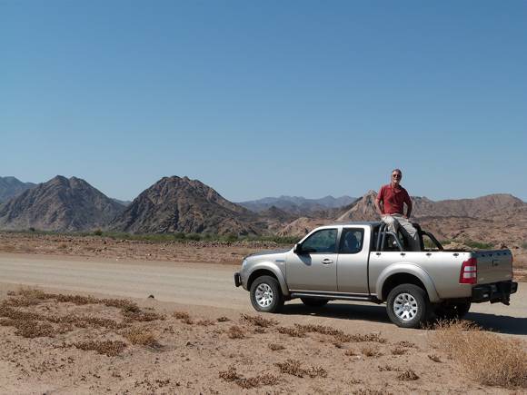
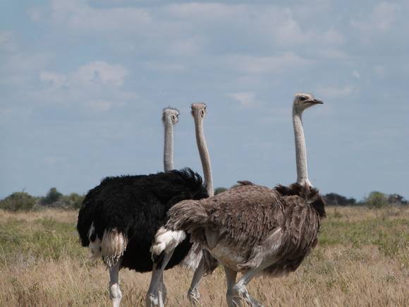
We drove along long stretches of endless highway keeping an eye out for game along the side of the road. It’s common to see gemsbok and ostrich like the ones below.,

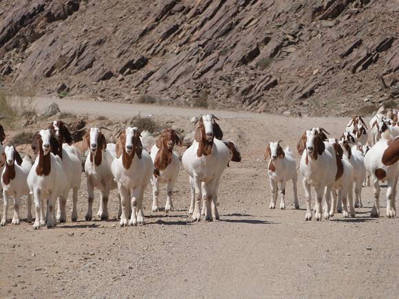
We saw quite a
few including this herd of goats making their way who knows where?
We spent a night at the Seeheim Hotel. The town of Seeheim is basically a ghost town
now – although in the early 1900’s it was flourishing as in important train
junction for all trains transiting between Namibia and South Africa as well as a
stopover for those heading to the diamond fields around Luderitz .

The Seeheim Hotel survived until 1974 but the completion of
the excellent tar road to Luderitz spelled the demise of passenger service and
reduced the importance of the railway.
The hotel was purchased in 1998 by a South African who has restored and
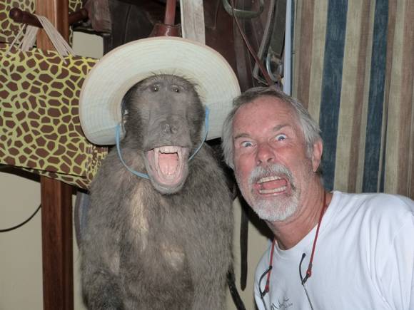
expanded it greatly – adding on a furniture business and a taxidermy! It’s got a neat bar with all sorts of
“stuffed” animal heads. Here’s two of
them!
Returning to Peregrina, we sailed to Walvis Bay - Namibia's principal port. It lies just about 300nm north of Luderitz at 22° 57’S, 14° 28.6’E. It’s a busy port but the entrance to the anchorage at the Walvis Bay Yacht Club is straightforward and out of the mainstream of traffic. We put out 150 feet of chain/rope and held rock steady even on the very windy days! The holding was good in about 10 feet of water and we could easily dinghy in to the yacht club.
Note: We had to keep a lookout for the Cape Fur Seals. They are adorable but when they jump on your boat, they make a TERRIBLE mess! This little fellow decided that our dinghy was a great place to take in the sun every morning!

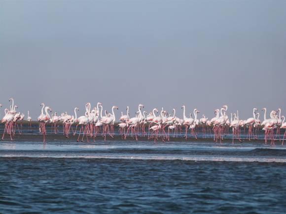
Walvis Bay is also known for its colonies of pelicans and flamingos. Thousands of them make their home here!

After a few days in Walvis Bay, it was time to do some sightseeing! The truth is, it was time to get away from the coastline which can be very foggy and gosh-darn COLD and windy this time of year! Peter and I would never in a million years have thought of Africa (at least South Africa and Namibia) as cold but, believe me, it’s bone-chilling! Kinda like the coast of Maine on a foggy day in October!
But, just a few short kilometers inland
and BAM!!! You’re back in the desert and
the temperatures start to rise! Throw
off that fleece jacket and enjoy the sunshine!
An easy drive from Walvis Bay is up the Skeleton Coast to
Henties Bay. On the way, you’ll see some
wrecks that are testimony to this treacherous coastline.

Continuing north towards Etosha National Park, we saw hardly any cars on the road so we assumed that there would be no problem getting accommodations. WRONG! We were told there was no space available and that we would have to find a place outside the park. So, if you plan a trip to Namibia, be advised to book the National Parks in advance!
Entering Etosha the next morning, we got an early start for
our long drive from the Anderson Gate/Okaukuejo Rest Camp to the Namutoni Rest
Camp -where we had CONFIRMED reservations for the night! The entire park covers over 22,000 square
kilometers – half the size of Switzerland!
The main roads skirt the edges of the Etosha Salt Pan which measures
4600 square kilometers. It is believed
to be the remnants of a dried up lake with fossils indicating lake conditions as
recent as 4500 years ago and as old as 2 million years ago. The local Hai //om (San) people call it the
“Great White Place.” They refer to
Etosha as the “lake of a mother’s tears.”
They believe she cried so hard for the loss of her child she filled a lake
and, when her tears dried, only the salt remained.
But, still there was life everywhere! And, in some cases, MASSIVE herds of hundreds
of zebras, wildebeests, springbok, gemsbok, the likes of which we never saw in
South Africa! Luckily, we were touring
at the beginning of the dry season so the animals were just coming out to the
waterholes accessible to the designated national park roads.
Etosha is different than the game parks in South Africa as the expanses are so huge and, often the animals are a bit further away that we had come to experience in Kruger, for example. But the rewards were just as satisfying. The sheer number of animals in the Park is astounding and, when you come across a herd of hundreds of zebra and wildebeest (who often travel together) at a watering hole, it is breathtaking! During a short stopover at the Halali Rest Camp, we were rewarded with a huge gathering of zebras and wildebeests enjoying a cool drink of water!

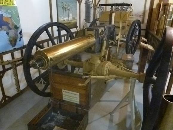
After Etosha, we headed south on B1 to Tsumeb, where there is a great little museum portraying the life and culture of the Ovambo, Hererol, Himba, Kavango and San tribes as well as a room dedicated to WWI and the battles between the German “Schutztruppe” (stormtroupers) and the Union Forces from Namibia (South West Africa)and South Africa. There is an AMAZING collection of German weaponry, including some beautiful old German guns, cannons and automatic weapons which were thrown into nearby Lake Otijikoto by the retreating German forces in 1915 to prevent the Union soldiers from capturing them. These weapons have been fished out of the lake by divers over the years and, after restoration, donated to the Museum.
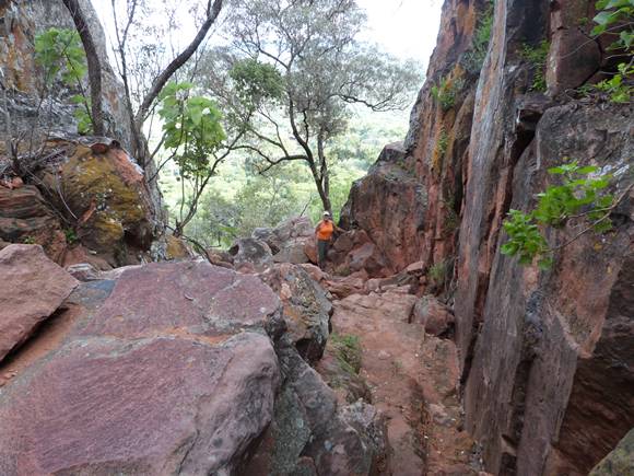
The next day, we made a spur of the moment decision to take a detour to the Namibia Wildlife Reserve Park at Waterberg Plateau! And we were glad we did!

The park consists of a plateau of compacted sandstone that spurts straight up some 260 meters high. It was formed about 200 million years ago. It’s not large but it is a major conservancy for eland, white rhino, roan and sable antelope as well as a number of other endangered species such as Namibia’s only colony of Cape Vultures and the spectacular Verreaux (black) Eagle so your fees go to a good cause.
The hikes at the park are a big draw. They range from 30 minutes to 3-4 days and the trails are well marked and the views spectacular! We did the one hour up/45 minute return unguided “Mountain View” hike to the top of the plateau at 3pm in the afternoon. The view from the top was amazing and we hung out there until almost sunset before hot-footing it back down.

Leaving Waterberg, we headed back to Walvis Bay and started preparations for our departure this weekend to cross the Atlantic! Stay tuned for more adventures of Peregrina as we head for the island of St. Helena, where Napoleon was exiled…
-