Navigating In Indonesia

Peregrina's Journey
Peter and Margie Benziger
Tue 11 Oct 2011 22:59
Position Report - 02:44.160S 111:43.500E
NAVIGATING
IN INDONESIA
Recently we
made the 300 mile crossing of the Java Sea from Bali to Borneo. It was a bit challenging, so I thought I
would share some of the many adventures of navigating in Indonesia.
1)
CHARTS
Many paper charts and the electronic charts
come from old hydro-graphic surveys made years ago. In some cases, the actual
surveys can be very, very old and quite inaccurate.
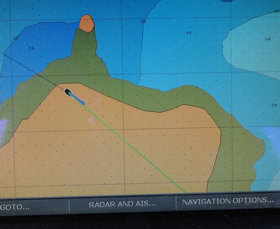
The picture below from our chart plotter
shows Peregrina happily sailing across an island. While we have gone aground twice
in the past two years we have not learned to sail across land! Clearly, the charts are inaccurate.
To provide you an idea of how far off
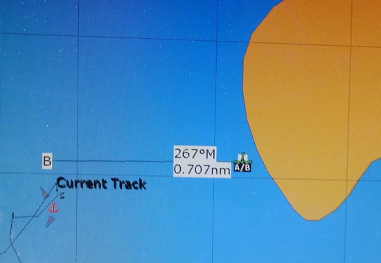
a chart can be, please look at the following chart which shows Peregrina at
anchor (Label B). While she is
actually anchored about 100 feet from shore (Label “B”), the chart shows that
the island (Label “A/B”) is almost seven tenths (0.707nm) of a mile away
from its actual location! Would you feel comfortable
trusting this chart for a night approach?
The point is that while charts may
provide good references in many parts of the world, you can definitively
not trust the charts in all parts of the world. Margie has a tendency to navigate focused on
the chart plotter. I am constantly
nagging her and saying “Get your head out of the chart plotter and look around!” On Peregrina, we try to combine all our
information: chart plotter, radar, depth
sounder, water color, visible land, current changes, wind patterns on the
water, smell, dead reckoning and best guess. And yes, sailors do develop a “sixth sense”
and we need to listen to it.
2)
FISHING
BOATS & EQUIPMENT
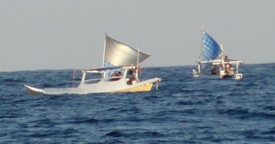
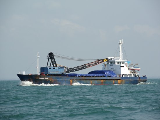
Indonesian waters are filled with
commercial fishing boats as well as small, independent operators and, even Mom
and Pop in a longboat in the middle of the ocean.
Indonesian fishing boats come in all
sizes and shapes. They are usually made of wood so they do not show up on radar
at night.
These boats tend to thousands of
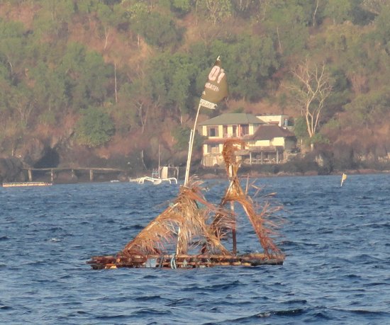
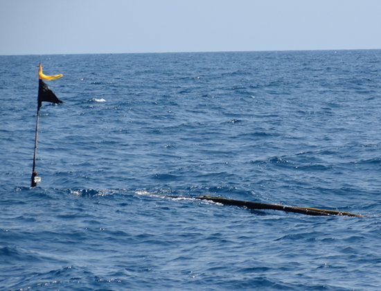
fishing traps marked by small floating buoys usually made from flimsy bamboo
poles. They are hard to see during the
day and nearly impossible to see at night. Two nights ago, our friends on the catamaran,
“Cop Out,” crashed into a bamboo platform at two o’clock in the morning. Ken had to hang over the stern of his boat
with a machete to chop off the rope and bamboo poles that were caught in his
propeller.
Another very scary part of fishing is
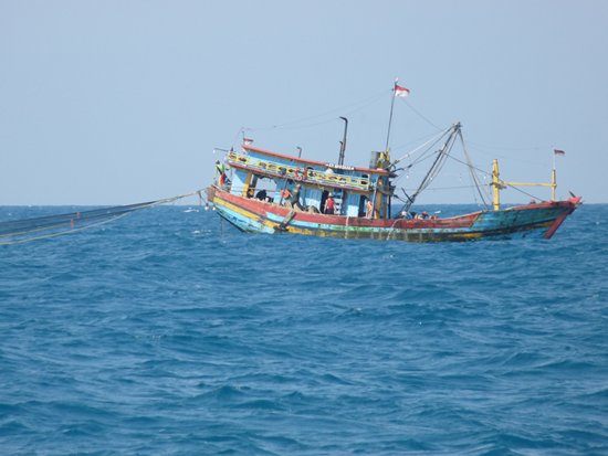
the long nets in the water.
Whenever we
see a fishing boat, we have to make a quick assessment as to whether it is
trailing a long net and then take the necessary maneuvers to avoid getting the
net tangled in our propeller. Several of
our friends have ended up stranded at sea when a net or a rope winded around
their propeller. Usually jumping
overboard is the only way to free the prop. I had to do this once and it is not
fun since Peregrina’s hull was crashing up and down in the waves and my head
got banged up pretty bad.
3.
COMMERCIAL TRAFFIC
A few nights ago, while crossing the
Java Sea we passed right through one of the many shipping channels in this
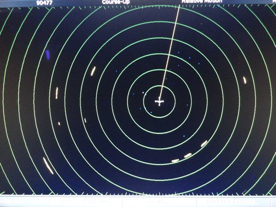
region. The picture below of our radar at night shows nine ships (little blips
of light) passing us on all sides.
Peregrina is
a good sized sailing yacht at 47 feet long but we really feel small and
insignificant next to these super tankers and giant cargo ships. We can see them easily on our radar and AIS
(automatic identification system) but sometimes they don’t see us! And the truth is, they don’t really want to
alter their course at all. For the most part, they do not answer radio hails
and when they do it is very unlikely that someone speaks English well. Often,
the best we can do is repeat the traditional marine traffic guideline of “Port
to Port” which requests that each vessel should pass with their left side
facing the other ship and then we just hope they make an effort to get out of
our way.
Another
danger is the tugboats pulling unlit barges. In the past month, two of our
friends have had collisions with barges pulled by tugboats without the proper
lights.
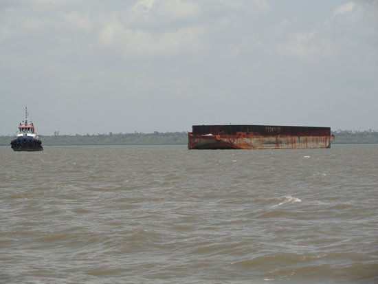
Both our friends boats remained
afloat and but one will require substantial fiberglass repair. Frankly, they
are both lucky to be alive.
4. STORMS
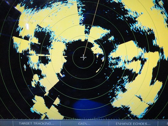
While we
have had many months of storm free weather, we are back in an area with storm
cells. The picture below was two nights
ago and the yellow shows the storms completely surrounding Peregrina which is
at the center of the screen.
Margie and
I are very good now at adapting to storm tactics and actually welcome the rain
and wind since it cleans Peregrina’s decks.
We have not been to a marina since departing Australia. There have been
no marinas, boat stores, haul outs, towboats or rescue services anywhere in our
route. We have to be self-sufficient. My standard mantra is “What would McGiver
do?”
I recently
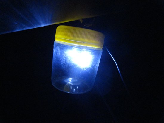
made a new anchor light out of a Skippy Peanut Butter jar and it works great!
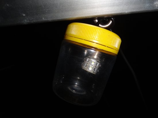
It works great!
While
Indonesia has some sailing challenges, it is still a wonderful adventure and we
will keep Peregrina’s bow sailing westward toward the setting sun.
