Day 8
Pearl of Persia
Andrew Lock
Mon 26 Nov 2012 18:21
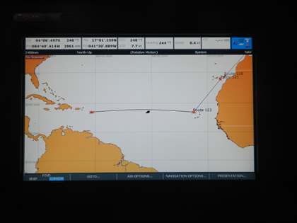
The daily noon plot shows we are pretty much half way, Senegal to the East
and the Caribbean to the west, with the boat positioned between the two.
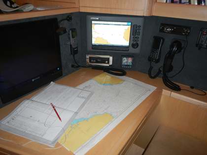
Even though we have electronic charts, with GPS we also carry a full set of
paper charts some on a huge scale covering whole oceans, and some of small
harbours with minute details of individual rocks, lights and buoys. We are
using the paper chart of the Atlantic ocean at present, which now has a
series of dots marking our daily position. The navigation station also has
our VHF radio for communication within 20 miles or so, a short wave radio on
several wavelengths which will allow us to make contact with ships or land
based coastguards several 1000 miles away, a satellite phone which means in
an emergency we can make a phone call, but also enables us to download
weather forecasts from the internet and our computer, which allows us to
email....and update the blog.