44. ROBINSON CRUSOE ISLAND -
TOBALABA-SANTIAGO-Chile, SCTB - 20.4.2009 - 458NM - 3:00hrs
"33:27.2S
070:32.6W"
For days we were constantly consulting diferent weather forecast sites
on the
internet for conditions on our next leg from Easter Island to Robinson
Crusoe
Island way east across the South Pacific 460 Nautical Miles off the
Coast of
Chile and Santiago.
Conditions apeared to be optimal on the 17th of April, with a high
pressure
system siting off the coast of central Chile and Robinson Crusoe Island
at
the time of our arrival there.
What this meant for us: A favorable tailwind componet practically all
the
way to our next destination and, Manfred and I decided to plan out take
off
at Easter Island at midnight on the early 17th of April.
The day before our planned departure, we obstained from any eating
and drinking, this for obvious reasons for a fllight of 11 to 12 hours,
and
just
relaxing at our Bead and Breakfast place.
At 10:30 PM, we were driven by our Agent to the airport to our plane
and the meteo office on the field, where we obtained the latest
information
from the met man and the local ATC controller.
Take off was into the pitch dark night towards the West and then after
climbing
through our imposed safe altitude of 3000 feet we made a 180 degree
turn
en route on the airway in easterly direction.
Communication with Air Trafic Control on Pascua was ok for the next 120
Nautical Miles was ok, but then faded away abrubtly.
As per normal procedure, we were then required to contact Santiago
Oceanic
Control on Short Wave and report our time estimates for the flight
route every
30 minutes to report "Operations Normal".
Initially we were able contact Santiago on one of the 8 HF frequency,
but then
communication with the control centre was impossible on Short Wave for
the
next eight hours due to the fact, that we were flying at night.
Our portable Iridium Satellite Telephone was then the ideal
alternative, to
contact Santiago ATC during this time, and we called them up every 30
minutes,
to report our positionp, estimations- and flight level, and this about
10 times
in
a row.
That night was really long and passed very slowly for us two.
With the half moon raising slowly in the east over the horizon, and
moving
slowly
higher and higher over us, it gave us at least a visual reference in
space
outside,
this naturally in addition with the well equiped IFR Instrument panel
of
our airplane.
We waited impationaly for the first signs of the raisin sun and the
asociated
silver- and
golden linings on tacthe horizon.....
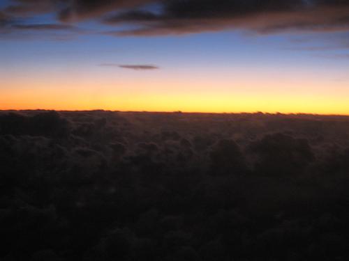
The first gold lining on on the horizon
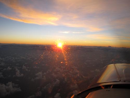
First sunrays
About 9 hours into the flight, cruizing along at 155 to 178 Knots above
solid
clouds,
we again reestablished solid HF contact with Santiago Oceanic control,
and we
were
given the latest weather information on Robinson Crusoe Island, our
destination
today:
Wind 160' at 15 to 25 knots, broken clouds at 2000feet and good
visibility......
Seamingly releived of this favorabel information, Manfred and I enjoyed
the
rest of this
flight, as we approached our destination.
Robinson Crusoe airfield is known as a particularely dificult and
challenging
place to land,
due to frequent and abroubtly changing weather conditions-, the
particular
uphill sloping
short runway configuration on the Islands steep raising cliff, with
lots of
turbulance on final
approach.
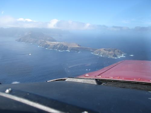
Aproaching Robinson Crusoe Island from the west
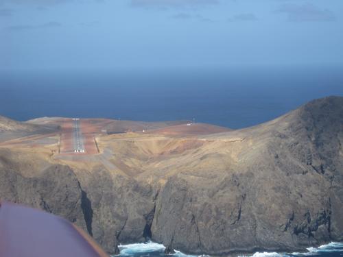
On finals to runway 14
After a flight of exactly 11 hours, the wheels of HB-PON touched the
brand new
runway
14 of Robinson Crusoe (1'005 Meters in lenghts), which was finished
only a few
days ago
by the Corps of Engineers of the Chilian Airforce.
This brand new installation, with its new runway-, apron- and terminal
building, has not even
officially been inaugurated yet as we arrived!
What a great place and a absolute surprise for us!
>From the airfield we were then driven by one of the two only cars
on this
part of the island
to the nearby jetty in the natural harbour, to take a 1 and a half hour
boat
ride on a small boat,
with passengers which have just arrived from Santiago, around the
island to
Cumberland Bay,
to the only settlement on the other side of the Island.
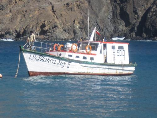
Our boat taxi to Cumberland, the only settlement with its aproximately
700
inhabitants
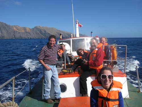
Passengers and the islands maire Paul on the left.
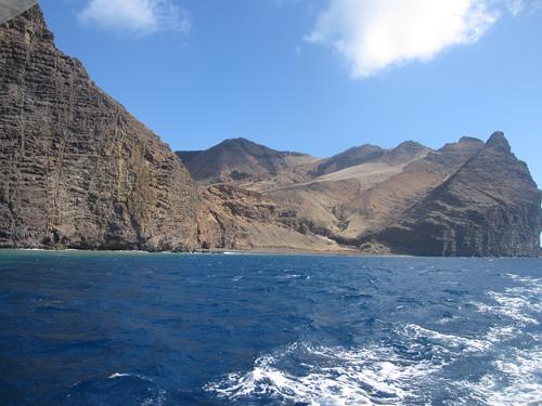
Cruizing along the northern side of the Island
What follows are some impressions from our stay at this unique Island,
which
has
the second highest number of endemic plants on our planet after Hawaii.
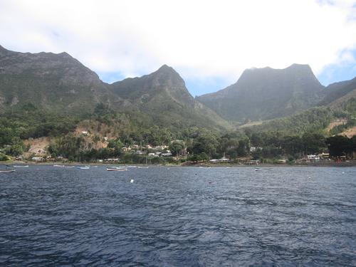
Ariving at Cumberland town
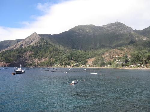
Cumberland town

One of the settlements street and Zunami escape way.
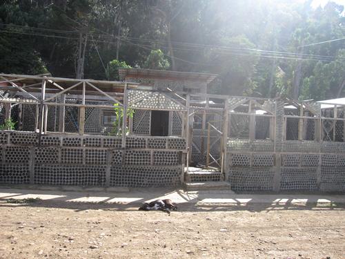
A town house constructed entirely out of glas bottles
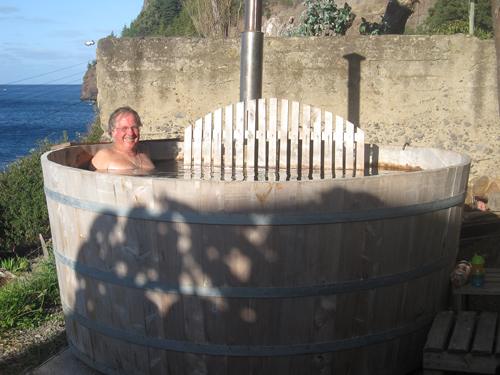
Captain Rolf enjoying the Hot Tab at the Bead and Breakfast place we
stayed
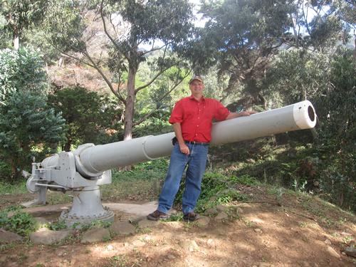
WWII artilery gun and Manfred
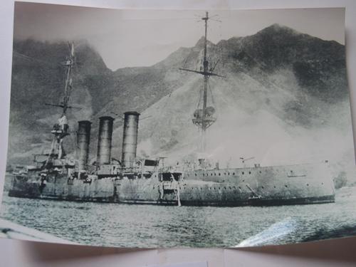
The German light cruizer "SMS Dresten" which was sunk by its crew in
1915 at
Cumberland Bay, after having been chazed for a long time by 11 British
warships,
and finally found here hiding during WW I.
Search on Google for SMS Dresten and read the whole interesting
story.......
http://en.wikipedia.org/wiki/SMS_Dresden_%281907%29
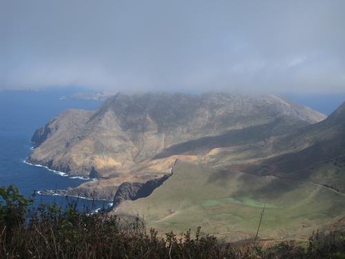
After a 2 hour walk uphill to the Robinson Cruzoe Lookout, a view to
the
other
side of the Island direction east to the Airfield. Walking distance
from here
6 to 7 hours.
Our next leg to Santiago Chile:
We will take off from here just after lunch end expect to reach
Santiago around
3 in the
afternoon.