Wednesday 9th May - Calm before Colon

|
9:22.08N 79:57.07W Wednesday 9th May – The San Blas Islands are like nowhere we’ve been before. They really are a haven of tranquillity with barely a ripple on the water. You can easily lose track of time – a whole week went by without anything very much happening - apart from thunder storms for our first two days. There was very little wind but of thunder, lightning and tropical downpours there was more than an adequate sufficiency. We did a bit of snorkelling on the nearby reef and donned the sub-aqua kit to get rid of the many barnacles that had decided (in a very short space of time) that the prop shaft, prop and the various underwater bronze fittings that are not anti-fouled looked like inviting homes. No, they are not – go away! But, the new anti-foul paint is holding up and the usual slime on the waterline was easily removed. In the end we stayed almost 5 days in Holandes Cays waiting for decent light to enable us to manoeuvre confidently amongst the reefs and, it has to be said, decent enough weather to make the sailing fun.
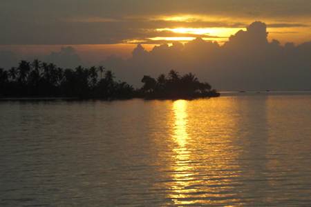
Sunset over the Holandes Cays
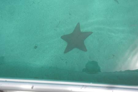
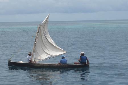
Crystal clear water – a star fish 12 feet down On Sunday 5th May, there was enough light to con our way out of the anchorage and move further west to the Eastern Lemmon Cays, anchoring between Banedup and Nuinudup. Some of the islands here are inhabited but only to the extent of one or two huts. The locals make a living by fishing or going, sometimes by sail, to the Kuna Yala settlements on the Panamanian mainland, 7 miles away, to work on their allotments.
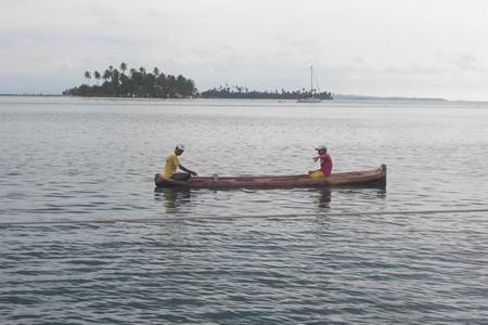
Gone Fishin’
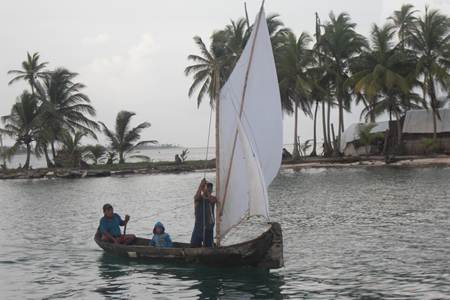
Gone Sailin’
Work for Sanders Sails here They also sell their colourful molas - embroidered panels which are sewn onto the front and back of blouses. Some of these are exquisite works of art and Carol, inevitably, ended up as the proud possessor of a few delivered to Arnamentia by one of the master mola makers, Venancio, and his boy touting their wares in a dug-out canoe.
Carol modelling a mola, Kuna style Having spent two nights there, we upped the anchor after breakfast
on Monday 7th May and motored the mile or so to anchor off Checking in was interesting.
Porvenir has no inhabitants apart from what appear to be soldiers
(difficult to tell here since the coast guard seem to wear army style camouflage
uniforms – which must be very effective at sea). There is an aircraft runway (being
repaired or widened or whatever when we arrived there), a café and the offices
of the port captain and the immigration authorities. By the time we got there – an hour or so
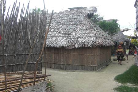
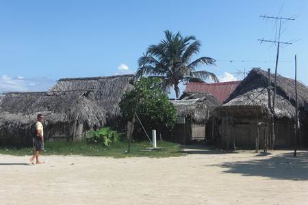
after having left Whilst anchored at Porvenir we took the opportunity to dinghy across to the islands of Wichubhuala and Nalunega (respectively about half a mile and a mile away). It was the first time that we’d seen the Kuna ‘at home’. The Kuna Indians have preserved their culture to an extraordinary degree. They don’t really recognise ‘San Blas’ as the proper name for their islands –‘Kuna Yala’, please. Nobody owns land. Until very recently the currency was coconuts. So, don’t go picking up coconuts – that’s a serious offence. The Kuna are all small in stature (apparently only the pygmies are smaller) and live in huts constructed of thin bamboo walls (made up of a single layer of 1” or so thick bamboo poles lashed onto a bamboo frame) and palm leaf roofs. By and large such family huts comprise a single room equipped with the requisite number of hammocks. There is, generally, no electricity or running water to the huts.
Nalunega
…… but somehow they all fit in – particularly at rush hour
A walk in the park Villages typically have 3 chiefs and a large communal hut (Congresso). Not only is this the place to hang out but it is where the villagers come to air their grievances and views. At such meetings they all sit on hard wooden benches whilst the chiefs preside swinging in hammocks, attended by interpreters (Argars) who translate the ethereal wisdom of the chiefs to the hoi polloi and apply it to the situation in hand.
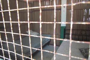
Congresso Hut - Nalunega There is another large hut – the Chicha hut. Chicha is, apparently, an alcoholic drink brewed from sugar cane and is used a few times a year. If you want to live in the San Blas Islands it’s all very simple – you have to be a pure bred Kuna Indian. If you wish to marry outside the race it’s also very simple – you go away. When you marry another Kuna, as a man you move to your wife’s village. If you irritate the chief or are found to have offended against the code you will be fined or otherwise penalised by him. If you become sick, the appropriate shaman will attend you to deal with the offending evil spirit and/or administer some secret herbal remedy. Regrettably, there is much more to know about these fascinating people than the pair of us now has time to learn. On the matter of punishments, Eric Bauhaus (more of whom later), reports that a favourite is to task the offender with the collection of coral rubble from the sea bed for landfill – an important civic activity since many huts are only a few centimetres above sea level. One luckless chap was tasked with collecting 10 barrels of the stuff for hitting his wife. When he complained to the Congresso that, in fact, she’d provoked him, the chief saw the point and employing the wisdom of Solomon, ordered her to collect 10 barrels of the stuff as well. There’s justice for you! Juxtaposed with all this was the sight of dozens of primary school children attending school (one of very few concrete buildings) on their island wearing the regulation white shirt and navy blue skirt or long trousers – all immaculately turned out and less than 100 yards across the sand from their huts. Well, I never . . . In addition we encountered a concrete basketball pitch laid out on Nalunega. It seemed an unlikely sport for such a vertically challenged race. However, our self-appointed guide assured us that when the ‘tall people’ came to play them the Kuna could still thrash ‘em! There are even a couple of hotels on the islands. We had a quick look at one on Nalunega. The accommodation is, to put it mildly, pretty basic. Rooms consist of two beds and absolutely nothing else. Nothing. At all. The mattresses (for, there was no bedding to be seen in the one we visited) – hm. The bedrooms are separated from one another by the afore-mentioned single-skinned bamboo walls. These walls might appear dauntingly tall to a Kuna – significantly less so to others we’d say. Meanwhile, there are, of course, plenty of gaps between each bamboo pole in the wall and its neighbours. Very communal – as are the two wash basins located in the open, outside the building.
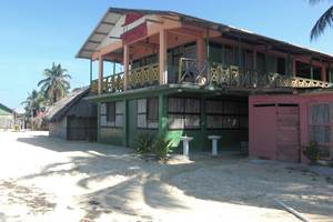
5* Accommodation with ….. …….. facilities “hors suite” Returning to Porvenir, we checked in as described above and immediately
set off towards So, here we now wait whilst the bureaucratic wheels revolve slowly. The admeasurer was due yesterday. Then it was today. Now it’s tomorrow – which is Saturday as I write – so that’s unlikely to happen. And it can’t be Monday because they don’t do yachts on Mondays . . . . The measurement business is a total nonsense but rules is rules and it generates $54 for the Government. On a more positive note; having understood that we’d have to pay $105 each for a visa we are now told that the requirement has very recently gone away. We ought not to leave this contribution to the blog without returning to Eric Bauhaus. This German has produced a guide called ‘The Panama Cruising Guide’ which is simply streets ahead of any other publication on the subject. In many ways it is streets ahead of most cruising guides of anywhere we have seen. It is lavishly illustrated with photographs but, much more importantly, he has undertaken the job that the hydrographic agencies have failed to undertake in producing extremely accurate pilotage chartlets for pretty well everywhere in the region. Our experience so far has been confined to the San Blas Islands and Green Turtle Bay but the difference his extremely detailed and accurate charting makes is really very considerable. The whole is accompanied by electronic charting which can be loaded onto a computer and linked to a GPS. It takes away much of the guesswork associated with navigating around the islands and permits you to place accurate waypoints on your normal chart plotter. The fact that your route will then, according to your normal charts or chart plotter mapping, appear to lie straight across reefs and your anchorage well up the beach of some island should not concern you unduly. Eric knows, and the offerings of the normal hydrographic agencies are, by comparison, merely vague stabs in the dark complemented by the application of a fair amount of artistic licence. The accurate charting of places not accessible by commercial shipping or warships clearly ain’t a priority. The book and the accompanying electronic charting (WGS 84) are not intended to replace standard charts and charting since they are concerned mainly with the fine detail of harbours and anchorages rather than the passages between them. But, from just about wherever you need to start paying attention to the pilotage, Eric’s your man. He could do something to make both the book and the electronic charting a bit more user friendly – it can be a bit awkward navigating from one chart to another at times – but, frankly, given the general clarity of what is on offer here, that is a very minor criticism. |
