Magnetic Island to Cairns
Jackamy
Paul & Derry Harper
Tue 14 Sep 2010 00:32
|
16:55.111S 145:46.928E
Tuesday 14th September
After ten hours of motor sailing we
anchored at 5.30 pm on Friday in Horseshoe Bay, Magnetic Island. The
island was named by Captain Cook, who thought his ship's compass behaved oddly
when he sailed by in 1770, thankfully we didn't have any problems with our
compass.
The island is one of Queensland's oldest
resort islands, with the first tourists arriving more than 100 years ago. About
70 % of the island is national park, with the 494 meter Mount Cook dominating
the centre of the island.
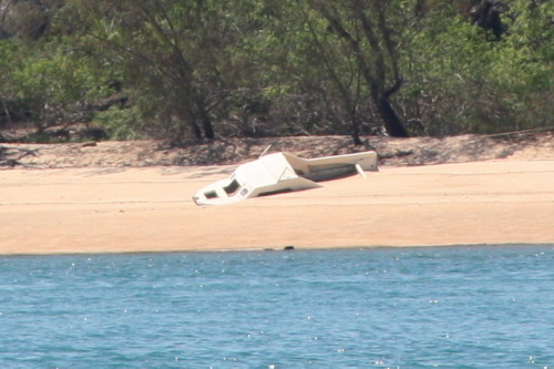
In the south east corner of the bay is the
wreck of 'Argonaut, a three-masted schooner that sank here in the late 1970's.
If you look at the picture closely you can see the top of the mast's above the
water.

On Saturday we sailed to Orpheus
Island, one of the Palm Island Group. The Palm Island Group consists of 10 main
islands, apart from Orpheus and Pelorous, all the other islands are Aboriginal
reserves and permission must be obtained from the Aboriginal council before you
can go ashore. Sadly crime has become rampant on Great Palm Island and isn't
recommended for visitors.
  Sailing by Palm Island ........
restoration project!!
We anchored in Little Pioneer Bay,
Orpheus island just after lunch and were joined by Blue
Magic and Bionic later that afternoon. Orpheus is a heavily forested
national park with lots of birdlife and turtle-nesting beaches and a giant-clam
research station belonging to the James Cook University.
 Little Pioneer Bay
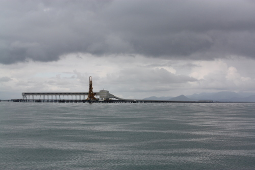
We left the anchorage at 8 am on Sunday and
motored slowly to the entrance of the Hinchinbrook Channel, we could see
the tower on the end of the bulk sugar conveyor wharf from a distance of 10
miles.
The sugar-port town of
Lucinda is situated on the mainland at the channel's southern entrance, the
channel is 26 miles long with the town of Cardwell at the northern extreme.
We entered
on a rising tide and at one stage had just half a meter of water below
us.
 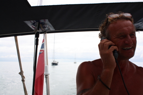 Approaching the channel entrance......
Talking to Blue Magic and Bionic
The conveyor belt structure projects 3 miles
out to sea at the end of which ships berth to load bulk sugar. At the shore
end are bulk storage sheds which are fed by tramways from surrounding cane
farms.
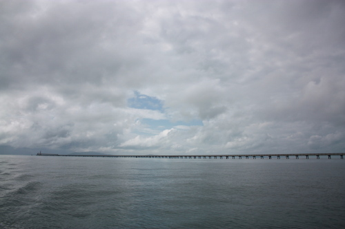    The
Hinchinbrook Channel is a scenic calm waterway with Hinchinbrook Island to the
east and the Cardwell Range to the West.
 Peaceful Sunday afternoon
We anchored for the night off Dunk Island.
Named by Captain Cook in June 1770 for Lord Montague Dunk, the First Lord of the
Admiralty.
The following day we had an 85 mile sail to
Cairn's. We had planned on a 5 am start but when it started raining at 3 am and
we had to get up to close the hatches we decided to whey anchor and slip out of
the anchorage. With just 15 miles to Cairns we passed Fitzroy Island;
it looked too inviting to sail on by so we dropped our anchor in Welcome Bay
just after lunch and sailed in to Cairn's the following morning.
 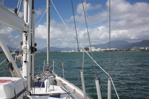  Approaching Cairn's
|