Day 56- day 57: Masvingo, Great Zimbabwe and Lake Kyle in the Rain
20:16.26S 30:55.5E
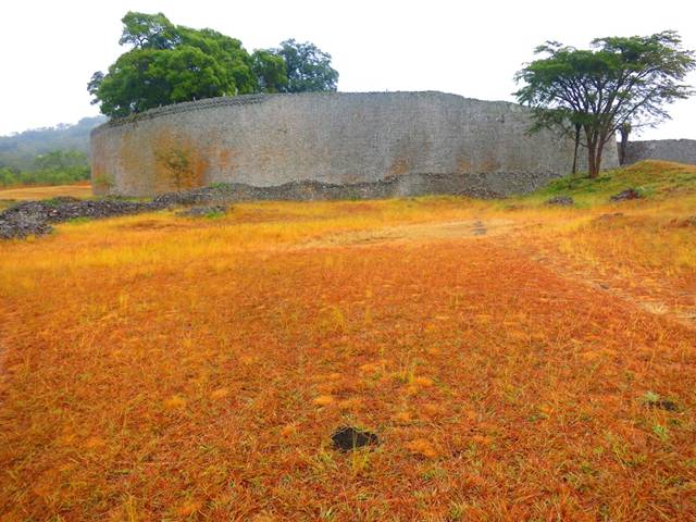
To Great Zimbabwe Ruins site via Masvingo 10th and 11th June I stayed at the Parks. hut for 2 nights. The weather was cold, rainy and misty most of the time, and as the only guest I felt like I was imprisoned. The ruins are quite astonishing, and really does make one think about how this all happened. Went to the Great Zimbabwe Hotel for dinner and had an interesting conversation with a black alpha male, who was with his mistress (he was married and this wasn’t his wife!) He was just starting to feel the rewards off his capitalist success, and had the BMW, with all the gadgets, and was definitely trying to impress his girl! We chatted about business, risk and when enough is enough, and it clearly hit some buttons, and it became clear he was pretty driven, making risky…. Great Zimbabwe National Monument is approximately 30 km from Masvingo and located in the lowveld at an altitude of some 1100 m in a sparsely populated region of the Bantu/Shona people. The property, built between 1100 and 1450 AD, extends over almost 800 ha and is divided into three groups: the Hill Ruins, the Great Enclosure and the Valley Ruins. The Hill Ruins, forming a huge granite mass atop a spur facing north-east/south-west, were continuously inhabited from the 11th to 15th centuries, and there are numerous layers of traces of human settlements. Rough granite rubble-stone blocks form distinct enclosures, accessed by narrow, partly covered, passageways. This acropolis is generally considered a 'royal city'; the west enclosure is thought to have been the residence of successive chiefs and the east enclosure, where six steatite upright posts topped with birds were found, considered to serve a ritual purpose. The Great Enclosure, which has the form of an ellipsis, is located to the south of the hills and dates to the 14th century. It was built of cut granite blocks, laid in regular courses, and contains a series of daga-hut living quarters, a community area, and a narrow passage leading to a high conical tower. The bricks (daga) were made from a mixture of granitic sand and clay. Huts were built within the stone enclosure walls; inside each community area other walls mark off each family's area, generally comprising a kitchen, two living huts and a court. The Valley Ruins are a series of living ensembles scattered throughout the valley which date to the 19th century. Each ensemble has similar characteristics: many constructions are in brick (huts, indoor flooring and benches, holders for recipients, basins, etc.) and dry stone masonry walls provide insulation for each ensemble. Resembling later developments of the Stone Age, the building work was carried out to a high standard of craftsmanship, incorporating an impressive display of chevron and chequered wall decorations. Scientific research has proved that Great Zimbabwe was founded in the 11th century on a site which had been sparsely inhabited in the prehistoric period, by a Bantu population of the Iron Age, the Shona. In the 14th century, it was the principal city of a major state extending over the gold-rich plateaux; its population exceeded 10,000 inhabitants. About 1450, the capital was abandoned because the hinterland could no longer furnish food for the overpopulated city and because of deforestation. The resulting migration benefited Khami, which became the most influential city in the region, but signaled waning political power. When in 1505 the Portuguese settled in Sofala, the region was divided between the rival powers of the kingdoms of Torwa and Mwene-Mutapa.
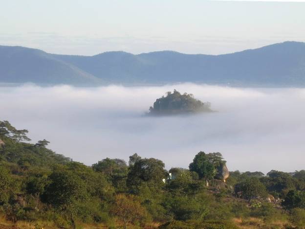
Next day, weather was a bit better, and I rode out to the dam wall for Lake Kyle ( Now, Lake Mutirikwe). The second largest lake in Zimbabwe, after Kariba.It is thought to have been named Lake Kyle after the Kyle district in Scotland from which pioneer of the Lowveld Tom Murray MacDougall came originally. The ride there was quite spectacular. A winding road, ups and downs with fantastic granite koppies, where the temeperature range has caused impressive rock erosion, where hug chunks of mountain side have been cracked off’, and lie like a giant’s building site down in the valley. I was a bit worried about petrol after all the sightseeing, and having time on my hands, I decided to ride 12 kilometres back towards Masvingo where I’d seen a Total service station. Got there, and they informed me that they were dry and I’d have to go right back to Masvingo….! Wasn’t keen on that, so decided to take a chance. Funny how decisions sometimes get made hey! Had dinner in the hut, complete with a small bottle of wine I bought at the surprisingly well stocked supermarket at the service station 12 th June I packed up and left early for a very cold but stunning ride back along the Kyle Dam wall road, but continuing on to connect to the Masvingo / Birchenough Bridge A9 road. FOG OVER THE LAKE
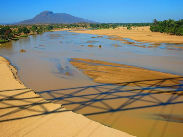
I had a tricky patch of about 10 km of rough dirt road before hitting the A9. NEARLY FROST BITE Filled up at Nyika, very cold and dying for a coffee, but nothing. A choir and band were practising in the restaurant…. Birchenough Bridge,
|