16 48 0N 62 12 3W
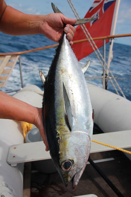
After a few days of giving Joy some TLC, we headed off early morning on Wednesday alongside Pannikin from Grande Case and once around the north east tip of St Martin we set our course beating to windward to sail in between Tintemaria, a small offshore island designated a nature reserve, and the east coast of St Martin. We sailed as close to the wind as possible to clear the small islands to the north of St Bart’s and then sailed the east coast of Bart’s too. On passage we caught a nice chunky tuna, a real fighter on the line and still trying to run when we finally got it to the boat and on board after 20 minutes or so.
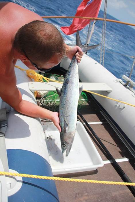
I got back on course and started to tweak sails. Our speed gradually dropped from 7 knots to 2-3 and I couldn’t work out what I was doing wrong! Then we noticed we had caught something else – a fishing buoy on Joy, probably attached to a large lobster pot or a net as it was dragging us almost backwards! We tried a few tacks and different manoeuvres to free it, but it was caught fast on either the keel or anode. Being on a lee shore we decided to limp out further to get away from land, and then furling sails to slow her down Jez went into the water attached to a line to investigate. Sure enough the rope was jammed in between the hull and anode, with a large pot attached which we had dragged for a few miles at this point. Rope cut free the boat immediately started moving without the weight dragging her back and with Jez safely back on board we set sail again, this time on a beam reach as we had passed St Bart’s and we had a glorious sail maintaining 8 knots to Nevis. An overnight stop at the lovely island of Nevis and we were off again the following day heading for Montserrat. If the previous days sail had been Ying, then this was definitely its Yang! Gusty winds off Nevis almost had us rounding up, and certainly had Pannikin rounding up and doing a full circle whilst Steve was down below with autopilot on! Once clear of Nevis we had Redonda in sight, an uninhabited rock about halfway to Montserrat, and unfortunately our east north east wind went east before it was forecast to do, and we had a difficult beat to windward with strong current against. Bashing into seas is not Joy’s favourite and every time we built up speed a large set of waves hit crashing against the genoa and slowing us to a standstill. Didn’t stop us from catching a large mackerel though, we now have plenty of fish to feed us for a week!
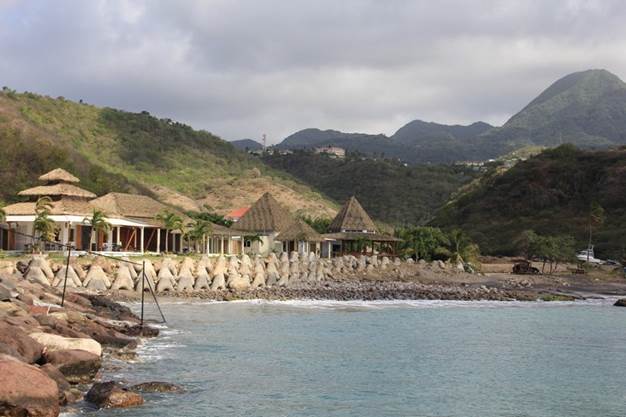
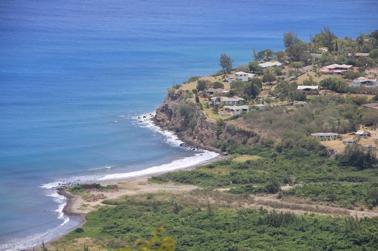
As we got closer to Montserrat the wind picked up and with 25+ knots across the deck we furled the genoa and used the jib sail instead. We knew we were not going to make the island in one tack, so we knuckled down and tacked back and forth to get a better angle to get into the only port of entry, Little Bay, on the north west coast. With only 3 miles to go, at about 6.30pm the sun was starting to set and then Pannikin radioed. Steve was closer in to shore than us and had just lost all steering. We furled away, engine on, and turned in the right direction to reach Pannikin to give him a tow. Then Steve radioed again to say he had set up his emergency tiller and was going to head straight into Little Bay and anchor before all light faded. What a relief! We arrived half an hour later in the dark and anchored safely, noticing the large swell sweeping into the small bay. A very rolly anchorage, 2m swell and a forecast for this to increase to 2.5m, so we knew we were in for a few nights without much sleep! Steve luckily managed to fix his steering the following day. Boy is this island worth it. Little Bay and the adjoining Carrs Bay is under development to create a new town after the destruction caused to the south of the island by the volcano.
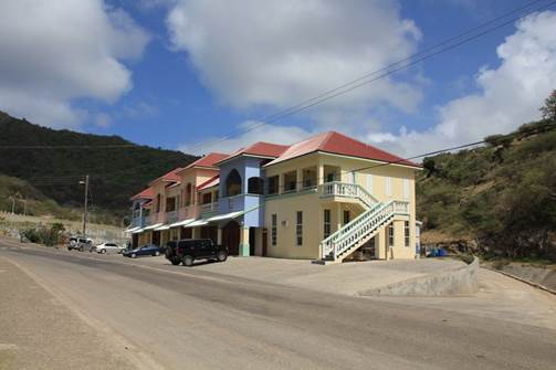
After clearing in at the very efficient port authority we started the long walk around the bays and up the hill to the shops. An elderly resident stopped his car and offered us a lift, so we hopped in and he took us to both parts of the ‘town’ which is very spread out. We were grateful for the lift as its quite a long way and uphill! After a beer – for Wi-Fi of course – we bought some local fresh produce and walked back down hill to Little Bay. The people are very friendly and laid back, almost everyone we passed said good afternoon. There are some large new buildings housing different enterprises, all built to a very high standard now as they have earthquakes and hurricanes here.
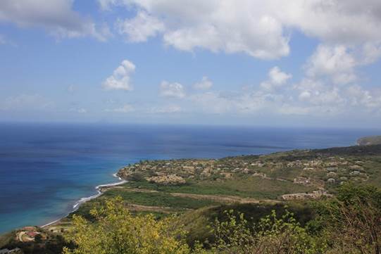
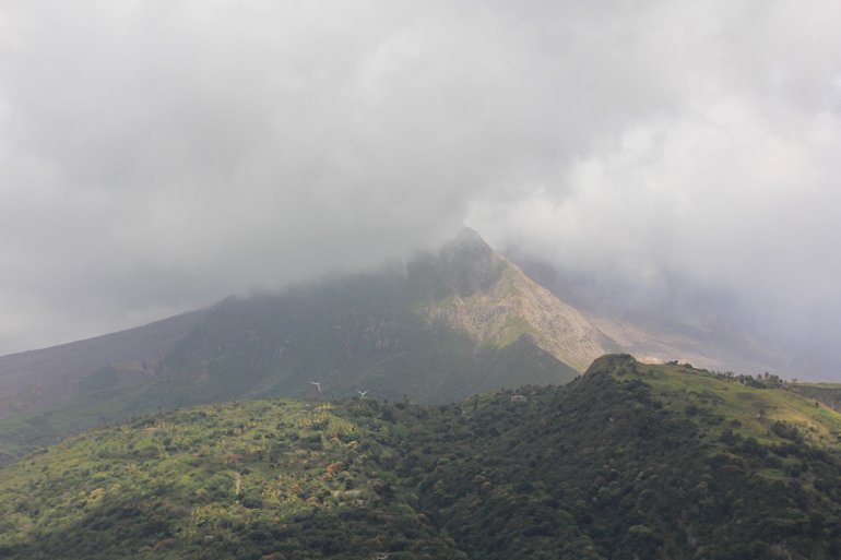
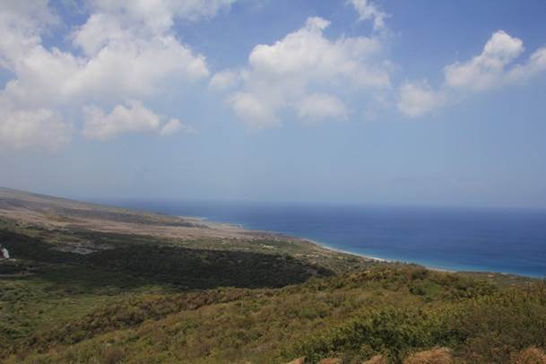
Today we took a trip to Garibaldi Hill by taxi, Joe our driver gave us some history regarding the island and it seems the remaining 5,000 residents here have endured some tough conditions. Joe lived in a village close to Plymouth in the south, and in 1997 the volcano erupted completely destroying the town and surrounding areas. The displaced people lived in schools and churches until they could be rehoused in the north. Joe himself lived in a class room for 2 years. The journey to Garibaldi Hill took us through the very dry north, where there are low growing shrubs and very little trees, then as you move further south where the rainfall is higher, the lush landscape changes with densely growing trees and vegetation. Following the volcano eruption, the river flooded which ran to Old Road Bay bringing with it sand and rocks from the hills which have not only completely buried the bridge, a house and a golf course, but has extended the coastline out to sea by 200 metres burying a wharf too. There is a temporary pass over this area where cars can get through to the other side and back onto the road. Only a few residents are left on the hillside the other side, the properties are beautiful and have incredible views out to sea, but they can be isolated when the pass floods again.
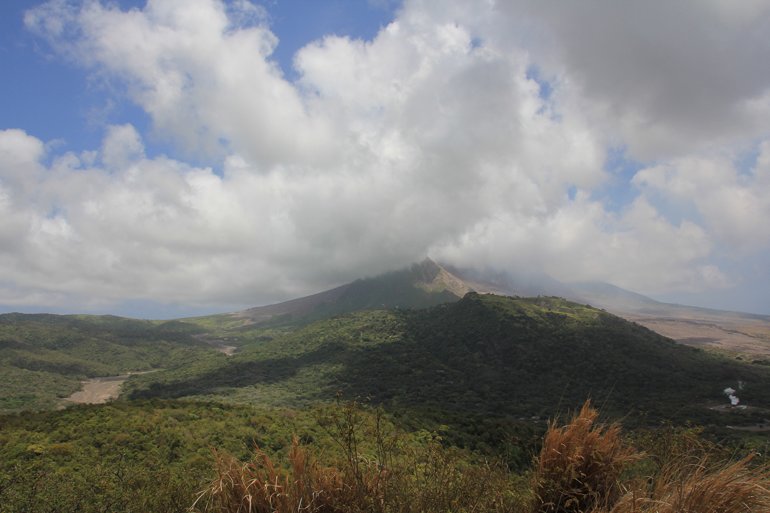
The beach used to be to the right of the small buildings you can see in the middle of the photo on the right! All the scrubland you can see used to be sea before the volcano erupted. The road from the other side of this pass turns into a narrow unmade track, very steep making its way up Garibaldi Hill. At the peak the view across the other side to the Soufriere Hills and volcano is spectacular.
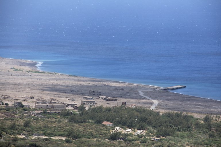
This used to be Plymouth, now completely covered under volcanic ash and sand although some remains of buildings can still be seen. This sand is being sifted and exported so they are still using the remains of the dock. The vegetation you can see has grown since the eruption, the last being as recent as 2010.
Next stop is Guadeloupe whilst the wind has a bit of north in it! |