33:01.12 S 27:52.01 E 17th-19th April 2012 Drive through the Transkei (Homelands) area of Kwa Zulu Natal from Port Edward to East London 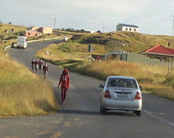
Passing students walking to school School is free, but the uniforms, food, books, transport to the higher eductional colleges and food an accommodation are not, therefore many children miss out 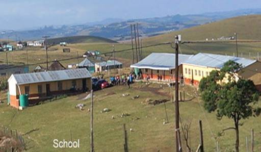
The students can at least have access to drinking water at the school. They learn English and Afrikaans, but most managed to speak 5 different languages just to get buy with the influx of people from neighbouring Mozambique and Zambia. They do not hear English spoken though, so are unable to use it. This is a perenial problem in most developing countries, there are not enough English speaking teachers willing to work for so little pay. 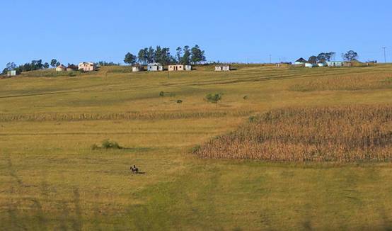
The man riding his horse across the land here shows the scale of how little of the land is used for agriculture, most of it was just grass, with no cattle on it either. Most of the trees and shrubs have disappeared as firewood. People apply for their parcel of land for 500 rand, and if they have the right identification papers showing they belong to the area, they are allotted a small parcel, as in the three sets of building groups at the top of this picture, where they usually build a 2 roomed house, with a piece of garden around it. They can then build another house next to it, or whatever they can afford. The ‘dunny’ toilet is usually a separate hut at the bottom of the garden. We noticed that a good many of the houses have electricity going to them, and most have guttering to catch water, but access to drinking water is a big problem we understand. I even saw one woman scooping water out of a puddle. 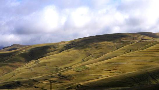
Rolling hills devoid if trees, just grass. No cattle either, all sold off. 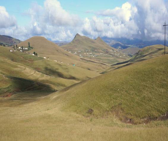
Scattered groups of houses become scattered villages, they are well spaced out, not all in communal little groups the way they used to be. 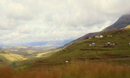
Thet might be remote, but they have amazing views! That’s a minibus on the road serving as their local transport into town. 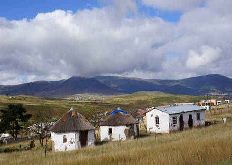
Slightly less well cared for traditional Xhosa huts, maybe they are abandoned, as it is close to the roadworks we are stopped at whilst I take this photo, and opposite the bar, below: 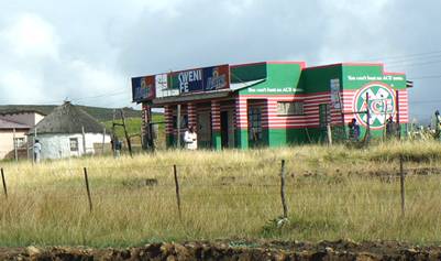
On the opposite side of the road is this shop and ‘bar’. 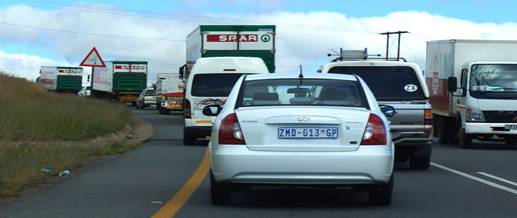
Four ‘SPAR’ trucks, negotiating the traffic after the road works, show how that franchise seems to have the monopoly for the smaller super markets in the area. 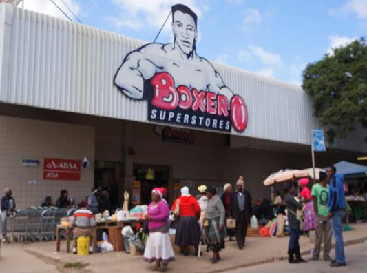
The first main town in the area formerly known as the Transkei, is close to where Nelson Mandella was born. This and the one below are among some of supermarkets here 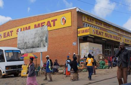
Eat Sum Meat has plenty of fruit and vegetables for sale around the outside of it. Transkei is the name given to the original ‘homelands’ during the Apartheid years. This area was intended to provide a home for all black South Africans, where blacks would be sel-sufficient, self-governing citizens, living togeter with others of their own ethinc group. Reality proved to be different. With no infrastructure or industry, and no capability of producing sufficient food for the burgeoning black population. Families were divided as men were forced to return alone to urban areas as guest workers without rights. This legacy, including completely insufficient infrastructure and distorted populaton concentrations, continues to scar South Africa today. 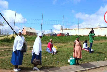
People waiting for a ‘taxi’ mini bus outside the town 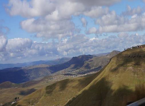
Those houses up on the top RHS of his picture really are a long way out of town! 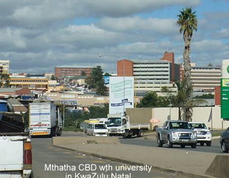
UMTATA, or Mthatha is quite developed, with a large University, but absolutely no sign of any white people. This area was where the blacks were kept segregated during the Apartheid years, and they still are, as no whites would want to come to this area anyway. 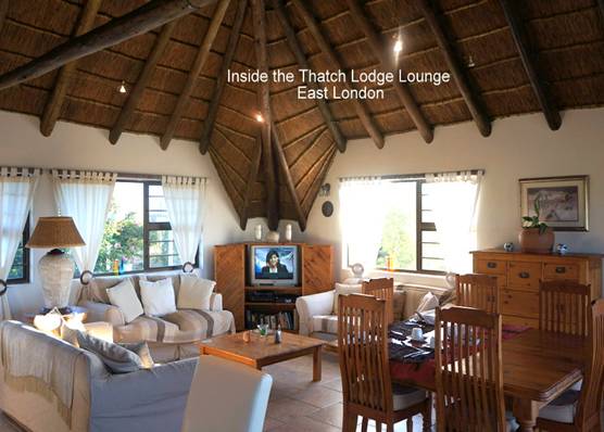
Arriving on the outskirts of East London, after a 570 kms drive across the Transkei, we found there were plenty of very nice places to stay all along the ‘Wild Coast’, this is called the ‘Thatch’, which proved to be a very popular roofing material for a lot of the lodges along this part of the coast . 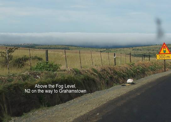
The following morning, this ‘wooly blanket’ appeared along the coast, very soon David was driving through it in on our way to Grahamstown, where almost 4,000 settlers arrived from England in 1820 to secure the border between the area settled by the Boer farmers and the Zulus who had escaped the fierce ‘Chaka Zulu’ king’s murderous ways, trying to conquer all the small outlying tribes in his ‘kingdom of Zulu’. It is this area, between the Drakensberg mountains which run up to Lesotho and the wooded valleys of Zululand that many skirmishes and squabbles between the Boers and these scattered people of the plains took place in the 1820’s. The English, mainly trades and business people were not impressed with the land however, and almost half of them retreated back to the towns of Grahamstown and Port Elizabeth to pursue the jobs they had held in Britain. It was this huge influx of settlers that solidified the British presence in the area, igniting another flame uder the now-simmering cauldron with the Boers. A pattern emerged where the English-speakers were highly urbanised and dominated politics, trade, finance, mining and manfacturing, wile the largely undeducated Boers were relegated to their farms. 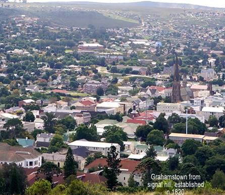
It almost looks like a colonial town in New England, with its Cathedral and spire as its centrepoint, and lovely colonial buildings surrounding it. Rhodes University Campus is in the foreground, which has both whites and coloureds attending it. 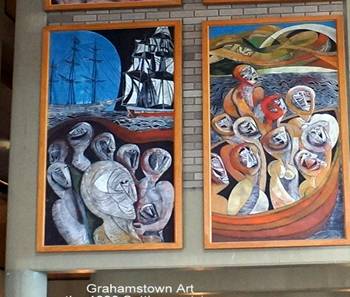
A whole series of paintings show the arrival of those early settlers 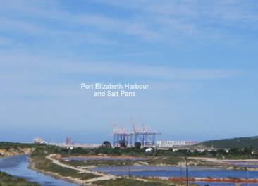
Port Elizabeth is a very important container port for the Eastern part of South Africa and home of the motor manufacturing industry 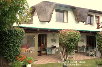
We stayed in this delightful thatched cottage in St Francis Bay, which belongs to a delightful Africaans lady and her ‘British’ husband. The Afrikaner who owned the land made a rule for the development that all of the houses in the area had to be painted white, and have either a thatched roof or gray coloured one, to make it all meld together like a village. The effect is very pleasant on the eyes. The guest house owners, below, she’s Dutch Africans, he’s English born, made us most welcom in their home 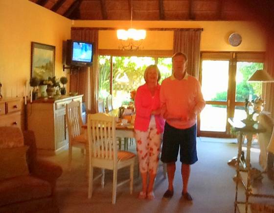
|