A couple of maps
Seafever
Wed 27 Jan 2010 00:48
|
Here are a couple of maps to give you an idea of where we plan to go. The first shows our route across the Gulf Stream, to Bimini, to Andros, to the Exumas. (Sketched sloppily in Photoshop.) I also put in that mileage scale to give you a sense of the distances.) 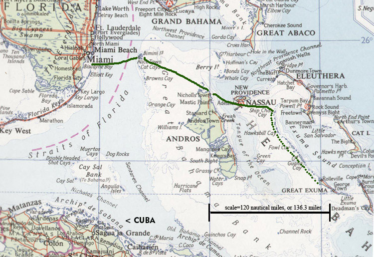 The second is a good chunk of the Exumas. Those depth numbers are in meters. We hope to travel most or all of this length of the chain, starting at the very northernmost islands and working our way down, maybe spending a day or two at each cay (pronounced "key," by the way). If we have time, we may visit Great Exuma Island, off the south end of this chart. George Town on that island is a major yachting center where people bound for the Caribbean stop off. It might be fun to visit and see that scene . . . for a little while. Mostly I think we'll stay in out-of-the-way places, quiet uninhabited islands, or the less-visited harbors and coves. This is a low-res reproduction of one of the small-scale Explorer Charts, which are absolutely incredible nautical charts. We have a book of them devoted entirely to the Exumas, and the large-scale charts show each of these little cays on a page of its own. The detail is extraordinary. If you really get curious about our location, you can zoom in on Google Earth. 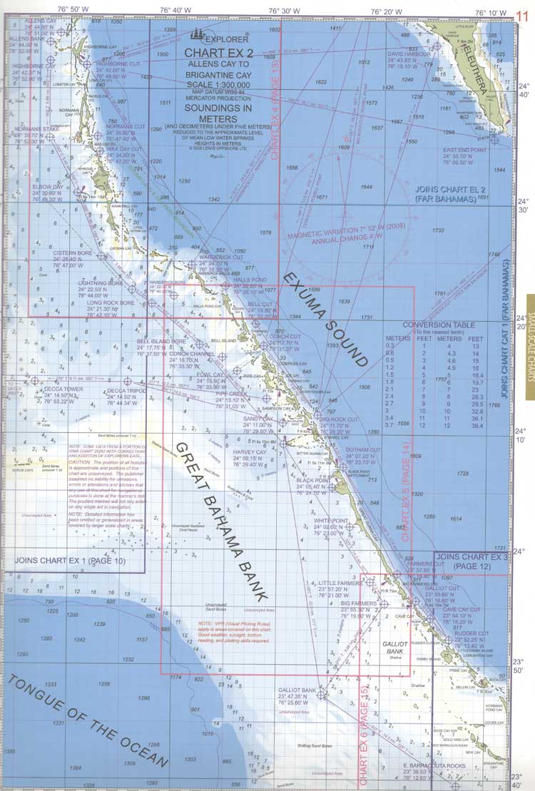 |