Atlantic west to east: in and around Spanish Wells
Stravaig'n the Blue
Sat 23 Apr 2022 15:26
Position: 25:32.25 N 076:45.45 W (near Spanish Wells, Eleuthera, The Bahamas) Position timestamp: Saturday 23 April 2022 15:00 (UTC-4 / EDT) After doing what we needed to do in Spanish Wells yesterday morning - covid testing, clearing out and provisioning - we returned to the boat to attend to the Bermuda inbound admin and check the weather. The conclusion of the latter activity was that leaving Sunday rather than Saturday would be the better option. So we have an extra day here anchored off Russell Island, just to the west of the West Channel. 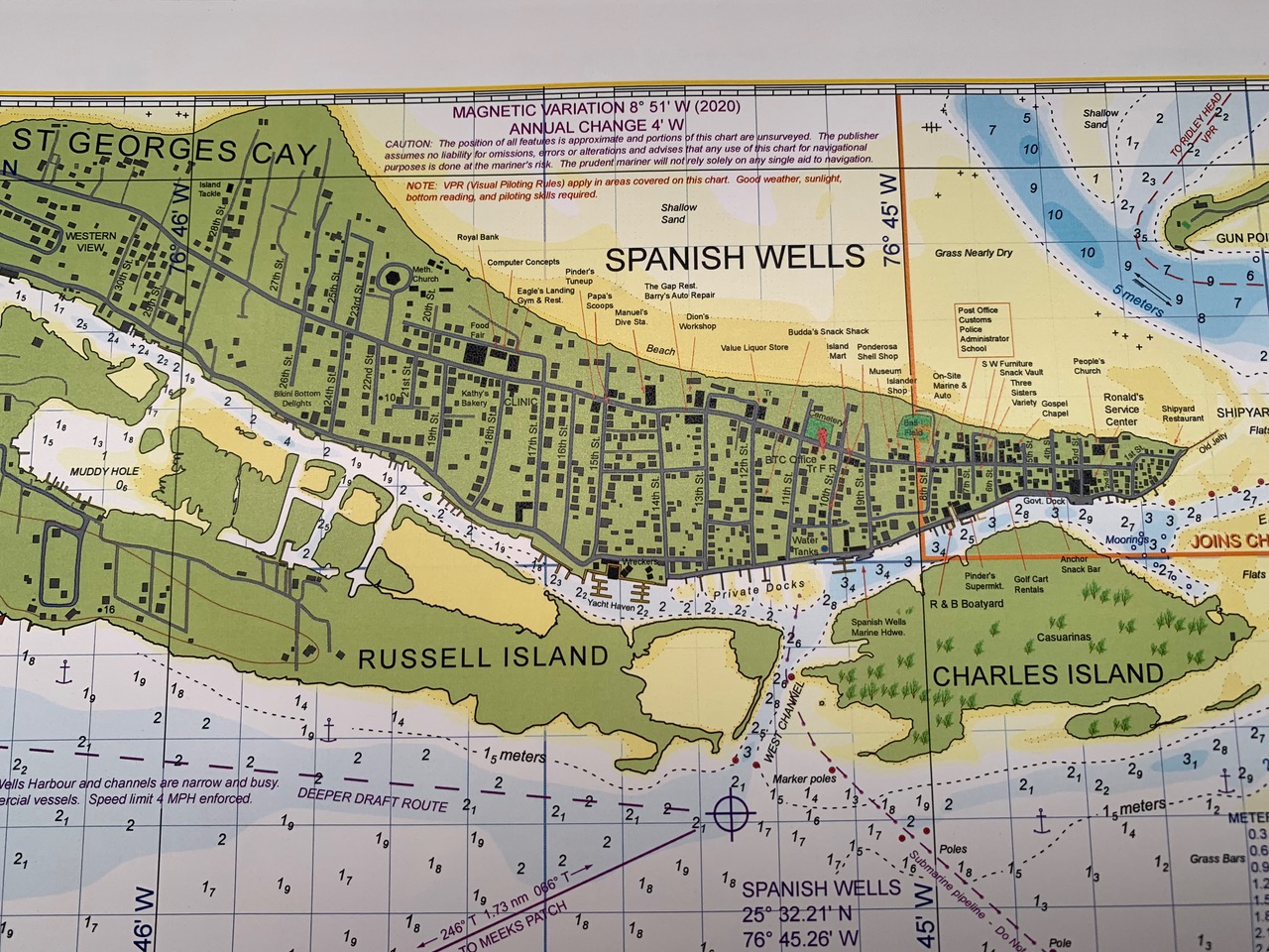 To quote from the Explorer Chartbook for this area, the community of Spanish Wells occupies most of compact St George’s Cay which is connected by bridge to Russell Island and by ferry to Northern Eleuthera. Spanish Wells’ name is derived from an early explorer who found fresh water here. The tidy, colourful community dates back to the 17th century when the Eleutheran Adventurers left England looking for religious freedom. It is famous for its prosperous fishing fleet which supplies well over half of The Bahamas’ commercial crop of lobster, conch and fish. Here are three of the dozen or so fishing boats that were in the harbour yesterday …. those are fairly serious trawling rigs. 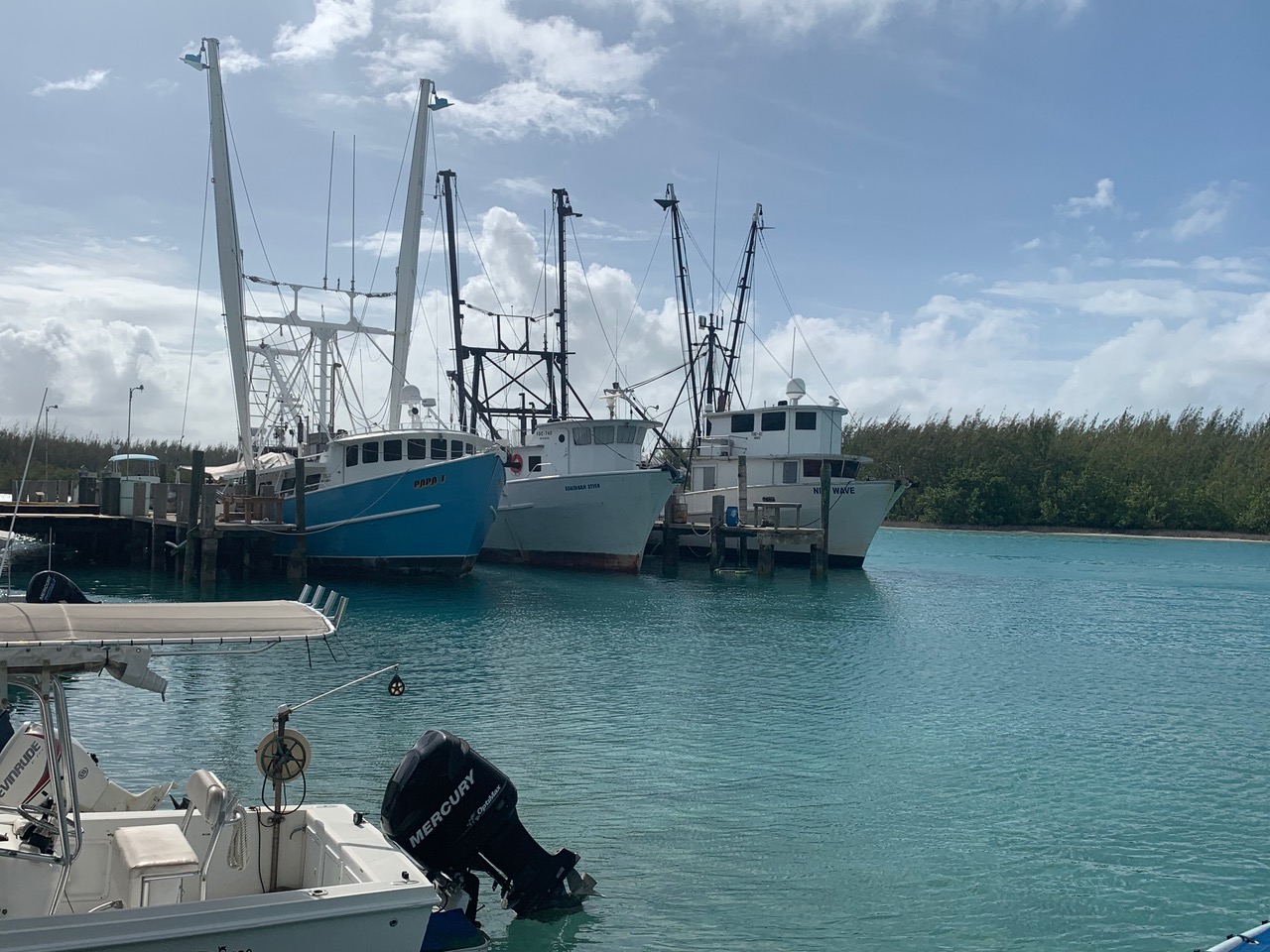 There are no golf courses on the island but there are countless golf carts, the primary mode of transport. 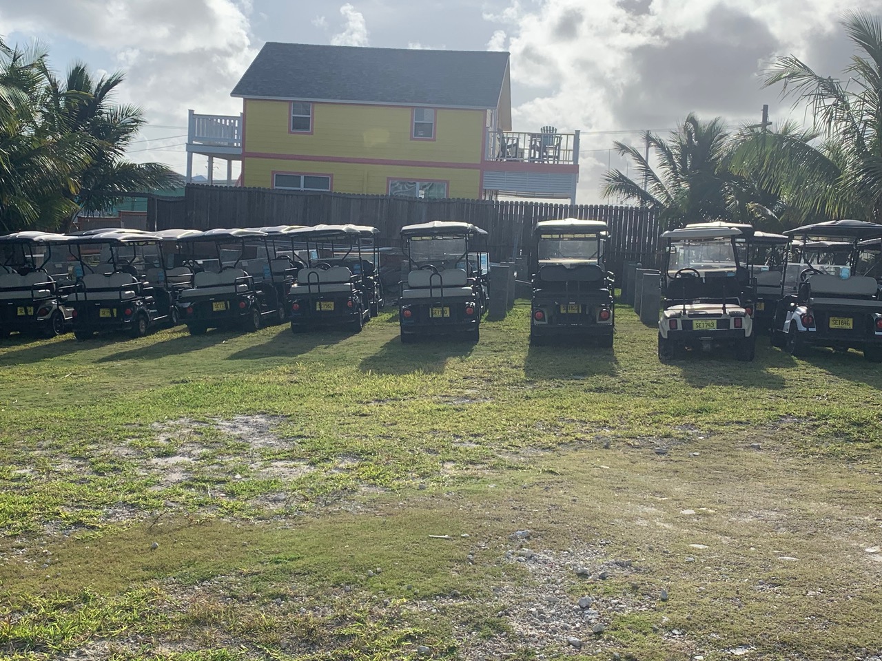 Even the offy (liquor store) has gone to some lengths to blend in. 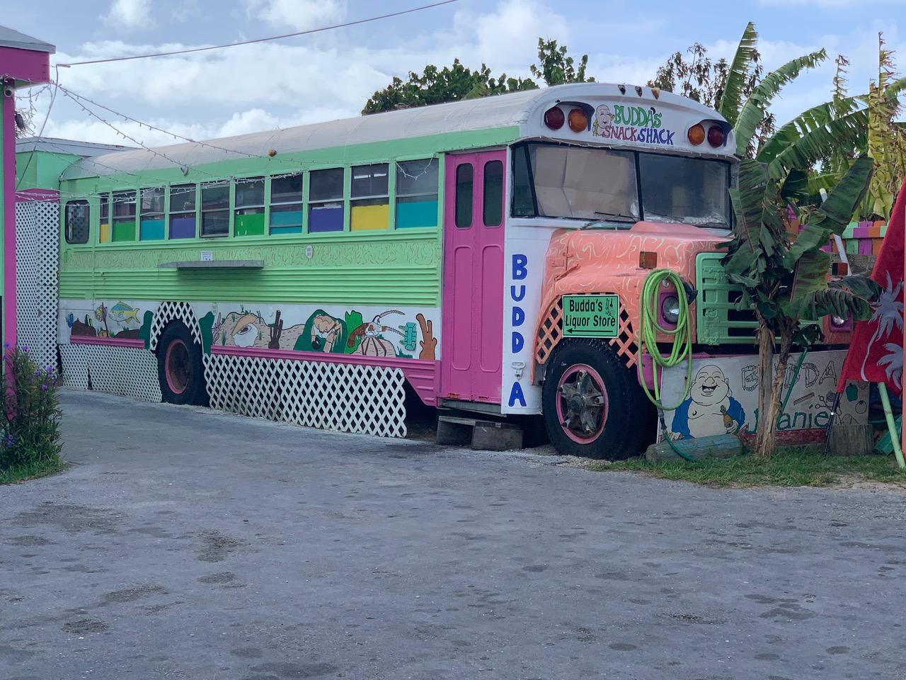 The car ferry en-route to Northern Eleuthera, a short hop of no more than a couple of miles. 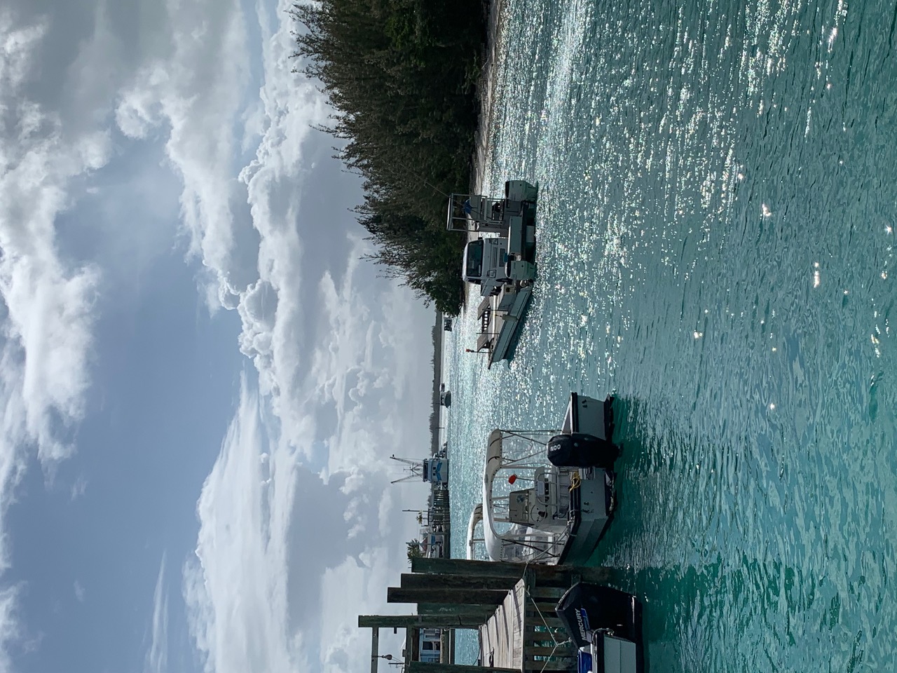 The customs office. 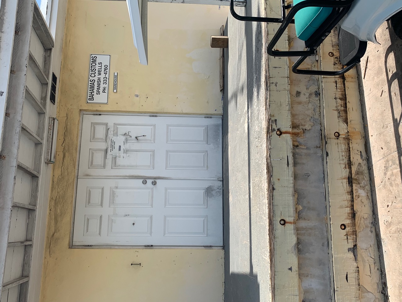 I had assumed that our Certificate of Clearance outbound had been printed on foolscap paper but on closer examination I have discovered that the size is called Legal (216*355mm). Are they just using up old stock or has someone written an application that actually demands this size of paper? A4 beside it for comparison. 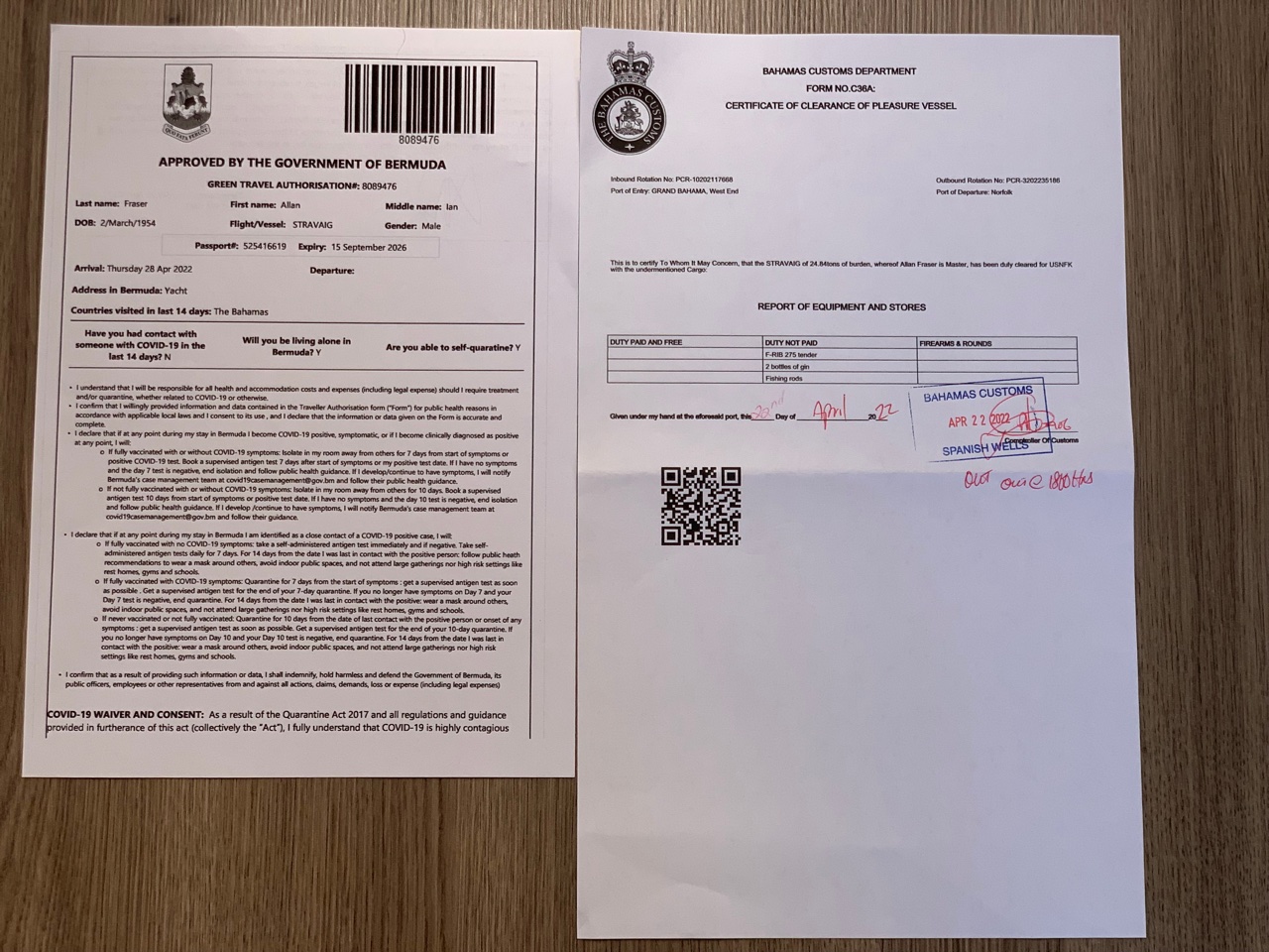 |