Exploring Shroud Cay
Amberisle2
Valt & Sandy
Fri 8 Feb 2013 12:33
Feb. 6, 2013
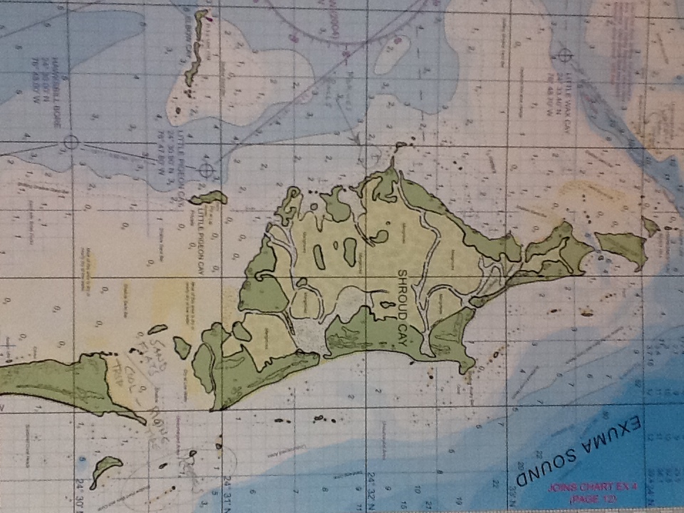
Today we took a dinghy ride to the south end of Shroud Cay. Our dinghy is sturdier and more powerful than most, and equipped with chart plotter, depth sounder and VHF radio we can go where others cannot. The Cut between Shroud and its neighbor, Hawksbill Cay turned out to be nearly inaccessible, choked off by sand bars. At half low tide, they stood high and dry for miles. We motored between them as close to shore as we could, then got out and pulled it in the rest of the way. Dropping anchor, we waded ashore. We walked over a small hill and were amazed to see sand flat over the entire cove. Some was tidal, some appeared dry barring a storm. The rippled sea floor pattern proved it was sometimes underwater as did the scattered seashells. The ocean side was also shallow, more sand bars and coral heads. We'd never seen such a sight before.
Next day we packed a lunch and a cooler to head back to Hawksbill Cay. We found a pretty little beach to sit and admire the scene. The sun bore down on us and although the water was only 75 degrees, it beckoned. After a refreshing dip we rode back to the boat. We passed Little Pigeon Cay, a tiny spit of land with several houses and docks. We would see a seaplane land there later.
We hoisted the dinghy back up to its cradle. Tomorrow looked like a good day for fishing. Amber Isle would go out into the Sound to look for Mahi Mahi.
Chart note: see the little creeks criss crossing the island. The south end is where we found the sand flats. Depths are shown in meters on this chart.