Rapid Bay (and some discussion concerning the Southern Ocean)
Where Next?
Bob Williams
Fri 30 Jan 2026 02:30
|
Position: 35 31.30 S 138 11.51 E
At anchor Rapid Bay Wind: SE, F5 strong breeze Sea state: 2 - wavelets Swell: negligible Weather: partly cloudy, warm Day’s run: 43 nm
The idea of continuing on overnight, yet alone of continuing out into the Southern Ocean*, slipped from my mind as the afternoon wore on. I followed my plan of remaining within a few miles of the Eastern side of the Gulf of St Vincent, tacking as required to
do so. And the plan was good, for, as forecast, the wind gradually increased during the afternoon. By 1800 we had two reefs in the main and the jib rolled down to 50%, at which stage we were crossing Aldinga Bay which made for a five-mile fetch, allowing the
seas to build up from the shore. Fortunately, by this time the wind had backed into the SE so we were able to close reach down the coast without having to put in any more tacks.
Sylph pushed on at five to six knots, with the regular thud of a sea hitting her side and clouds of spray enveloping her deck.
By 1900 we had crossed the Bay and started getting back into the lee of the coast under Haycock Point. The seas abated, the ride became more comfortable and not quite so wet. I had by then decided to seek shelter in Rapid Bay for the night, which provides good
protection from the SE. At 2000 we were under the wind shadow of the cliffs to the south of Second Valley where the wind became mostly light and fickle, one moment coming from the port beam, then from starboard, then from ahead or astern, with the odd willywaw
spiralling down from the cliff tops just to keep things interesting. It was at this point, with only a mile to go, that I decided to hand sail and motor to anchor. As we approached the beach off the township of Rapid Bay, we cleared the wind shadow of the
cliffs and once more the wind streamed in at twenty to thirty knots, perhaps made worse by the funnelling effect of the valley in which the township rests.
At 2037, as the twilight was fading, I let go the anchor in seven meters of water over a sandy bottom, paying out forty meters of chain to ensure Sylph had plenty of cable to ride to in the boisterous conditions.
Overnight the wind has remained strong and Sylph has danced around her cable, tugging this way and that as the gusts have blown through. Nonetheless, with the anchor alarm set and plenty of sea room behind us, I slept reasonable well and this morning
was pleased to find that Sylph had not budged an inch from when I turned in.
Now that we are firmly at anchor, my intention is to remain here today and tonight. The wind is forecast to remain fresh to strong from the S to SE over the next several days and my experience just coming this short distance has persuaded me that I would rather
be snug at anchor than bashing to windward in conditions that are undoubtedly going to be worse than those of the last 24 hours.
I still have plenty of time in hand to get to Sydney by 28 February. The winds are expected to ease on Tuesday, so we will aim to break out of Backstairs Passage then.
All is well.
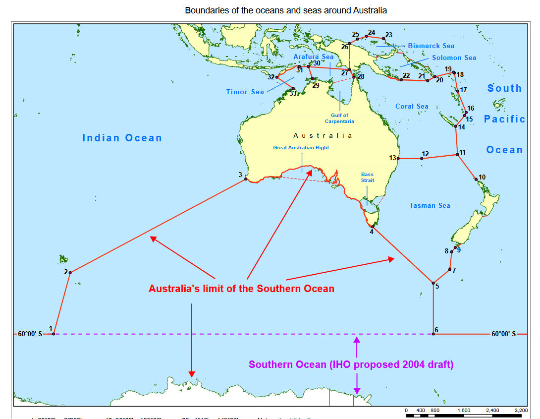
* A bit of geography – many people, quite understandably I think, call the seas to the south of Australia the Southern Ocean, but this label is in fact under some dispute. According to a Wikipedia article, the International Hydrographic Organisation proposed
in 2002 that the Southern Ocean should be recognised as the waters south of 60º S, and that the boundary between the Indian Ocean and the Pacific Ocean is at the meridian of 146º 55’ E, at South Cape, Tasmania, but this boundary has yet to be ratified. In
particular, as a matter of the Australian Constitution reflecting the establishment of the colony of South Australia in 1848, the colony claimed the Southern boundary of its territory as the Southern Ocean. Therefore, as a loyal South Australian and a matter
of protocol recognising Australia’s claims, I will call this body of water the Southern Ocean.
“… that part of Australia which lies between the meridians of the one hundred and thirty-second and one hundred and forty-first degrees of east longitude, and between the southern ocean and the twenty-six degrees of south latitude, together with all and
every the islands adjacent thereto, and the bays and gulphs." South Australia Act, or Foundation Act of 1834 (UK).
Image from AHP20, Mariner’s Handbook for Australian Waters, 5th Edition. September 2019:
 |