Lots of Sailing!!! - Lagos to Gibralter 3-5th Sept.

Nimue
Fri 5 Sep 2008 15:24
|
In total a 200 mile trip, but we decided to split
it into 3 legs. The first to Olhao, which is basically Faro
(Portugal). We were at the entrance of the narrow channel at high water
and this gave us sufficient water to navigate up the channel and we
anchored about 3 miles further down, next to Ilha da Culatra.
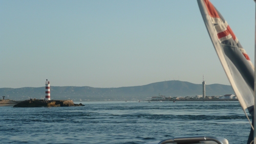
  The narrow entrance in
Olhao
and the tidal effect on the water
The area looked lovely to explore but we left at
first light next morning and headed the 85nm to Cadiz. We have a great
beam reach sail for most of the way, but decided to put the engine on to
complete the last few miles and to try and get into Cadiz before
dark. As usual this didn't happen and we had an interesting time trying to
work out the entrance to Peurto America marina, as there was the
usual green light marking the starboard entrance, but no red marking port
side. Instead there was another green flashing light in the same
entrance and when we shone our 'super dooper' torch at the entrance, we noticed
the other green flashing light was marking an empty pontoon, which was to the
port of the entrance, so surely the flashing light should have flashed
RED not green??. Anyway as soon as we pulled into the marina we were
greeted by the sound of a marching band practicing in the buildings next to us
and also security wanting us to check in and pay.
We understand Cadiz old town is well worth a visit,
but as we only had a day, we decided to leave this delight for another
time.  Leaving Cadiz
So we watered up the next day and headed for
Gibralter. We rounded Cape Trafalgar and not too long
after Michael noticed a tanker on the AIS
(Automatic Identifcation System) about 4 miles away on converging
course. Although we were sailing, we didn't see the tanker make any
correction to his course and so we ended up having to. The MV GIESSENBORG
eventually passed less than 50 metres away from us and you can imagine, Michael
was not best pleased.

 Cape
Trafalgar
The culprit MV
Giessenborg
I had carefully studied my recently purchased
Gibralter Straits handbook and was by now beginning to bore the rest of the crew
with the detail, but the Straits can be a tricky place and is perhaps one
of the most consistently windy stretches of water. The Strait is situated
at the juncture of the two major bodies of water, the Atlantic to the west and
the Mediterranean to the east and much of the water lost through evaporation in
the Med. is replaced by the Atlantic and it has been estimated that
approximately one million cubic metres of water per second flows through the
Straits of Gibralter into the Med. Therefore an understanding
of what the weather, currents and tides are doing before you arrive there
is a wise move. As we headed for the Straits the wind was less
than 10knots and my tidal and current calucations worked perfectly as
we were soon having the benefit of 3knots of tide and current with us. It
could have been worse as Tarifa, being the most Southerly city of mainland
Europe is renowned for winds in
excess of 30 knots blowing for 300 days of the year!
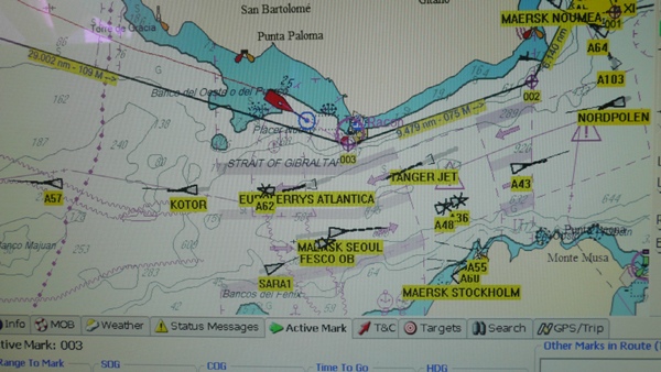
 Snapshot of Gibralter Straits and the
ships seen on AIS taken from our chart plotter.
The red boat shape is Nimue's
position.
  Ferry leaving Tarifa for
Tanger
Tarifa Lighhouse (further point south in Europe) As we headed through the Straits we both marvelled
at the sight of Europe on one side and North Africa on the other (18km wide) and
both really felt a sense of achievement. We had a lovely sail as the
Rock of Gibralter came into sight and again we ended heading into the busy
harbour in the dark. However we decided to drop anchor just the other side
of the airport runway in La Linea, Spain, quite odd?
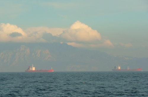
  Container ships in the Sraits of
Gibralter with Morocco in the background
  The Rock in the distance (left side
of
picture)
Heading into Gibralter Bay
|