Blog update: Up the River Gambia
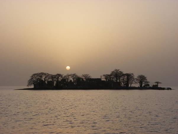
James Island We headed upriver from Banjul into a stand storm blowing off the Sahara Desert. We felt our way to James Island using the depth sounder and radar, dropped anchor and there we stayed for the next 3 days – we couldn’t see the shore on either side and only glimpsed the island itself occasionally through the thick, damp, pink dust. We heard what we presumed were ‘dolphins’ blowing around the boat and were delighted when they came within visual range and turned out to be melon-headed whales.
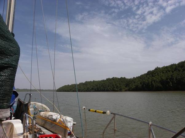
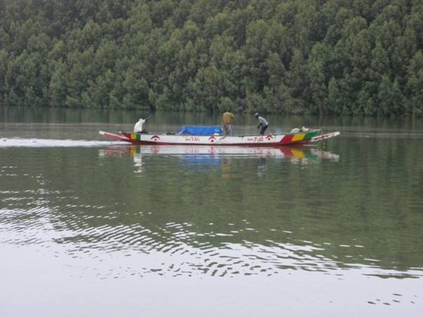
Spooky James Island played a ‘significant role’ in the West African slave trade. Going with the flow When the dust storm abated, we washed what we could of the pink sludge off the decks and solar panels and started upstream. The river is brackish for the first ‘half’, turning to fresh about 75 miles inland; it took us 5 days to reach the freshwater section. We motored onwards with every incoming tide during daylight hours, and anchored overnight and when the tide was against us. The water was cloudy (but clean) and very fast flowing – with a 3-knot tide running there was no jumping off the boat to cool off. The salt section of the river is edged with tall mangroves, interrupted by the occasional ‘bolong’ or creek. Mangroves are boring; the lower section of the river is wide (up to 5 miles wide in some places) and as the navigable channel tends to be the centre, the banks are sometimes just a hazy line on either side. The monotony of the mangroves was broken by having to navigate around sandbanks when a bolong met the main river, around sandbanks on the inside of the bends, and around nets set by the local fishermen – sometimes laid across the whole width of the river and marked by inconspicuous floats (old water bottles).
Mile after mile of monotonous mangroves.
Local (Senegalese) fishermen laying nets to catch unsuspecting fish and yachts.
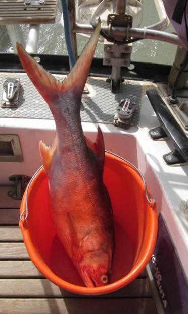
The captain fish (Nile perch) that we bought from the local fishermen and ate for the next few days... We did venture into one of the bolongs with CAPE, but only just scraped in over the entrance bar – we quickly scuttled out again when we realized that there was a real possibility that (as lovely as it was out of the flow of the main river and closer to the birdlife) we might get neaped in there (tides not high enough to allow us back out). Oh the joys of a 7-foot keel!
B&B exploring one of the bolongs by dinghy.
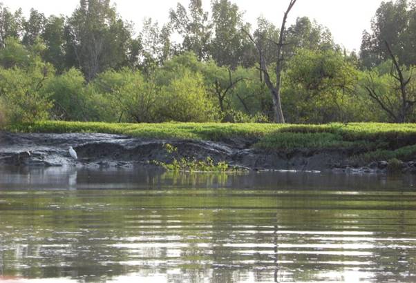
Grassy banks, still water, mud and birdlife in the bolong. Tendaba Tendaba Bush Camp was a welcome break in the mangrove-and-sandbank-watching marathon. We stayed for a couple of nights and had bush pig (wart hog) for supper in the large, open-sided bar/restaurant, plus cold beer if the camp generator was working and warm beer if it wasn’t. We thought that the dress code of the staff was a bit strange (basque worn over a t-shirt, and extremely tight jeans), until we found out when we got back to Banjul that the place is actually run as a brothel as well as a bird-watching centre! We wandered inland on our own bird-watching tour, accompanied by a gaggle of the local kids.
CAPE anchored off Tendaba Bush Camp.
Sunset at Tendaba.
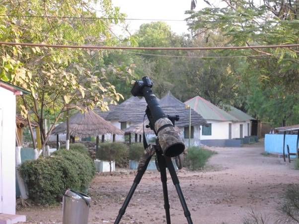
Camera envy! We took lots of (bad blurry) photos of birds and lizards – we won’t bore you with too many of them...
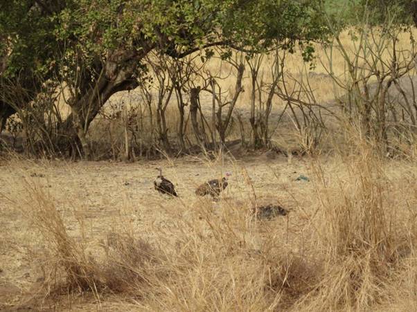
Vultures scavenging in someone’s back garden (a little more exotic than starlings I suppose).
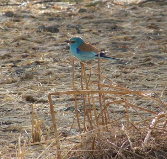
Abyssinian roller.
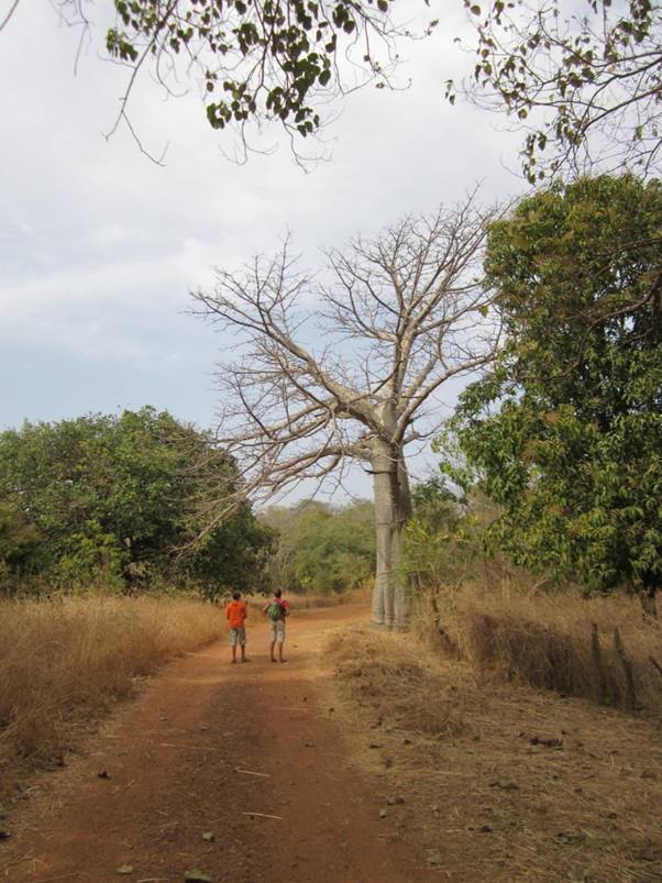
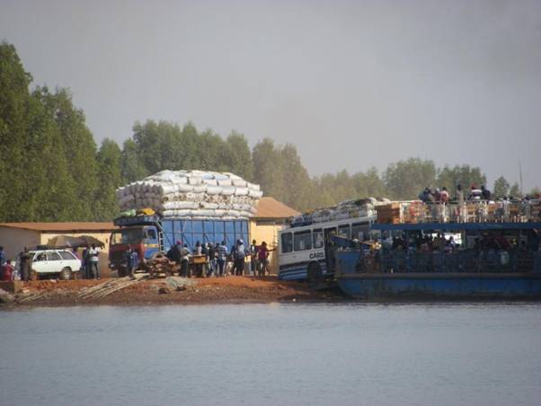
Beth, Bryn and a baobab tree; the baobabs are leafless during the dry season. Farafenni ferry The Transgambian highway crosses Gambia from Dakar (in northern Senegal) to Ziguinchor (in the Casamanche region of southern Senegal), crossing the river at Farafenni. Apparently the trip from Dakar to Ziguichor is smooth and uneventful until it comes to the river crossing, which can involve a 3-hour wait while the ferry is loaded. There are usually lots of foot passengers to help push the buses and lorries onto the ferry...
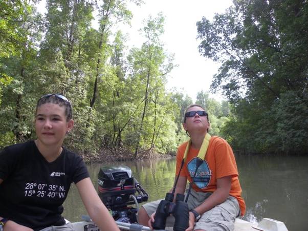
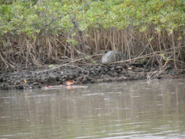
Luckily the ferry is single-deck affair with no height restrictions for vehicles. The crocodile hunters Being eager, newly qualified crocodile hunters, we took watches to keep our binoculars trained on the exposed mud and mangrove roots, particularly as we approached the freshwater section of the river. It was still quite a shock when we actually saw a croc though! We went on to see quite a few more smaller ones slipping quickly into the water as we passed.
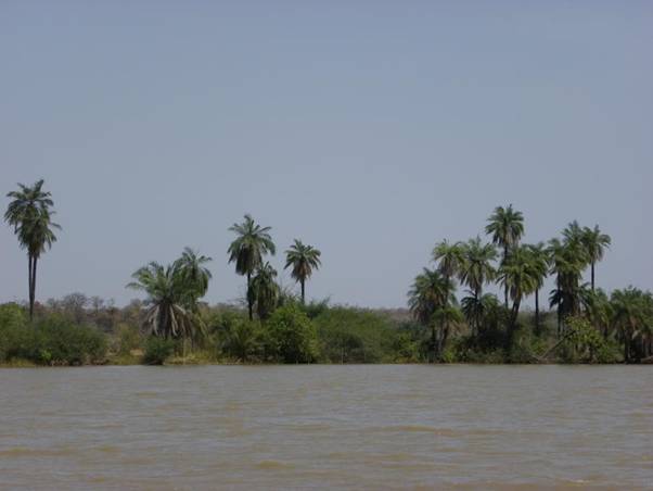
Blurry photo of a stonking great crocodile (roughly 3 metres in length) lurking in the mud and mangroves! Sweet water As we entered the freshwater section of the river (round about Seahorse Island), the change in the scenery and wildlife was dramatic. Boring mangroves gave way to lush vegetation, palm trees, bulrushes, sandy beaches, rocky outcrops and grassy banks.
Palm trees and grassy banks.
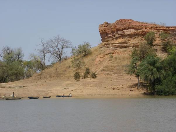
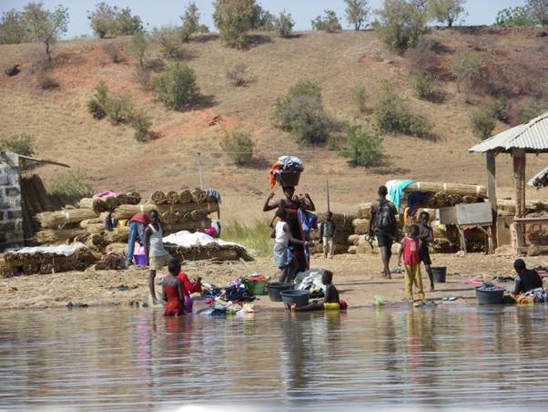
Outcrops of red laterite rock. Without mangroves to block our view and as the locals had easier access to the river, we saw villages, and people washing, working and playing beside, in and on the river. With access to sweet water by the bucketful, we did our laundry, washed ourselves, and sluiced the rest of the pink mud from CAPE’s decks, rigging and solar panels.
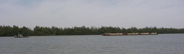
Washing, working and playing at the water’s edge; rolls of rushes for roofing are stacked in the background. With more villages closer to the river, its role as a form of transport became more obvious. We passed small ferries, a small tug towing barges of peanuts, bamboo rafts – and many more fishermen (and nets to dodge).
Peanut barges under tow. Peanuts are Gambia’s main export crop; peanut butter is then imported from the USA.
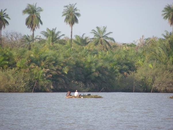
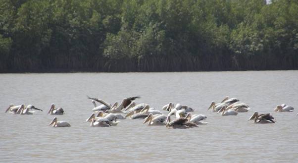
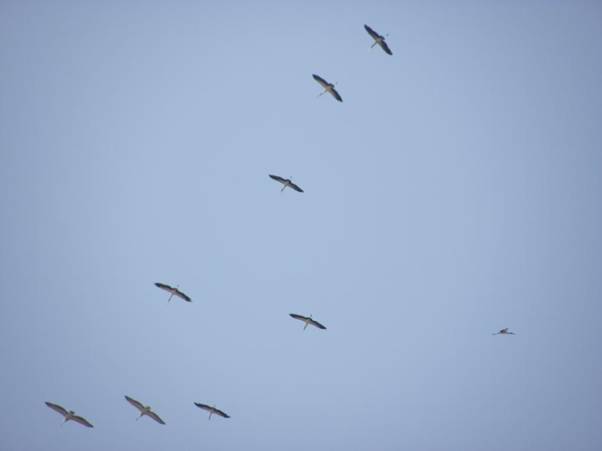
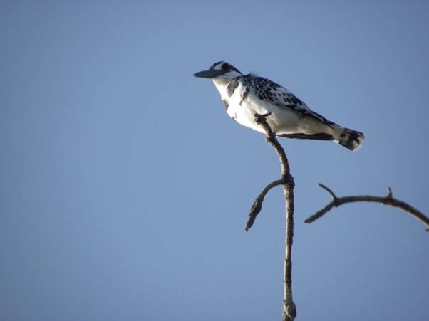
Rafts of bamboo being taken down river. Occasional brief glimpses of birds in the mangroves were replaced by ospreys perching brazenly in bare baobab branches, noisy pied kingfishers, and sightings of snowy egrets, herons, pelicans, ducks, flamingos and grazing cattle.
A raft of pelicans.
A flight of flamingos.
A pied kingfisher.
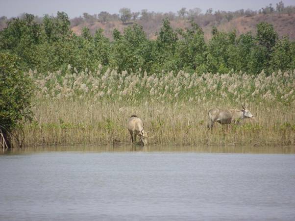
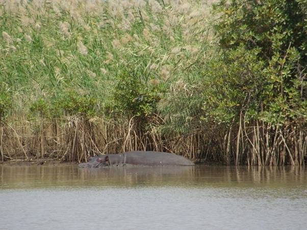
Bulls in the bulrushes. Seahorse Island was named by early Portuguese slave traders who saw hippos in the river here and thought that they were horses swimming with just their ears, eyes and nostrils showing (hippopotamus means river horse in ancient Greek). We didn’t see hippos here, but we did see them further upstream.
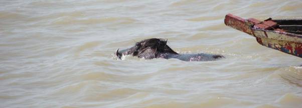
Hippo ahoy! At one point a wart hog (complete with curly tusks, just like in a National Geographic wildlife programme) swam smack into the side of the boat, bounced off, disappeared underneath the hull and then popped up like a cork behind us. He swam to the far bank (hotly pursued by local kids in pirogues) shook himself dry and trotted off into the scrub. Neither the pig nor CAPE was any the worse for the collision.
Close encounters of the wart hog kind.
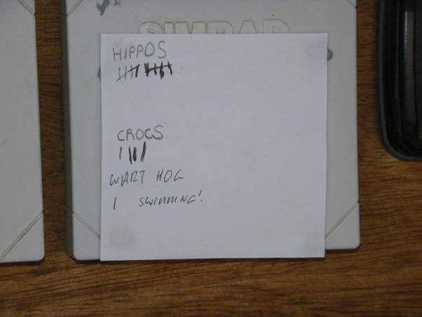
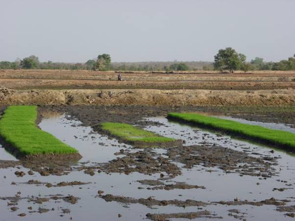
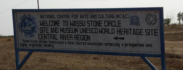
We kept a tally of the large wildlife as we went. Kai-Ur We went ashore at Kau-Ur. The locals were building a boat on the beach here, and a local ferry collected and disgorged foot passengers (including a small herd of cows). The village itself was set a kilometre or so inland, out of reach of the seasonal floodwaters. We were able to buy tapalapa, fresh fruit and veg here, as well as top up water, diesel (by jerry can), and credit on our 3G Q-Cell internet dongle (we had internet access all the way up the river). Kuntaur and the stone circles at Wassu We stopped for a couple of nights at Kuntaur to visit the stone circles at Wassu, making an early start to walk the 3 km or so inland to the site while it was cool. On our way we passed locals planting up rice fields ready for the next rainy season. Gambia could be self-sufficient in rice, but there is more kudos to be had buying expensive rice imported from the USA.
Paddy fields and rice seedlings.
Waterlilly.
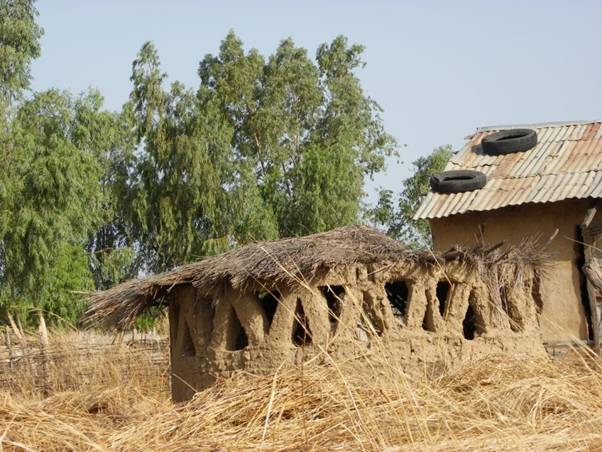
Gambian architecture; ancient meets modern in Kuntaur.
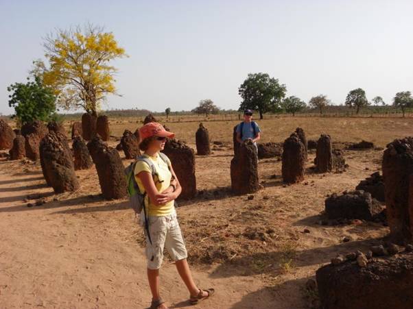
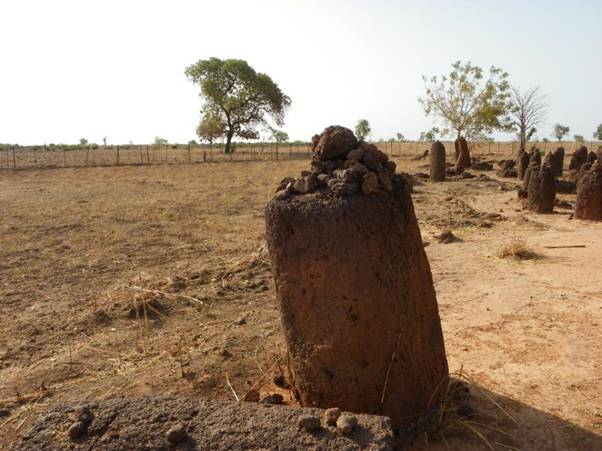
Welcome to Wassu. The Wassu site consists of 200 laterite megaliths arranged in 11 circles, including some concentric circles. The small on-site museum shows how the circles at Wassu are part of a series of more than 1000 sites throughout Senegal and Gambia, constructed over a 1000 years ago. It is not clear why the circles were constructed, although they might have been elaborate gravestones (according to our guidebook). B&B contemplating ancient mysteries.
Away from the river, the landscape is a moonscape of hard, dusty ground littered with rocks. On our way back to CAPE, Bethany received her first marriage proposal. She declined. We never got to ask how many goats/sheep/cows we would get for her.
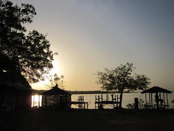
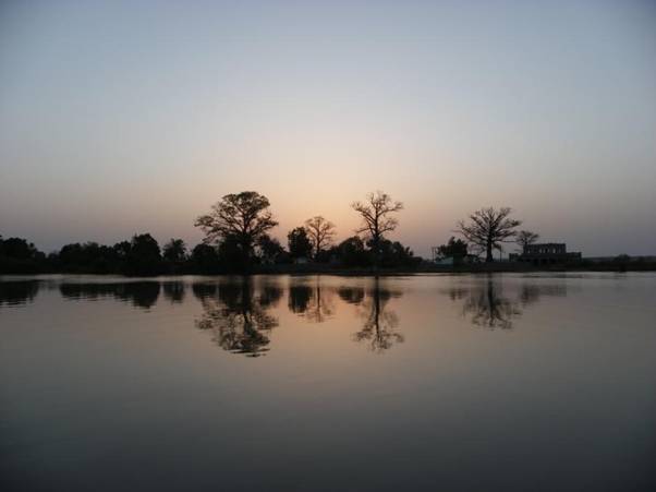
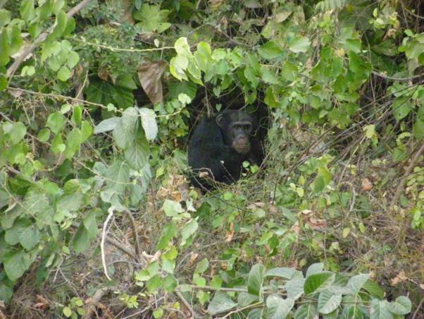
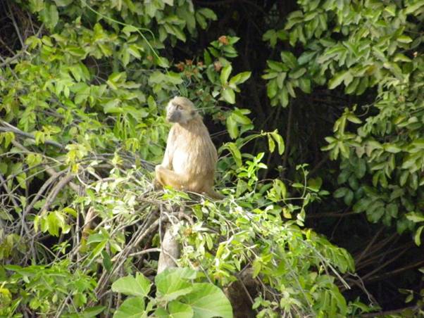
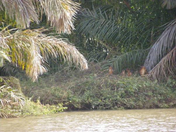
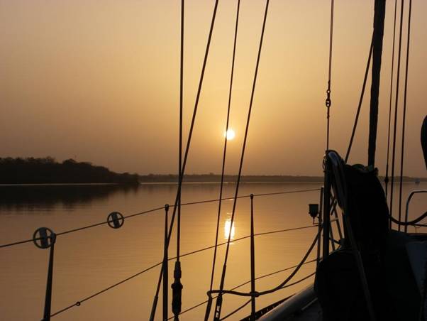
Sunset over Kuntaur. River Gambia National Park The River Gambia National Park is a series of islands that are administered by the Chimp Rehabilitation Trust and home to chimpanzees that were mistreated in captivity. The park is also home to a troupe of baboons, as well as patas monkeys, Western colobus monkeys and the surrounding waters have crocodiles and hippos – we were lucky to see all of these as we passed through. The reserve is patrolled and landing is not allowed, but the wardens are keen to educate visitors and direct them to areas where the animals are likely to be seen.
Chimpanzee on Baboon Island.
Patas monkey.
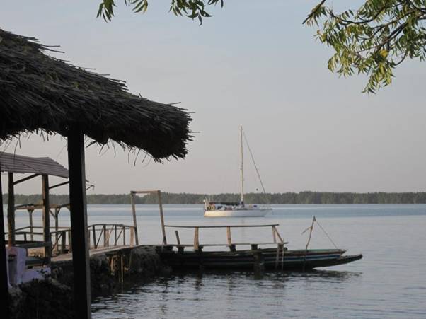
A family of Western red colobus monkeys; these are on the endangered list and may be extinct within one generation. Tales of the riverbank The Port Captain in Banjul had told us that not many people ventured up river – he had issued just 11 cruising permits that season (including ours). We saw four other yachts. On our way up river we anchored overnight near another British-registered yacht (THANKFUL) and swapped information on shallow patches and good hippo-spotting areas over a glass or two of red wine. On the way back down we traded tales with a Swiss couple on a catamaran who had gone much further up river past Janjanbureh (Georgetown) as far as Basse, waiting until the power was turned off in the afternoon to venture under the sagging electric cable that prevents most yachts from going any further! The furthest point that we reached was just past Baboon Island in the National Park. At this point, we started to struggle to find water that was deep enough and touched the bottom a few times. While we would have liked to have made it to Janjanbureh, it seemed prudent (in view of the falling river levels as the dry season progressed and the fear of being stuck up river until the start of the rainy season in April/May) to turn around and make our way back to Banjul. Back to boring mangroves Did I mention that mangroves are boring? Luckily, the boredom was alleviated by some stunning sunsets.
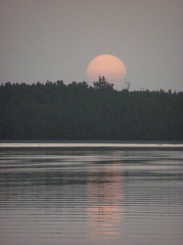
Sunset over the mangroves: 1.
Sunset over the mangroves: 2 (sorry out of inspiration on the caption front). You can get in touch with us via sarahsmith dot phd at gmail dot com. © 2012. All materials (text and photographs) in this blog (unless stated otherwise) are the property of Sarah and David Smith. Copyright and other intellectual property laws protect these materials. Reproduction or retransmission of the materials, in whole or in part, in any manner, without the prior written consent of the copyright holder, is a violation of copyright law. |