Photo Journal of Swift Part II - The Azores
|
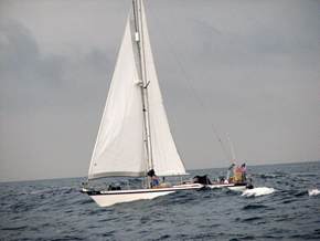
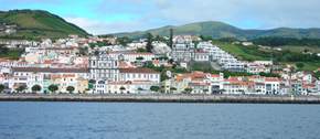
The Voyage of Swift – Part II Swift sailing into Horta after
19 days at sea!
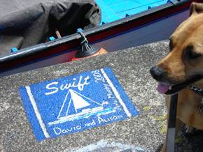
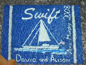
It is a tradition in Horta for boats to paint their names on
the harbor wall,( in fact it is considered bad luck if you don’t).
You can see our artwork! We had a very small amount
of red paint so I was able to draw the stripes on the flag. It may only last one season but we have left our mark in
Horta! We began our tour of the island of Faial (Horta is the
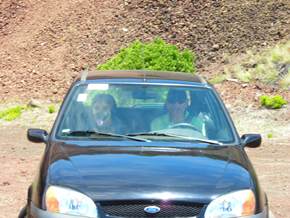
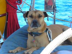
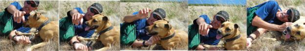
capital, Faial is the island). Murphy would like us to believe she deserves to sit in
the front seat, but it is a myth!
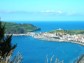
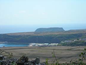
The first hill as you leave Horta has a wonderful view
back towards the harbor. You can just make out the breakwater for the marina. On the other side of
that thin spit of land is Porto Pim (pictures in part 1), the original harbor.
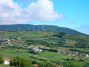
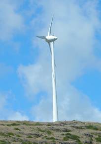
Most of the islands have wind turbines to generate
electricity. Some might say they damage a good view, but I find them fascinating.
In this picture we are looking Northeast over Faial.
The green hillsides are mesmerizing, the gardens are full
of flowers and blue hydrangeas grow along the edge of the road.
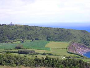
I guess this might look like a valley because we are so
much higher looking down, but you can see from the cliffs that it is still quite high.
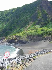
This beach is on the north coast, that is sand although
it is a bit gritty. Into the water the edge shelves very quickly. Murphy was chasing around the
beach with her ball and decided to let it go. She happily watched it roll down to
the water. Of course she won’t
go in the water, so I had to rescue it which is how I found out about the
shelf – I caught the ball just in time. The sign says (in four languages) “No Lifeguard on
Duty”. .
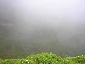
All the islands of the Azores are volcanic. Faial
has a large volcanic peak in the center of the island which we never saw the top of because of the clouds. The volcano is extinct
and they have created a national park inside the center of the volcano called a caldeira. Of course it was
cloudy the day we visited the volcano but you can see into the center where it is quite green. On Pico (the island
with tallest peak) people camp in the center.
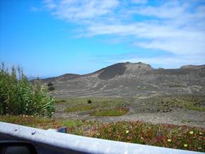
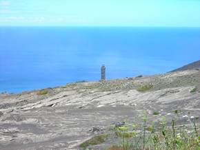
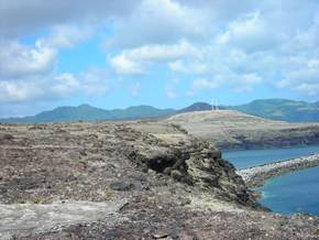
There was a volcanic eruption on the northwest corner of
the island in 1957. You can see the resulting landscape. The lighthouse
used to be on the edge of the ocean but is now about a half a mile inland.
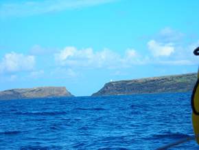
It was a good tour, the island is small and we saw it in
a day. After two weeks in Horta it was time To move on. This is our last view of Horta as we
sailed away. What a sight!
There was no wind the day we left so we motored the 20
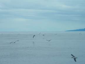
miles to the island of Sao Jorge. Along the way we interrupted this flock of birds searching for dinner.
The birds (Cory Shearwaters) spend the night in the
cliffs above the marina. They start to arrive home at sunset and shriek and squawk until 1 in the morning.
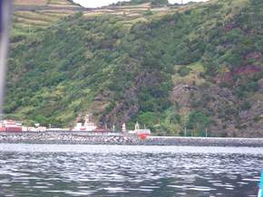
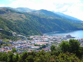
Sao Jorge is bigger that Faial but less population
(15,000 in Faial vs 10,000), the marina was in Velas, the main city – Velas was relatively flat but the
hills overlooking the town were quite high.
At the top of one of the hills at the entrance to Velas
was this ruin which was built for the whale watchers when they used to hunt the
whales.
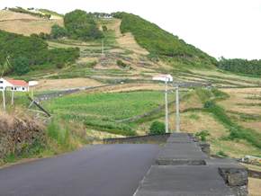
Sao Jorge is very popular with hikers and you can
see why, very few cars and when you’re at the top of the hills it is
relatively flat.
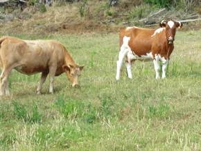
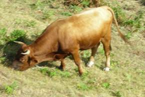
Sao Jorge is also known for its Cheese and Beef (which
they call cow meat)
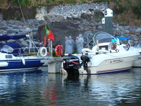
One evening about 9pm we glanced out and saw this group
walking down the dock.
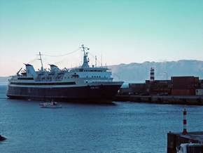
These large ferries take people on the long journeys, at
first we thought this was a cruise ship but we kept seeing it every few days and finally I asked the
dockmaster.
We wanted to press on towards Madeira and the wind picked
up as we left Sao Jorge for the 200 mile journey to Santa Marie the most southeasterly island in the
Azores. We know Murphy is thinking “Where to NOW?”
Santa Maria is quite a small island but at one end was
this plateau where the Americans built an airfield during WWII, it is now the island’s airport.
Apparently the island was quite prosperous just after the war because it was the only island in the Azores with a proper
airport. Unfortunately the other islands caught up and Santa Maria became a sleepy little island of about 6000 people or as
one brochure said 5956 – very precise.
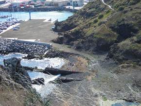
The island is off track for most sailors especially for
heading to mainland Europe and therefore not visited very often, however they have just opened a brand new marina
so maybe more boats will visit. We had it almost all to ourselves. To
get to the town you had to climb a very steep cliff which gave a great view of
the marina.
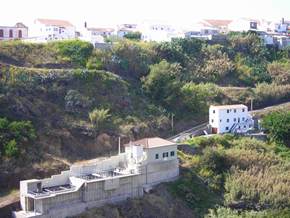
This beach, just beyond the marina, did not look very
attractive but was packed on the weekend.
It wasn’t for us, because just up the road was a
pumping station.
The island had some great walks, we all enjoyed walking
along the coast below the wind turbines.
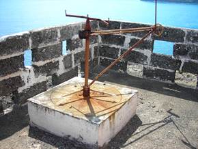
In the other direction on the plateau was the lighthouse,
Behind the lighthouse was a sundial, the time seemed to
be correct!
From out on the plateau there you could look back
towards the harbor and the turbines, it looks quite desolate and we only saw one person
fishing during our entire walk.
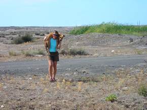
Murphy got a ride over rough ground, she acts as if she
was born to be carried but you have to be pretty strong to carry that 45 pounds for very
long.
After a few days we were ready to move on to Madeira
which was a five day journey. So we left Santa Maria behind (the plateau on the left is where the lighthouse was.)
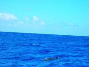
And finally on the way I managed to photograph a dolphin,
well at least you can see it if you look closely (lower middle right) – I will try again
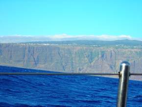
The next installment will be about Madeira – here
is a teaser of the view on our approach, a very imposing island!
Adios! |