Photo Journal of Swift Part III - Madeira
|
The Voyage of Swift – Part III The next island we visited was Madeira which was a five
day sail from Santa Maria. This island is quite large, 320 square miles
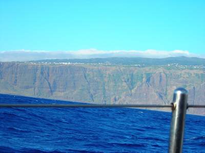
with a population of 246K. We were amazed by our first sight because the island
seems to rise straight up from the sea and the wind intensified as we approached the south west corner and the last
hour as we rounded this was the roughest of
the whole trip so far. Unfortunately photos
never seem to show the size of the seas!
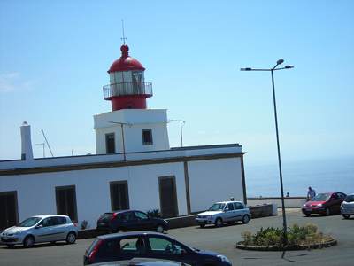
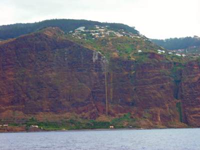
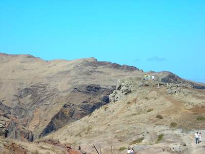
Later when we toured the island we visited the lighthouse
on this corner and laughed to think of all the people ashore who had been getting a great deal of entertainment
watching us bouncing around in the large sea that
day we arrived. Those people you see are standing behind the lighthouse
and are extremely close to the cliff edge from which there is a long straight
drop to the sea below.
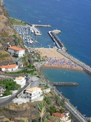
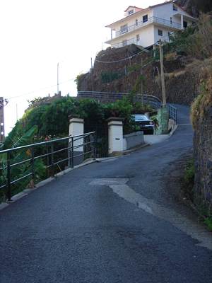
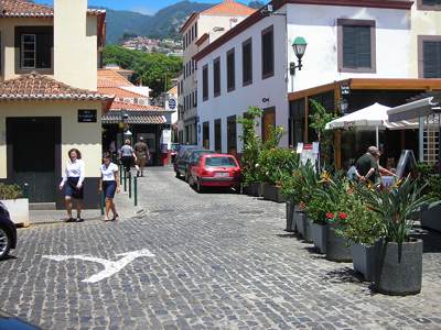
Our first stop in
Madeira was in the resort town of Calheta. It had all we could ask for, a
big marina, restaurants, and a grocery store, but the hills were tremendous
and you couldn’t walk far without going straight up. The picture on
the left is looking down on the beach and marina from the hill above.
Madeira has no natural sandy beaches so this beach is manmade with sand
imported from the Sahara desert, every morning there are men brushing the
sand from the walkways back onto the beach and those breakwaters are to keep
the beach from disappearing, It was August so the beach
was always very crowded. In the second picture you can see that just
beyond the shore is a sheer cliff. They have some wonderful
highways in Madeira, but we thought of Madeira as the land of a thousand
tunnels because we felt that there was more tunnel than open
highway. We could only imagine how hard it was to move about the island
before the highway was built. The roads to a few of the
places we visited were a bit scary but the views were tremendous.
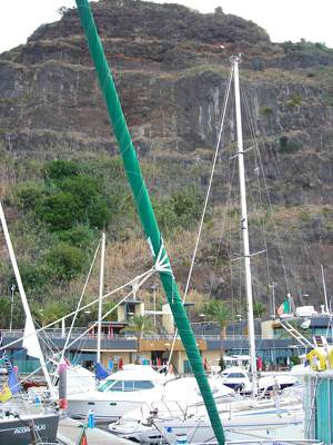
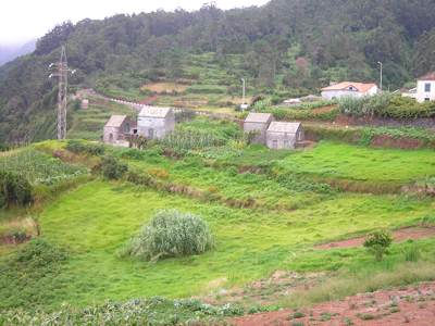
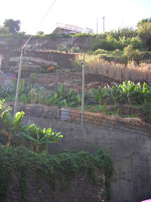
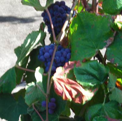
There is a lot of
agriculture on the island, mostly bananas and grapes. Grapes to make the
famous Madeira wine. All are grown in
terraces up the sides of the hills.
In one place they have
cable cars that run from the top of the cliff down to sea level so that the
farmers can get down to this flat and fertile land. Before the
cable car the farmers had to go by boat. You can just see the cable car
in this picture – it is the straight line down in the middle.
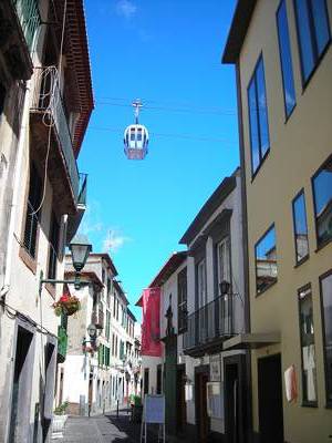
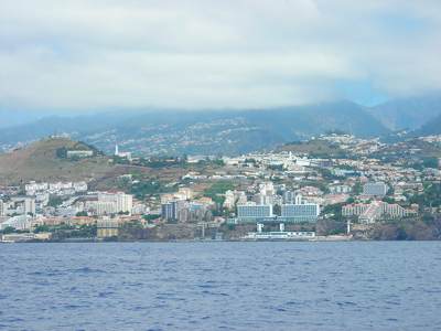
The capital of Madeira
is Funchal. We visited by car and despite the traffic think it is one of
the nicest places we have seen because while it is truly a city it is not so big
to be overwhelming. The old town, although touristy had some nice
restaurants and yes, another cable car. This one went a few miles up the
hill.
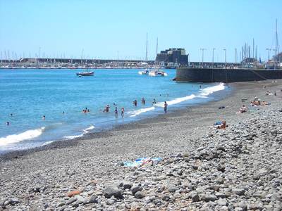
There was even a beach
downtown next to the marina. You can see it wasn’t very sandy but
there were many people in the water and laying on the stony
beach. There were many of these stone beaches along the cost, I guess you
never had to worry about getting sand in your shoes. The marina on
the right of the picture doesn’t have much room for visitors but it is
possible to moor bow or stern to the long harbor wall and you can see these
boats to the left and center
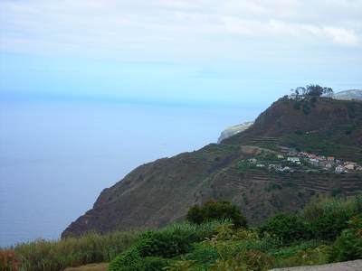
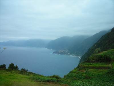
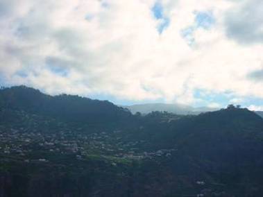
After a week at one
end of the island we decided to spend a few days at the other end before
leaving for the Canary Islands. The trip from Calheta on the southwest
to Quinta da Lorde on the southeast was uneventful, in fact there wasn’t
much wind so we motored along taking pictures of the
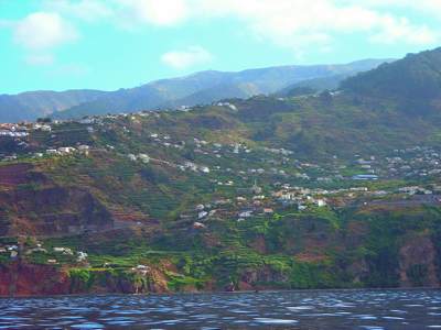
changing clouds and landscape. You can see that there are quite a few small
towns and villages along the south coast but most people appear to live
in Funchal, which is the last picture in this group of four.
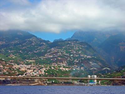
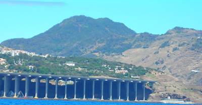
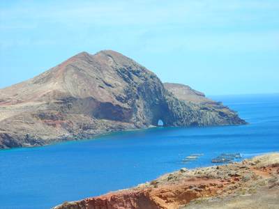
As we traveled the
short distance of 30 miles or so east to the new marina we passed the
airport. On the island there is a shortage of flat land so the airport
extended out over the ocean on pillars. I tried and tried to get a
picture of a plane landing and this was the best, you can just see the plane
coming in from the right.The highway goes under the airport runway and you can
see a small beach on the bottom right.
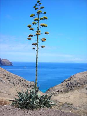
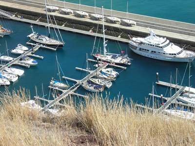
Our new marina, Quinta
do Lorde, was in a very quiet location. The landscape on this corner of
the island was dramatically different from the rest, dry and
barren, but still very beautiful. This was a spit of land that stuck out off
the east and at the very end was a wonderful trail with some great
views, out to sea and straight down.
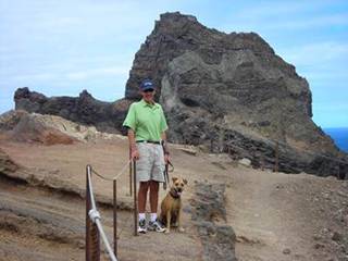
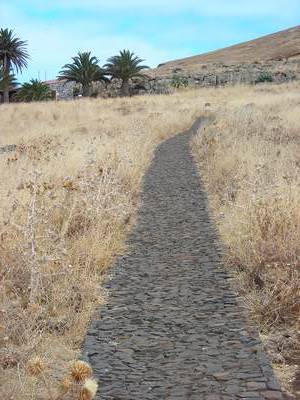
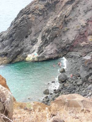
The trail was supposed
to be 3 miles but it seemed a lot longer as there was a lot of climbing.
At the end, which could be called the middle of nowhere was a hut, and
this wonderful path which led to the steps down to a secluded beach. I
kept wondering why the path? It did not seem to serve a purpose,
but maybe it will in the future.
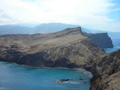
Of course there was
another large hill behind the marina, and we took a hike up this, there
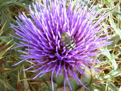
wasn’t a lot of color at this end of the island so this really stood out.
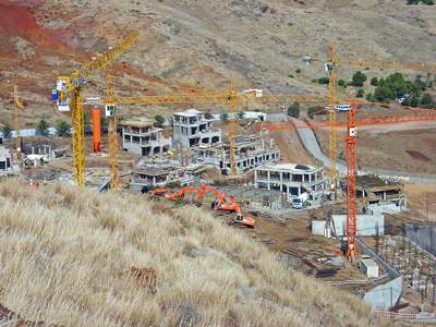
Everywhere progress
comes, the developer who built the marina was working quickly to build this
resort right next door, they worked from 8am to 8pm, 6 days a
week. We counted six cranes in total!
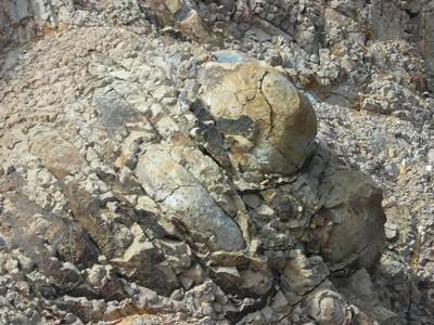
In some place the
stone made some odd shapes and to us it looks like a turtle, it is definitely
not manmade!
At last it was time to
leave the island and head south for Gran Canaria, so many islands, so little
time!
|