Day 6 - Slowing down
Blue Note
Marco M.
Mon 11 May 2015 16:23
|
Date: Monday 11/05/14 - Time: 12:30 EDT Position 30:55.96N 70:20.203W COG 7M SOG 5.3kt, Wind 114T 12 kt, Temperatures: Air 27C, Sea 20.7C, Humidity 70% Barometer: 1016 mB Last 24h Sailed Distance: 134 NM Last 24h Decrease Distance on rhumb line: 121 NM Sailed distance since departure: 834 NM Time since departure: 6d 0h 02m Average Speed since departure: 5.74 kt Average VMG since departure: 5.59 kt Average VMG speed last 24h: 5.03 kt Intention: sail to Chesapeake Bay Distance to End on rhumb line: 462 NM ETA: Friday May 15, 2015 Detailed Track (50 is the maximum number of point, i.e. once the last point reaches 50, the last point always is 50): http://share.findmespot.com/shared/faces/viewspots.jsp?glId=0EIVGO9oiEYLjqAfRxhderm34cEEF9dMP Yesterday night I decided to slow down and alter course from the rhumb line to a true-North. This is because the first tropical depression of the year Ana, that had developed near South Carolina, decided to move North following the coast and it will bring (keeping our current course and speed) a crossing of the Golf Stream with a North wind. Crossing the Golf Stream with a North wind is to be avoid because the south current and the wind will create a choppy confusing sea. By looking a the prediction of the position of the Gulf Stream we are targeting a crossing at 34:30N and 74:00W. This morning the grib file predicts that if we reach that point on May 15 at 6:00am EDT there should be near no wind or only 5 kts of wind from the west. So the plan is to keep a reefed main and sail a course north to the rhumb line and not to pass the latitude of 34:40N, our intended Gulf stream latitude crossing. Slowing down as necessary to reach the longitude of 74W by May 15 6am. This also should give time of the high sea caused by Ana north of Cape Hatteras to have calmed down. Of course tomorrow download of the grib file might change the timing or the plan. Last night as I was enjoying my quite dinner listening to some good classic music, someone called Blue Note on the radio and interrupted my dinner. It was another sailing vessel (Safarina or something like that) that could see me on her AIS system (but I could not see her because she only has a receiver and not a transceiver like Blue Note does). She is heading to Bermuda, then the Azores and then Portugal. I was tempted to follow her since it looks like Yael ha yafa is having such a blast in Montreal with her friend Sophie and she would probably not even noticing me missing . 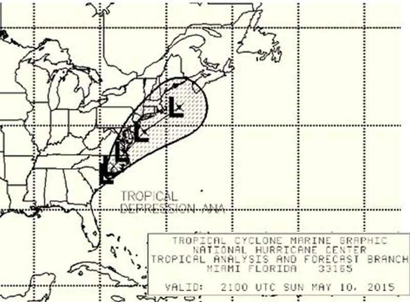 Warning issued yesterday regarding Tropical Depression Ana 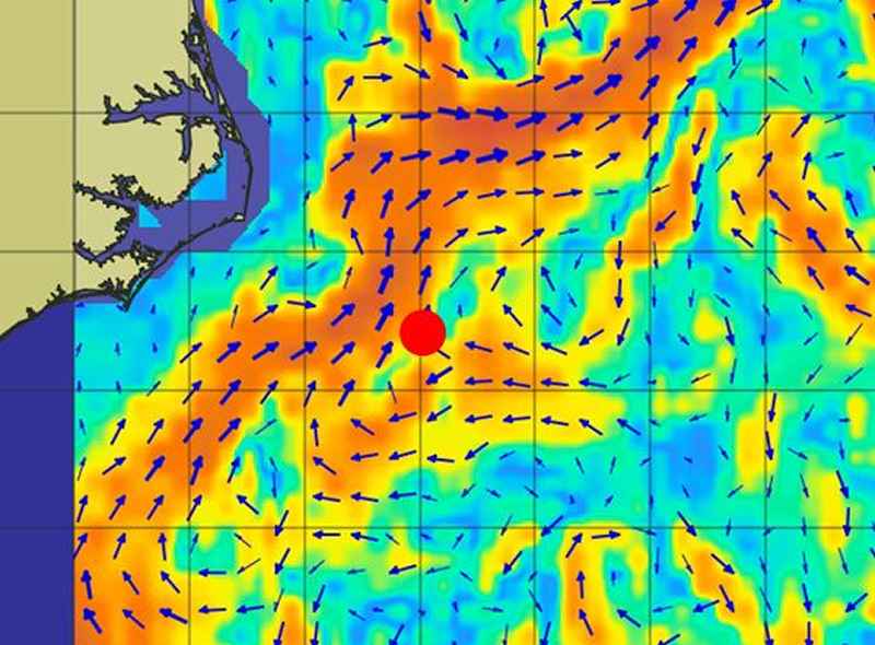 Gulf Stream current map with a red-dot for the intended point of crossing 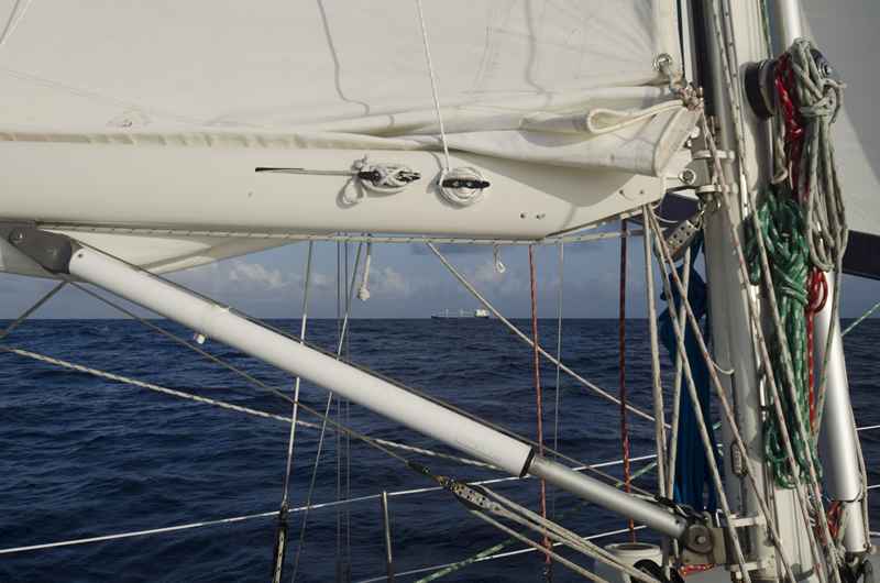 Closest encounter of this morning a ship heading for Colombia passing 0.8 NM port-to-port |