That big hill...

|
You
know what, I really thought I would be disappointed with Not
so… Not so at all! I set
off from Kirstenbosch Botanical Gardens heading for Skeleton Gorge. I went that
way only because I wanted to visit the gardens (I am so ‘Rock ‘n
Roll’!) and had no idea that in so doing, I was setting myself up for one
of the hardest ascents of the mountain. As the beautifully manicured lawns
yielded to a narrow, steep path, I realised that this was no ‘walk-in-the-park’.
Very soon I was climbing over rocks in a fast-running stream, crossing numerous
copper-coloured waterfalls under dense tree-cover. This was ‘Smut’s
Track’ and I was climbing rustic ladders, negotiating huge boulders and clambering
over slippery tree roots. I stopped to catch my breath and thought perhaps I
should read the leaflet I’d been given at the entrance to the gardens It
started by saying… ‘You
need a map of D’oh!
It’d been raining for the past week and while those of you back in the I
eventually reached a fork in the path at the top of Skeleton Gorge and made an
arbitrary decision to turn right towards Maclears Beacon. I didn’t know
it at the time but that meant more climbing to the highest point on the entire
mountain at 1,085m. By now I was in the clouds, literally, and couldn’t
really see very much but, my goodness, what an exhilarating experience. Occasionally
the cloud would clear to reveal the most unbelievable view over False Bay, over
Table Bay, Lion’s Head, over the city, the peninsular and the
I was
absolutely exhausted. The climb had taken just over two hours. That’s two
hours almost vertically. What luck then that I came across a ‘hub’
where the various routes were marked. It suggested that I was about an hour
away from the cable-car and at the time, that seems like a welcome relief. I
followed the path around the northeast side of the mountain where, to my right,
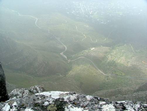
the cliff-edge overhangs a precipitous 1000m drop to the valley floor. The path
even carves a route within a metre of the edge and I’ll be honest, I did
wonder for a moment if this could possibly be the way-marked path. It was (the
second photo above is the path and although you can’t see it, the drop to
the right goes all the way to the bottom!). Eventually I came to the point
where the path drops away dramatically down through a narrow gorge between the
towering rocks. To the left, according to another signpost, the path would lead
to the cable-car. I felt re-fuelled by the exhilarating walk along the
cliff-edge and decided then that taking the cable-car would be cheating. I
started descending through Platteklip Gorge but my progress was slow. I had to
keep stopping as by now I was absolutely shattered. I emerged under the cloud
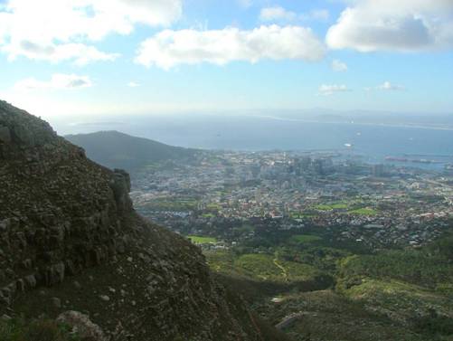
layer and the city spread out below like a model.
By
1700hrs, I had arrived at the bottom of the cable-car station. Looking back up,
the cable-cars seemed to disappear into the clouds like some kind of modern ‘Jack
and the Beanstalk’. I’d done it. It would have been unthinkable to
come to I
should mention too that on Saturday, I was invited to crew again on Lobelia in the Portugal Day pursuit race
around the bay. The weather was forecast to be wet and windy but we couldn’t
have asked for better weather. We couldn’t have asked for a better result
either – we won! Yep, first over the line with 43 boats in our wake.
What
a weekend!! Rob
Clark W2N
Global Ltd. +44
(0)7967 661157
|


