Wednesday 26th Feb
A good breeze gave us a very pleasant and fast passage for the 25 miles or so from St Kitts to St Eustatius. We anchored in Oranje Bay and went ashore to explore.
Also known as “Statia” this small island has a very interesting history.
Today it is a municipality of the Netherlands and has been under Dutch control for much of the time since the 1700s when most of the major European powers were fighting amongst themselves. The Dutch, however, remained neutral and established
Statia as a Freeport. Here entrepreneurs bought goods of all sorts (including weapons) from, and sold them to, countries that were at war, effecting huge volumes of trade that would not otherwise have happened.
The island became one of the world’s busiest harbours and made many of its inhabitants very wealthy.
“Harbour“ is perhaps a generous term to describe what is in fact a very open, if sheltered, roadstead. Nevertheless, in the day, there would have been hundreds of ships from all over the world anchored off the wharves on the sea front.
Those days are long gone and all that remains at the water’s edge are some ruins and a couple of old buildings that have been restored and converted to a hotel and a dive centre. The main settlement on Statia is Oranjestad, the town on higher ground directly
above the harbour. Today the economy is heavily dependent on a large oil storage facility on the flatter northern part of the island, and on tourism centred on diving, and a few visiting sailors like us!

Thursday 27th Feb
The other big thing on Statia is it’s dormant volcano known as the Quill. Inevitably we had to climb it, and descend into it’s crater.
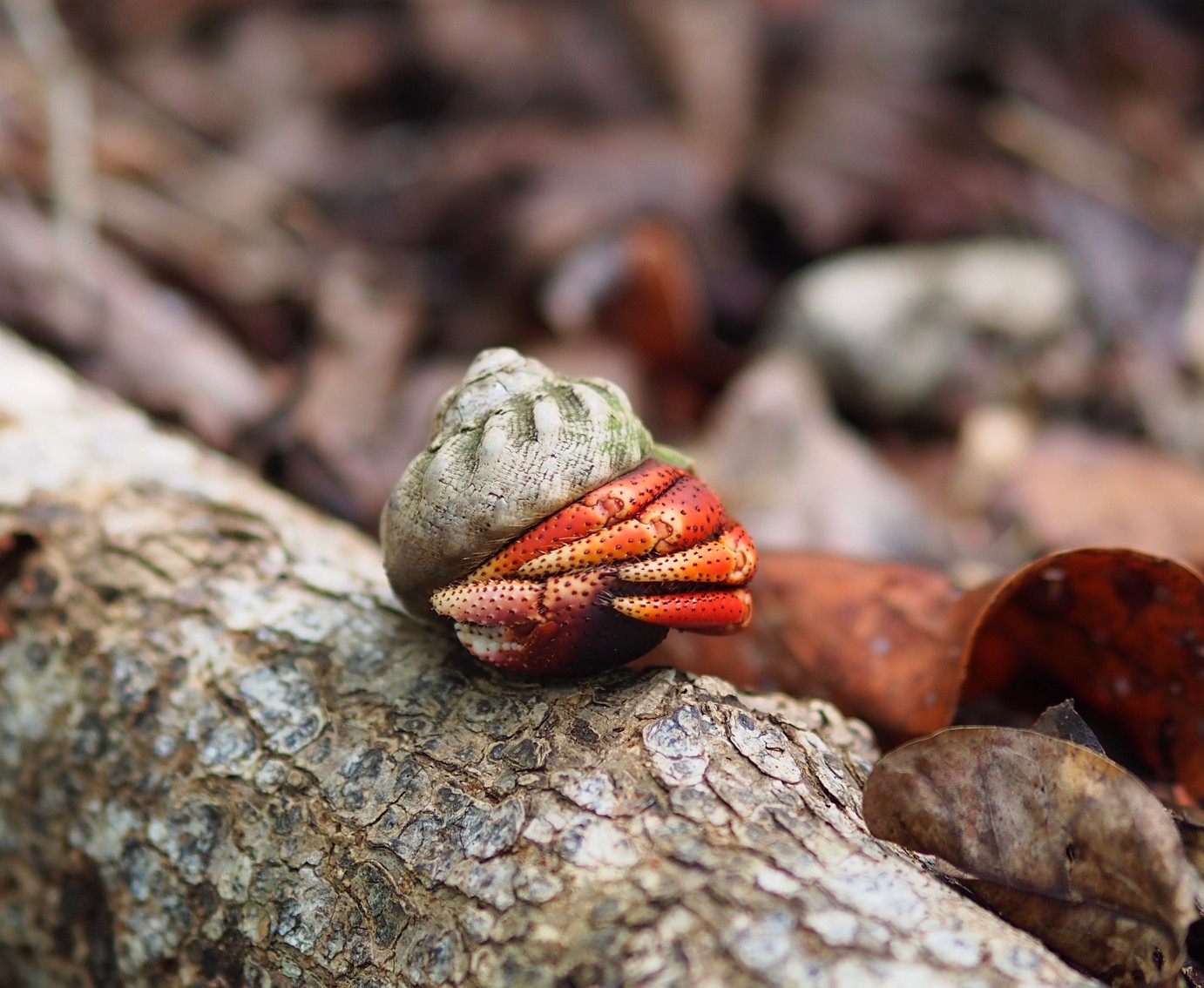
It was a great walk with well marked paths for the most part and some very steep sections with fixed ropes. The upper sections and the crater are proper jungle with plenty of lizards, a few snakes, and lots of hermit crabs! ( See the video in the photo
album-link below). The crabs are born and reproduce in the sea but spend most of their time ashore and clearly cover significant distances to higher elevations!
 The bottom of the crater felt like being in Jurassic Park. It was very overgrown and the path was much less well trodden than the main route up to the top. Amanda thought we were lost at one point; she was very happy when we found an “Exit” sign!
The views from the top, both into the crater and panoramas of the island, were fantastic.
We returned to sea level and went for a snorkel just off the old harbour-front where we saw a very large, very old anchor and a canon as well as the usual fish and corals.
The following morning we checked-out and set sail for Saba, an even smaller island, to the north-west.
The bottom of the crater felt like being in Jurassic Park. It was very overgrown and the path was much less well trodden than the main route up to the top. Amanda thought we were lost at one point; she was very happy when we found an “Exit” sign!
The views from the top, both into the crater and panoramas of the island, were fantastic.
We returned to sea level and went for a snorkel just off the old harbour-front where we saw a very large, very old anchor and a canon as well as the usual fish and corals.
The following morning we checked-out and set sail for Saba, an even smaller island, to the north-west.
More pictures here.........
https://photos.app.goo.gl/nCoeKqVrZ6SUMivH6
Nick Clayton
Sent from mobile phone
+44 7733 327026
|