A Greenland Story At Sea - Our Blog

A Greenland Story Blog
Jamie Young
Tue 14 May 2019 15:07
|
A Greenland Story Satellite Blog
This is our first blog post delivered through our satellite phone
connection. We’ll keep this short and sweet.
We will be using this blog to provide updates once we head off across the
Atlantic. From this link you will be able to track our current position and see
a breadcrumb trail of our route so far. For us to send this blog post we tap
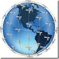
into Iridium satellite network, the
constellation consists of 66 active satellites in
orbit, required for global coverage, and additional
spare satellites to
serve in case of failure. They are continuously passing overhead, or more
like we are continually spinning within the network. The constellation is
actually owned by a publically traded US corporation called Iridium
Communications, let’s hope they stay afloat!
 Iridium Network
For me to do a blog post I simply send an email and it appears on our
personal blog page. The emails themselves are pretty cheap but the images, like
the one of the satellites above, can end up costing a lot if you are not
careful! So all images and videos are compressed right down, image quality
definitely takes hit but less of a hit on the wallet.
To
call any phone costs around €1.30/min. However, to create a connection in
order to send an email is charged the same as a phone call. Considering that the
data speed of the Iridium connection is 2.4kb/sec, in theory after I compressed
the image above to 7.7kb that costs me roughly 7 cent (in theory....). It’ll end
up being a bit more than this but not bad all the same!
Weather
This is all very old technology, we are essentially managing to use this
tech for something that it wasn’t originally designed to do. We use this to get
our weather as we cross the Atlantic and while we’re away from any other type of
signal. This is standard for anyone doing ocean passages but I found it pretty
interesting the first time I heard about it.
To get our weather we simply send an email to an automated service asking
in the subject line for the type of weather data and the patch of ocean we are
interested in, using a grid of latitude and longitude. Their algorithms
automatically ping back a file of One’s & Zero’s in a matter of seconds,
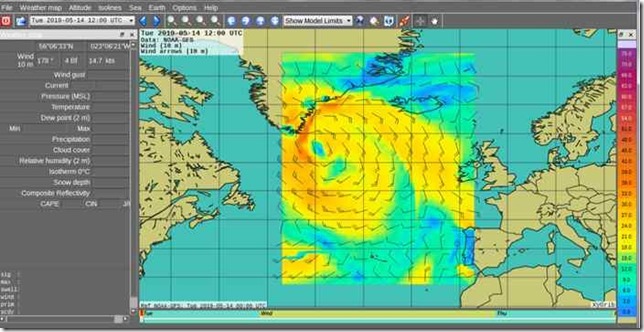
yeee old binary code. This is what’s called a GRIB file, General
Regularly-distributed Information in Binary form. We then use a different
program to interpret the code and we get something like the image below. For the
image below I used a program called XyGrib which gives a nice visual interface.
The bristle chart below shows wind strength and direction, usually we’d include
a more parameters, pressure, wave height etc
 GPS Position Tracking
Adding our coordinates, for example,
53:45.38N
009:39.38W
should show our
location on the map.... all going well you should be able to see my location.
Whether this is my real location or not will remain a mystery.
That’s it for today!
Vincent & The
Crew |