Maldives: Atolls, reefs and turquoise seas. 06:02.98N, 073:03.4E
Meikyo
Phil and Sarah Tadd
Sat 4 Apr 2026 13:00
We have been in The Maldives now for 10 days. In some aspects it has been a steep learning curve as we reacquaint ourselves with atoll sailing, navigation and anchoring. The Maldives consists of 22 geographical atolls comprising about 1200 islands plus isolated coral reefs. Some islands are developed with towns where locals live and work others are tourist islands developed into resorts and there are others which are uninhabited. The climate is dominated by the SW wet monsoon and NE dry monsoon and the lack of rivers to carry sediment into the sea means that the waters are amazingly clean and clear. The majority of the islands are very low, less than 2m, and may well disappear totally due to global warming and rising sea levels. The religion is Muslim so covered shoulders and knees are required on local islands and alcohol is only available in resorts. The charts are not brilliant, 200 m out in places, but they are a guide to where places are. To navigate into anchorage’s inside the lagoons we are using satellite photo charts and taking waypoints from them. These are then put onto our plotter so that we have points to aim for. We also keep an iPad in the cockpit with satellite charts open so that we can double check our position in relation to the reefs. When we get into shallow water we have one person on the bow as a spotter looking out for bommies (isolated coral heads) and rocks. Anchoring can be in very deep or very shallow water, the deepest so far has been almost 30m and the shallowest 3.2m. With 100m of chain in light wind and current and good holding on sand 30m is ok. Motoring into a sand patch between coral at 3.2m is worrying, our draft is 2.1m. 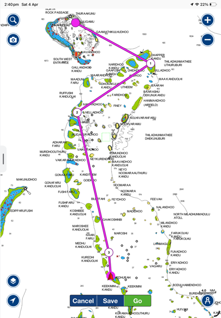 Our trip so far. So, we arrived in Uligan at the N end of the Maldives. This is a port of entry with customs and immigration officials to clear us in. We had an agent, Asad, who happens to also be the Ocean Cruising Club local rep., the formalities were dealt with very quickly. We had asked if diesel was available and been assured that it would be, so arrangements were made to take on 160L to replace what we had used since Galle. This was brought out and pumped into our tanks on the first evening. The price is rising quickly due to the situation with Iran so we were lucky to be quoted $1.73US a litre. The town at Uligan is very clean with its white sand roads regularly swept clear of leaves. The government offices provide employment as does the fairly new resort. We were anchored here in 25m but when we asked if there was a diver who could clean the barnacles off our keel we were asked to move to anchor in 5m on a small patch of sand where there was less current. 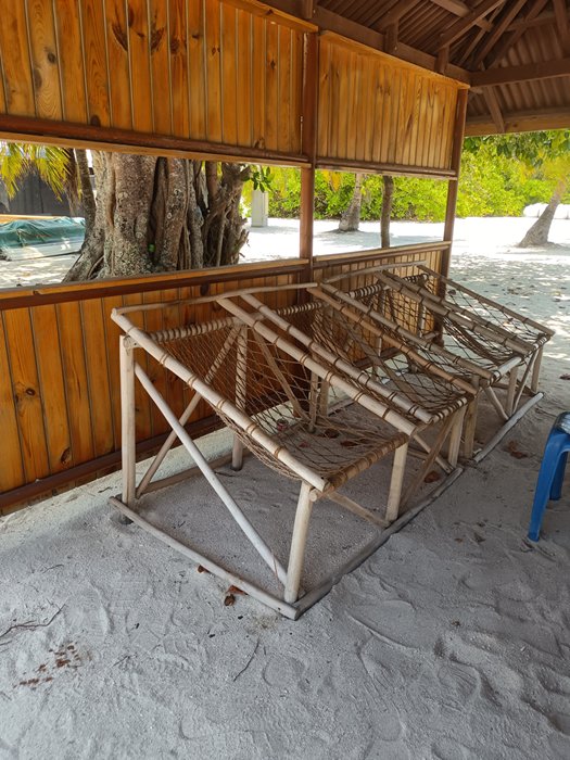 Comfortable seats for relaxing in, found all round the town and in the homes. 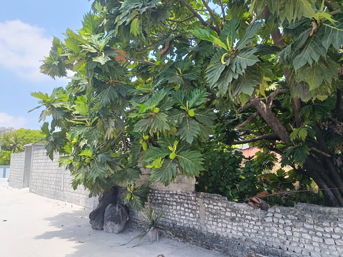 Bread fruit trees again, hopefully the fruit will be in season while we are here. Having picked up our cruising permit and the mandatory tracker we were free to move on and start cruising. We sailed south towards Dhapparu and a more comfortable anchorage in 8m. The logical route to here would take us down between two islands but as we approached the pass we could see that it would be rough with wind against tide. A ferry boat was waiting to enter this pass so we decided that it made sense to go east around the island. We would have had to wait two hours for the tide to turn so one and a half hours to go round made more sense as we would arrive at Dhapparu while the sun was still high enough to see the coral. The clarity of the water here is amazing and you can see the anchor and chain in 20m, in 8m you can see easily if the anchor is dug in in sand or the frequent sand/coral mix. We spent a couple of nights here as it was so pleasant to be away from towns. 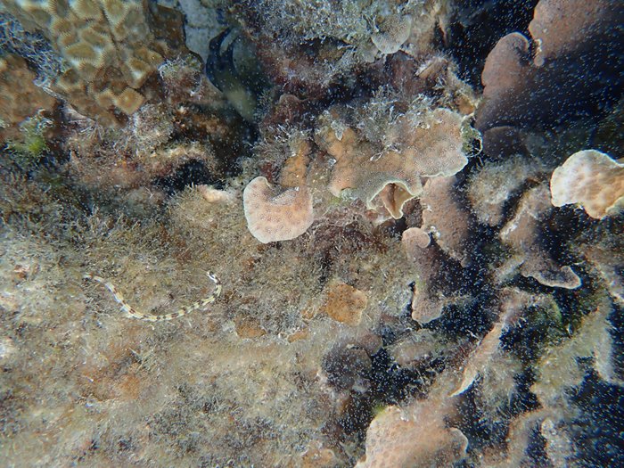 Banded snake eel at Dhapparu 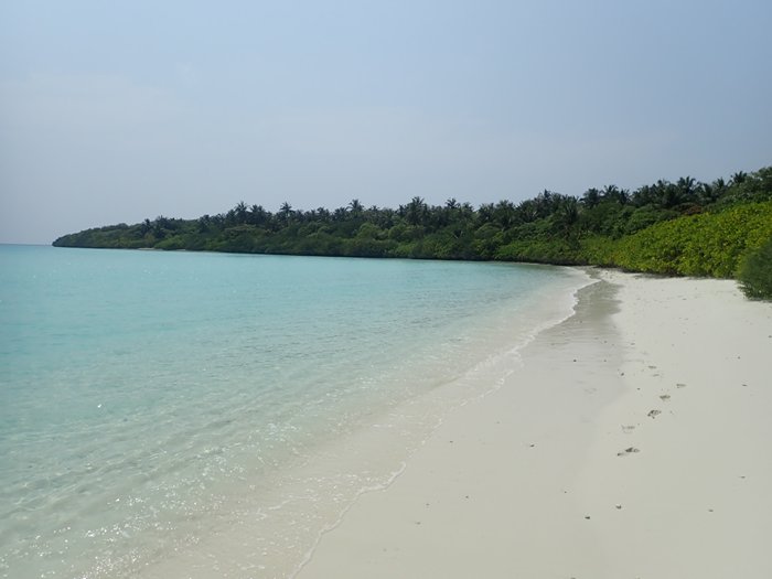 A short walk on the beach 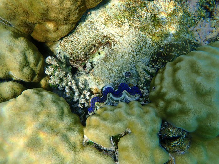 Clams Then on to Rasfushi where we rejoined Ozone and Jamala. This is a reef anchorage with no land around, protection from the seas is purely by the reef areas. By heading in as close as we dared to the reef we managed to drop the anchor in 25m, not a place to be if the wind went southerly. 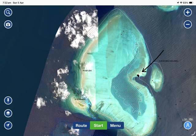 Rafushi, our anchorage is marked. We wanted to visit an anchorage on the north of Hurasfaruhuraa, this was 35 miles to the south and the forecast showed that the wind was going to die to nothing for a few days perfect weather. The anchorage was on a small sand patch with a depth of around 3m open to the north. Leaving at 07.00 we used the last of the wind to sail down there and it died out just before we arrived. Sarah had put two waypoints on the plotter to guide us in past two coral outcrops and we watched the depth go from over 30m to 5m then 3.4m we stopped and dropped the anchor. Our first desert island, very low and covered in scrub. We did go ashore to meet up with the crew of Allora who were anchored in 30m on the south side of the island. We snorkelled on the reefs here which had lots of fish life, turtles and stingrays. Outside the pass we frequently saw dolphins. 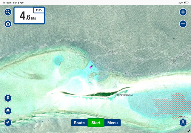 Hurasfaruhuraa, the anchor symbol marks where we were. 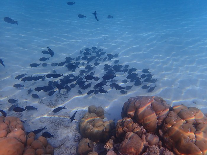 Shoals of fish off the reef 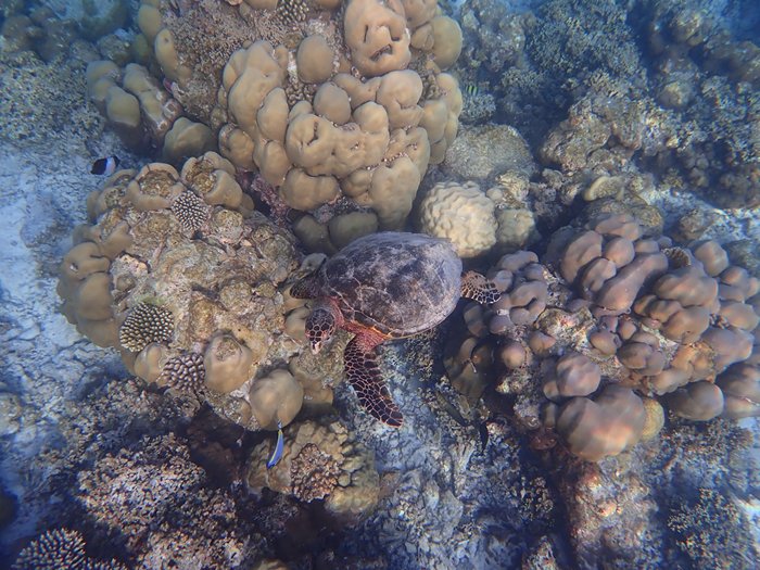 One of the turtles 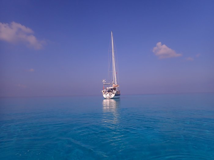 The beautiful clear blue waters. We needed to restock with a bit of fruit and vegetables at this point so our next short move was to Kamandoo where there is a small town, shops and a couple of restaurants. We were there with Ozone and Allora, We did our small restock, diesel as well as food and had a meal ashore. The restaurant had an impressive menu but we may have been too early as most of it was unavailable, we were limited to Subs, Burgers and Pizza. We spent time snorkelling and thanks to Brian and Alison on Ozone, who told us where to find them, we were able to swim with Manta Rays, the gentle giants of the sea. these were not as large as the ones we saw in New Caledonia but they were cruising around feeding and coming within a few feet of us. Unfortunately, we think they were attracted by effluent in the water and the high levels of zooplankton because of it. There was certainly a lot of rubbish in the water and algae on the surface. 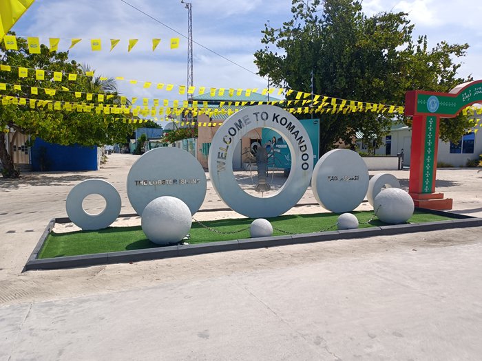 The town of Komandoo from the harbour, so neat and clean. The flags are election bunting for the council elections. 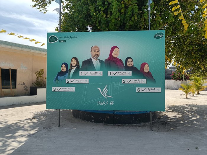 The candidates 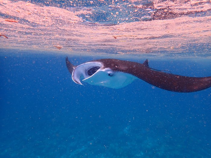 Manta Ray at Komandoo, visibility was spoiled by the scum on the surface and particles in the water Sent from my iPad |