Isle of Skye to Inverness and on to Iceland

Honey Mooney HB-DVN
Flemming and Angela PEDERSEN
Sat 21 Jul 2007 21:03
|
A day with a lot more flying than we had planned and had to do, and on
top of that 3 missed
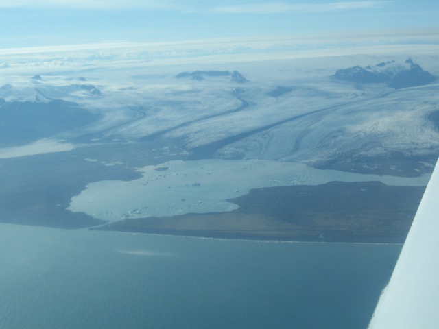
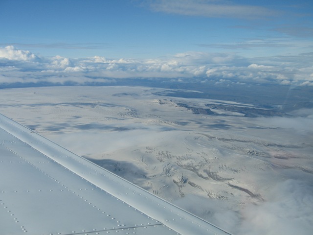
approaches on the same day! Weather at departure from Broadford, Isle of Skye was fine as the easterly flow made worse weather on the east side of Scotland. The plan was to fly to Inverness, refuel, do customs out and unload Pam who was taking an EasyJet to Gatwick. After that continue to Höfn (Hornafjordur, BIHN, 3:30 hrs) to do customs in and then on to Vik (BIVI, another 45 mins) near the south tip at Iceland. Due to weather, we did however not land in either of those two places where we had planned to land. No radar service at weekends at Inverness, so there was a slight delay of about 10 minutes for our arrival. After departure from Inverness, we were soon in the sunshine with a slight 10 - 15 knot tailwind. Still have this odd rule in Scottish advisory airspace where you fly FL105 with a NW track whether you are IFR or VFR. Lengthy delay in getting our oceanic clearance in class A airspace from Iceland radio on HF although the transmissions were loud an clear, but after half an hour we finally got our clearance at FL100 in Reykjavik oceanic class A airspace. The forecast for Höfn (Hornafjordur) was pretty good: BIHN: FC210716Z 210817 VRB03 9999 FEW15 BKN20 TEMPO 0817 9000 -DZ BR BKN015 OVC025 so we did not expect any problems. The problem with Iceland weather is that is can be unpredictable and changing fast. While we were on the initial approach we got a report which was a lot less good: 230/08 vis >10k N 3000m S FEW02 BKN07 14/13 1015 and a bit later SCT03 OVC05 but even with these numbers we should still make it in on the NDB36 approach with a minimum descent altitude of 320 feet. Well, we got to the marker, descended from 560 feet to 340 feet, saw a couple of rooftops very close straight below, but absolutely no sight of the runway ahead. So after passing the beacon (MAP), we were forced to execute the missed approach procedure climbing back up to 3600 feet. The problem was that SW wind which pushed low sea clouds in over the field. We were then advised by Höfn information that the GPS approach from the north might have a better change to succeed, so we then tried that as there was a lot of clear sky to the N of the field as well as a great view of the Vatnajökull glacier. But while established on the approach GPS Rwy 18, we were advised that the airport was now closed due to fog. So we had to divert to our alternate, namely Egilsstadir (also a customs ariport) to the east of Iceland. Although there were some rain showers in the vicinity there were no low clouds and on top of it they gad an ILS. So we spent another hour in the air before landing in Egilsstadir. Entry procedures were fast and efficient and we were told that there are no landing fees for light aircraft in Iceland! The guy in the tower was extremely helpful with weather and flight plan formalities. Welcome to Iceland, an aviators paradise. That is apart from the tricky weather! We then filed IFR for Vestmannaeyjar (BIVM, about 1:20 hrs) where the weather was not too bad, with some scattered low clouds at 300 feet and a broken layer at 3500 feet. And we hoped that we could cancel IFR on the approach and continue VFR into Vik, where two of Flemming's cousins (Anna and Dorthe) were waiting for us. About two hours later, we were back over Höfn at FL90 and saw the runway bathing in sunshine! And we had some great views of Iceland's largest glaciers on the way.  Vatnajökull between Höfn and Vik
 Myrdalsjökull from 9000 feet
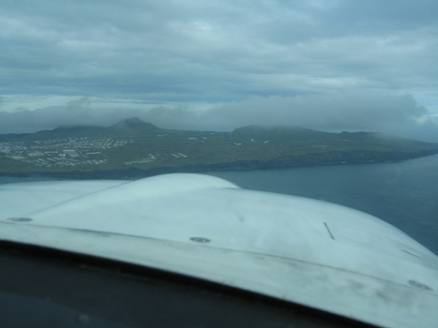
Later towards Vik, there was several layers of low clouds, so we were not able to cancel IFR then. While we were on initial approach 10 miles from Vestmannaeyjar we broke out of the broken layer at 3000 feet, and decided to give the VFR approach into Vik only 30 miles back east a try. Several times during the day we had been in contact with Dorthe in Vik to check the local weather and we knew it had been changing a lot during the day: from fog to low clouds to not so low clouds and then back to fog again... The weather quickly deteriorated to marginal VFR condtions over the sea, at times we were down to 300 feet over the sea, then climbed between layers at 1000 feet with scattered low clouds below, pretty scary (and dangerous). We found the town of Vik with its characteristic rocks but was forced out to sea again due to low clouds. A few miles further east, we headed north towards the Vik airfield again at 400 feet, made it to 1.4 miles from the airport, had it actually in sight, but clouds near the airports were down to 300 feet or so above the field and there were high rocks and mountains just on the other side, so we decided to give it a miss: turned south and climbed back up to a safe altitude of 3000 feet and headed back the 37 NM towards Vestmannaeyjar. We did a visual approach, but due to a low cloud we could not see the runways neither from the east nor from the south, but thankfully they magically appeared while on right base for runway 13.  On final for runway 13 in Vestmannaeyjar
It was nice to back on the ground after 3 missed approaches and a much longer flying day than we had planned. We quickly located a friendly bed and breakfast and had a nice fish dinner in Heimaey with a good bottle of Chilean Chardonnay. |