Santa Cruz de La Palma 28:40.40N 17:46.00W
Saro's Gyda
Derrick Thorrington
Tue 8 Feb 2011 16:20
The predicted
easterly winds did not happen of course! We were forced to motorsail the whole
60 miles as the wind was "on the nose" again. Either the weather forecast is
always wrong or the height of these islands causes the effect. Research was
carried out en route and we read that La Palma has the greatest height to area
than any other land mass, rising almost 9000ft above sea level. It also features
the world's largest volcanic crater which occupies most of the north. At the rim
of the crater, on the highest point of the island is situated the largest and
most important observatory in the northern hemisphere. Quite a few claims to
fame for an island measuring approximately 20 miles by 10
miles!
We arrived in the well-lit port of
Santa Cruz de La Palma at midnight hoping that the problem with swell affecting
the marina had been solved. We immediately realised that it had not! By the time
we had sorted ourselves out the following morning (in the rain) we were
utilising a whole double berth between two fingers with a spider's web of lines
trying to keep us from surging, snatching and rolling. The occupation of two
berths was not a problem. Apart from three or four resident
yachts there were only two other visitors in the 100 available berths.
Everyone was occupying two spaces and all lines were coated in many versions of
chafe protection and snubbers. We don't think that this brand new marina will
survive unless steps are taken to stop the swell rolling in.
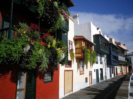
After a couple of days of rain (and the unusual inclination to abandon the
shorts for trousers) the weather brightened a little to dispel the general
feeling of greyness brought on by the cloud and the grey volcanic building
materials. Having had a glance around the town on a quiet, wet Sunday we were
keen to see if it fared better on a weekday in the sunshine. It
did.

Once again the buses proved to be very reliable, frequent and cheap
(2 euros per trip) so that we were able to plan our explorations without
difficulty. As the weather had once again closed in, and we were getting very
fed up of the rolling and creaking from the lines, we decided to take a bus to
the opposite (west) side of the island. We had heard rumours of a brand
new marina at a little old fishing port, Tazacorte. The bus zigzagged
ponderously up the steep slope of the volcanic ridge separating east from west,
entered a long tunnel at the top, emerging into bright sunshine and clear skies!
Having left the bus in the town we walked down to the port through huge banana
plantations in the hot sunshine.
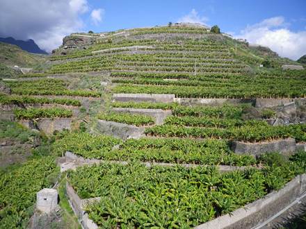
Bananas
Tazacorte was small and colourful with a black sandy beach. The marina was calm
and blue. We decided to move asap especially as on the return journey, the
opposite occurred - blue skies to grey drizzle! Unfortunately we had to wait for
the right weather to take us around the southern tip and up the west coast which
took a further 4 days. Time was not wasted however as we took the opportunity to
explore the NE coast by bus and foot. D also discovered the Canary
local forecast on the internet which seemed to be entirely diffierent from the
general site which we had been using!
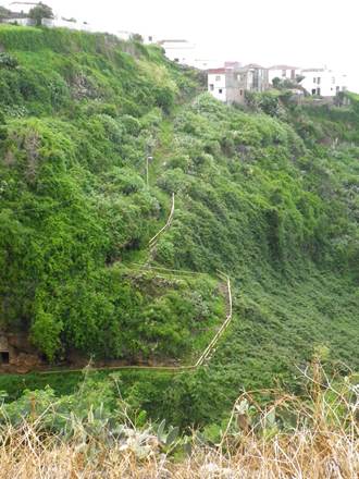
NE coast. Up
again!

Tazacorte with the
marina in the background

Tazacorte
Marina.