World ARC Tour to Piton de la Fournaise
Take Off
Jörgen Wennberg
Sun 29 Oct 2017 14:17
On Sunday 29th of October we all gathered at 7h45 to take a grand tour of the island.  The island was inhabited until the 17th century. It was visited by Arab, Portuguese, English and Dutch sailors as it was a popular stopover on the trade route thanks to the abundance of fresh water. It is found on many maps under various names, however the French used it first as a prison: they sent undesirable mutineers from Madagascar being at the time a French colony. The first mutineers landed there in 1646 and stayed until 1649. The mutineers discovered a dream prison as the island was covered with forests and rivers and the soil was very fertile. The first settlers, accompanied by Malagasy servants, settled there from 1654. In 1663, a second group of volunteers led by Louis Payen came to colonise the island. The interest of the lost island is gradually revealed. The East India Company rules it thoroughly for a century, until its bankruptcy in 1767. The culture of coffee is developing, the system of slavery is taking shape. The white settlers buy their slaves from Madagascar and East Africa. The white population of the origins, which had begun to be mixed with its first coloured servants, Malagasy or Indo-Portuguese women, became largely a minority. At the end o the 18th century, the coffee plantations disappeared quickly, soon replaced, from 1815, by the fields of sugar cane. During the Revolution, the island briefly changed its name. Later on it was named Réunion, symbol of the meeting of the revolutionary troops in Paris, in 1789. From 1810 to 1815, it then passed under English control, before being returned back to France. The island became prosperous in the 19th, thanks to the sugar cane. The “sweet reed” makes the fortune of the colony, the distant France buys at a price of gold the sugar loaves folded in dozens of “factories” adjoining the colonial properties. The large estate extend, the mountainuous interior of the island is gradually getting popular and the circuses are populating. In 1848, slavery was abolished. But the cane still requires more labour: call is made to Indian and African volunteers whose conditions of existence will be very close to those of the slaves. An orchid, coming from America, gives rise to dreams of opulence among the settlers: vanilla. Its dried pods are attractive, but it breeds badly in the island. Until the day when a slave, Edmond Albius, discovers a simple and effective way to fertilise her flower, with a simple gesture of the hand. The fields of vanilla extend. At this time, Reunion also discovered that it can produce geranium and remove which, once distilled, give essential oils appreciated by great perfumes, but the wealth of the land does not benefit everyone and prices are down. The population is suffering in a forgotten colony. France prefers to bet on the huge Madagascar nearby. In March 1946, the island obtains the status of Department of Overseas. She becomes French in her own right. The movement accelerates from the 1960’: Reunion is equipped, the people are educated, the economy diversifies and develops. Since the mid-90’s, tourism has yielded more revenue than sugar cane, vanilla, geranium and vetiver combined. We drove along the West coast of Réunion down to the Southern part of the island. The island has a beautiful coastline... 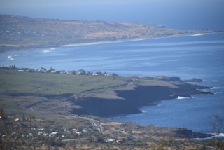 … and likewise beautiful mountains. Every where we lay our eyes we were reminded of being in an exotic island in the Indian Ocean: the landscape, the fauna and the vegetation.  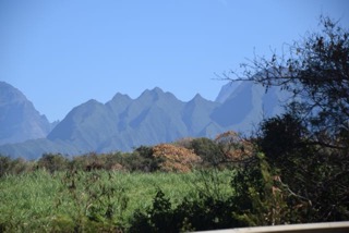 However driving on the motorways and following the road signs we were quickly reminded that we were in France, this island being some 9200 km away from “La Métropole” as they call the mainland France.  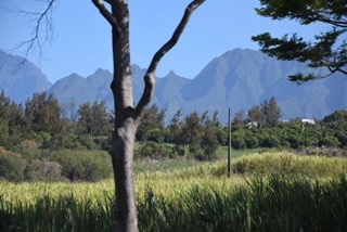 The beautiful “Jacaranda” with its purple flowers adorns along the roads, just like in Portugal.  Everywhere we see different religions and different backgrounds. 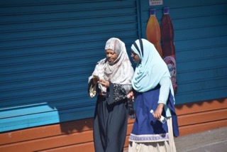 France! The villages are still named as in the old time. We have now left the motorway and are now driving up towards the volcano Piton de La Fournaise which is situated at the Southern part of the island. For this we are climbing and climbing the mountain. In the former days each village was named “the first”, “the second”….”the twentieth”, “the twenty-second”… and so on, referring to the villages from the bottom at the sea level to the end of the road reaching the volcano. Very practical and you know exactly where every village is situated. 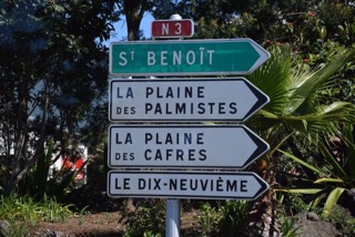  The mountain comes and goes and back and forth behind the clouds.  
Our first stop is “Nez du Boeuf” with an altitude of 2050 m. This is considered being the FIRST COLLAPSE of the volcano creating a marvellously beautiful valley. We could have stood here for hours and hours just contemplating what beauty earth has created. Down in the valley you can imagine a river called “A discret river”. La Rivière des Remparts has dug its bed in the very permeable lava of Commersor which as come to line the bottom of the valley. Most of the time, it remains invisible, since it gets scarce water which seeps into the cracks of the lava flow. During heavy rains though, the water has no time to seep in completely and flows down the minor riverbed.    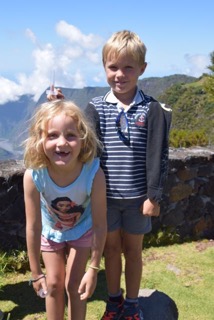 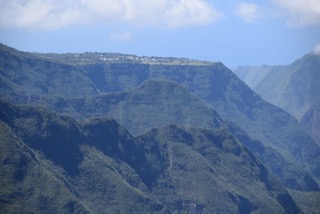 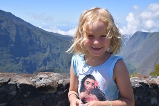    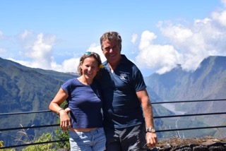 Åsa and Anne with Inez.  450 000 years ago a volcano submerges out of the island “Piton de la Fournaise”. 300 000 years ago, a part of the volcano collapses creating a break guiding La Rivière des Remparts. 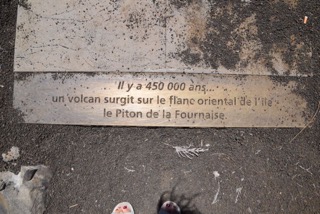  65 000 years ago another part of the volcano collapses creating another break which will become “La Plaine des Sables”.  We continue further on towards the volcano and our next stop is “La Plaine des Sables”, being the SECOND COLLAPSE, looking like if we were on the moon: dry soil with stones. A few vegetation manages to grow in this harsh landscape. We are now coming up in altitude and immediately we feel a great difference in temperature.   The mysterious moor… This moorland type of landscape, typical of high altitudes, displays few species but a high level of endemism. Here, the plants are particularly well adapted to the harsh climate with significant temperature variations, wind, rain and periods of drought. The leaves are very small and thus hold out well against the withering of the sun. The leaves are also endowed with little hairs to allow the capture of any moisture in the air.  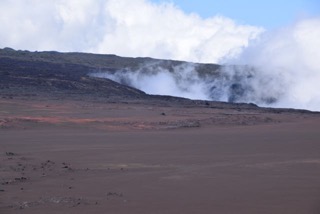     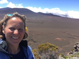  A lovely guide Agnès together with her chauffeur, Roger, is explaining a few things to Gary and Bob. 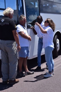 We continue further on driving through the “La Plaine des Sables”. 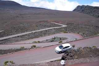  Our third stop is the volcano Piton de la Fournaise, being the THIRD COLLAPSE, which at this time of the day is always in the clouds. So we can try to imagine the top of the volcano behind the clouds.   Down in the sandy valley you can see at the right hand side of the left picture a little crater. It is enlargened in the picture to the right where you can see small people walking around. It takes approx 3 hours to hike down to this crater.    Inez getting some help in reaching the binoculars!  This point is called Pas de Bellecombe and we are now at 2 345 m above the sea lever. It’s a lot more cooler here ….  i iWe enter the little museum of La Piton de la Fournaise, explaining how the volcano has emerged. An interesting tour for bigger as well as smaller ones. 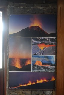 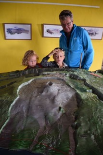  Walking further away with La Piton de la Fournaise behind us we had a look at this dormant crater, the Crater Commerson.  The Crater Commerson is part of a set of three aligned craters, born from an explosive eruption, about 2 000 years ago. With is 200 m width and a depth of 235 m, this crater dominates La Rivière des Remparts and is the most impressive on the island.       The family is here together with our new crew member, Johan Lilliehöök.   We enjoyed very much the dramatic landscape of La Réunion, beautiful as well as breathtaking for some parts. Many hikes are to made in these mountains exploring the fauna, the rich birdlife and loosing in the wild of these high peaks. After having lunch on our way down from the volcano we found this small fruit and vegetable market.     Alex and Inez found entertainment with Sam and Karen from Lexington.  We enjoyed a lovely together with our guide Agnès and her chauffeur Roger. She is a mix of Malagasy and French. She learned English only 3 years ago (!) and is now working as an English guide, only since 4 months ago (!). She said that in order to hang on the increasing International tourism they have to acquire the English language too. She is a lovely lady and we wish her all the best in her new job.  Coming back to the marina we enjoyed a lovely sunset accompanied by a sundowner together with our friends on Sandvita. 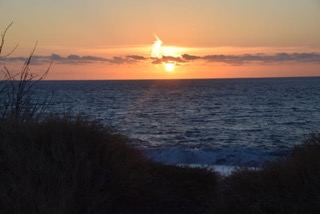    Pictures of Réunion found on the Internet.    |