-Dutch Enterprise and Engineering
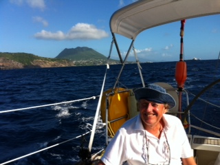
Sunday 26th January Road Harbour Tortola, British Virgin Islands, 18:25.415 N 64:37.065 W Distance sailed 133 miles. The music in Basseterre ended at 22.00 so we slept well. I had received help and advise from the marina manager on arrival so I put some EC dollars in the chart table for him. St. Kitts was the final country that we could use this currency. It left me 14 EC dollars short to pay the bill at Ballahoo restaurant. I offered the owner Peter Dupre a 5 Euro note to make up the difference which he reluctantly accepted. Euros are accepted in many of the new shops near the liner pier. On Saturday at 11.00 I went to the marina office to give the manager our little tip, 20 EC, to find him a little tipsy with a bottle of Carib lager in his hand. As there was no where else I could spend the currency I gave it to him but refused his offer of help during our departure. We had noticed many people walking the streets in the Caribbean with a bottle of lager in their hand drinking it. I was sorry I had saved the money and did not have enough to pay at Ballahoo in EC after such an excellent lunch there. At 11.10 we released Shelduck from the marina piles and headed for the BVI. We had planned to visit St. Martin and St. Barts. but decided against it because of the outbreak of the Chikungunya virus in St. Martin. Our departure time would allow us to be past Saba by sundown at 18.00 and give us an obstacle free passage through the night. As Shelduck approached St. Eustatius or Statia we were surprised to find 6 large oil tankers anchored in the lee of the island and as we got closer saw a very long pier connecting to a huge oil tank farm. This small island was the trade capital of the Indies in the mid 1700’s. The Dutch opened Statia as a free port then and many made fortunes, however, it soon went into decline and subsequent hurricanes destroyed most of the lower town. This island, it seems, is beginning to thrive again with many old derelict buildings being restored with help from The Netherlands. On to Saba. another Dutch island, which has moorings available for yachts but they are very exposed. Maybe unique in the Caribbean, an island with no beaches. It is a very small island with houses clinging to a hilly landscape and with roads built to what seem from the sea impossible inclines. In Basseterre I had some difficulty with the slave chart plotter at the wheel and managed to remove GPS and AIS from the screen of both plotters. Back to basics, almost, and navigation by waypoint only on the separate GPS. We had a beautiful sail through the night to Tortola with very little traffic although the sea was rough and we rolled a little being on a run with just the main up. As we reached the entry to the Sir Francis Drake Channel we thought that Fallen Jerusalem was Ginger Island because of it’s colour. With the help of the GPS we realised it was it’s shape on the chart that gave Ginger Island it’s name. Found the correct gap between it and Round Rock and entered Road Harbour to a berth at Wickhams Cay Marina and checked into the BVI. Next morning phoned Colm of Dunmast in Cork and had the chart plotter back in order in a few minutes. Thanks Colm. |