Tapotupotu Bay to Rawene
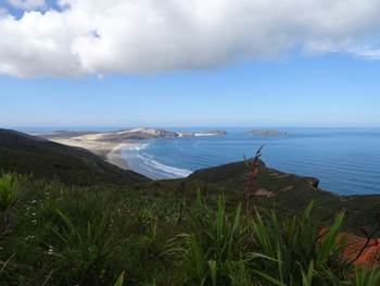
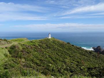
Position 35 24.202S 173 30.143E First stop, Cape Reinga with its lighthouse. The cape was named after the governor of the Dutch East Indies wife, by Abel Tasman way back in 1643. Most of the sand in northen North Island came from cenrtal North Island volcanoes, whch erupted 2 million years ago. The weathered sands flowed down rivers and out to sea and then drifted north along the coast and were washed up on beaches, blown inshore forming the sand dunes that creep along this coastline. The cape was originally an island, formed by a marine volcanoe. Whole sections of North Island have been uplifted as the Pacific plate is going under the Australasian plate. The cape is now connected to the mainland by the massive accumulation of sand drifting north. View of bay and beach to the north or west or even north west.
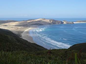
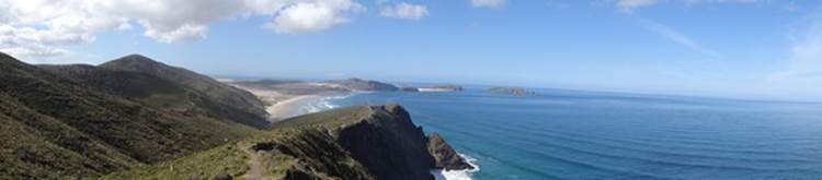
180 of the bay, you can see the waves from the Tasman Sea bending around the shoreline.
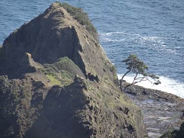
What is really special about this area, is that it is the jumping off point for Maori souls on their journey to their ancestral homeland, Hawaiiki or Hawaiki (they don’t seem to know how to spell it). The rocky point below is where the sprits enter the underworld. The little tree you can see on the promontory is as 800 year old pohutukawa tree, the souls of the dead climb down steps formed by the tree roots. They then continue their journey to Hawaiki, their spiritual homeland. They say the tree has never flowered in 800 years.
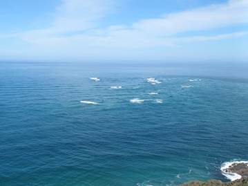
Another reason this special is that this is where the Tasman Sea meets the Pacific Ocean. Apparently waves can reach 10m (is that all?) on stormy days., Nice and tranquil today except this region just below the light house. When you looked closely you could see that the waves were coming in from two different directions. The disturbed water here is where the Tasman and Pacific are meeting. Maori liken the whirlpools and crashing together of waves here, to the coming together of male and female and the creation of life.
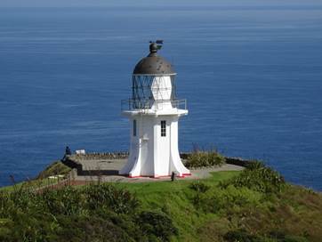
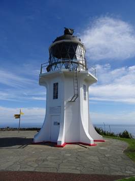
This is the first lighthouse within the area, built in 1878.
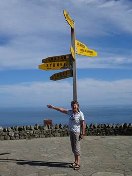
The tower stands 10m high and 165m above sea level. You can this 19 nautical miles off shore. Gladys point the way home – only 9735 miles.
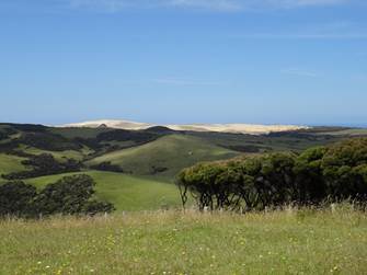
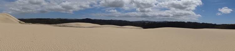
Back down SH11, stopped off at unsignposted rest stop for views of those dunes in the distance.
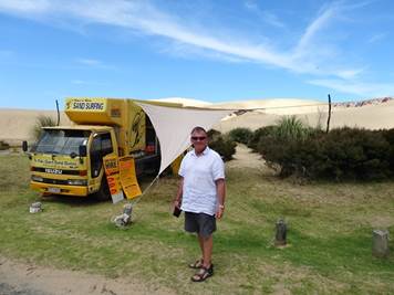
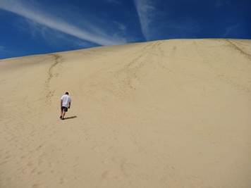
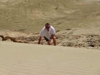
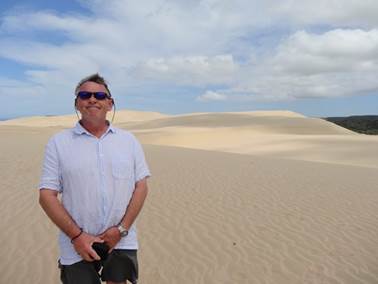
Next stop were the giant sand dunes (Paul recons 150m) at Te Paki stream. However before that, the ever subtle Paul, eyed up these sand surfing boards that you could hire. He then told the guy he should drive a 4 x 4 up the sand dunes, taking people with him, he’d earn more money that way. Should have seen the guys face. He told us to climb this dune (the highest we could see) for a great view of 90 mile beach. Ok at the start but this dune was nearly vertical, we could not get up it. We had to circumnavigate and gradually go up.
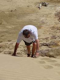
However, the last bit was almost vertical. Hysterical watching Paul climb up
As indeed watching me climb up.
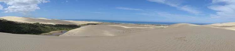
180s from the top, looking inland,
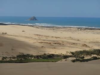
And out to sea.
90 mile beach below..
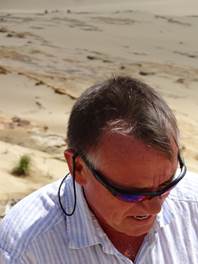
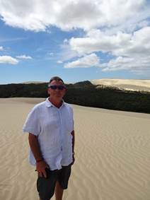
A satisfed looking Paul, he has decided to do funny faces because I take so long setting a picture up.
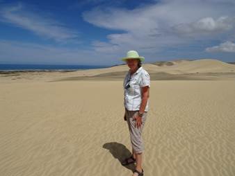
And me…
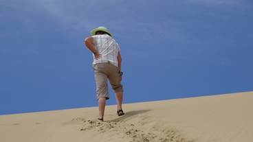
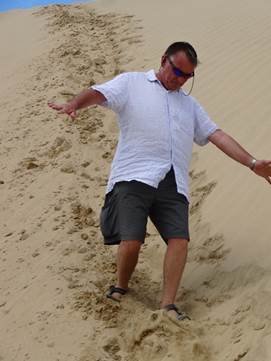
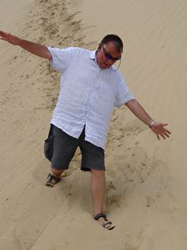
Paul surfing on the way down. We had to go back down the way we came up, as every time he looked down the slope he did a runner back up a dune. He nears the bottom here so decided to have a play.
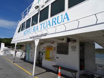
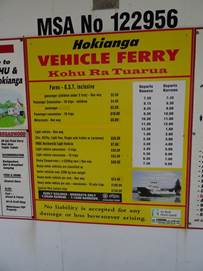
We continued down the road and caught the ferry from Kohukohu to Rawene. Cost us $40, if we had known that, we would have driven around! We are now travelling down the west coast of the North Island.
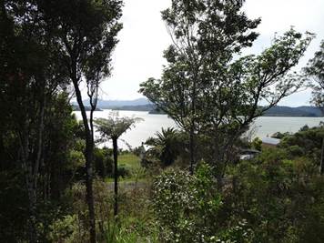
For a change we got the site with the best view – those Germans have normally draped their campervans. View from our pitch over Hoianga harbour – or part of it as it is huge.
|